1940s Maps of Sherman, Wisconsin
Explore 12 historic maps of Sherman from the 1940s. These maps offer a rare glimpse into what life looked like during the 1940s — showing old roads, neighborhoods, homes, and landmarks that have changed or disappeared over time.
Whether you're researching your family's past, planning a metal detecting trip, or studying how Sherman's landscape evolved across the 1940s, these high-resolution maps are a powerful tool for exploring the history of this region.
- Focus on a specific era: All maps on this page are from the 1940s, giving you a focused view of this time period.
- See what’s changed: Compare century-old streets, trails, and buildings to today's modern landscape using overlays and satellite layers.
- Research with precision: Use these maps for genealogy, historical research, land use analysis, or educational projects.
- View, download, or print: Maps are fully viewable online in high resolution, and can be downloaded or printed for your own records.
Start exploring Sherman's history through authentic maps from the 1940s. This is your window into the past.
Sherman, WI maps
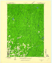
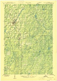
(12)- 1940 Map of Mercer, 1953 Print
 1940 Mercer1953 Print · USGSIron County’s lake-rich landscape is captured in the early 1940s, showing the early growth of Northwoods tourism and timber management. Researchers can trace the rail corridor of the Chicago and Northwestern, find the rural Springstead Sch, and locate the historic Mercer Fire Tower.
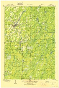
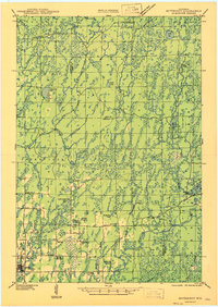
 - 1940 Map of Butternut, 1961 Print
 1940 Butternut1961 Print · USGSAshland and Iron Counties come alive in this wartime-era survey of the Northwoods timber and rail country. Genealogists and historians can trace rural schoolhouses like Otto Sch, the local government at Agenda Town Hall, and the old rail paths of the Soo Line.
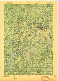
 - 1941 Map of Park Falls, 1952 Print
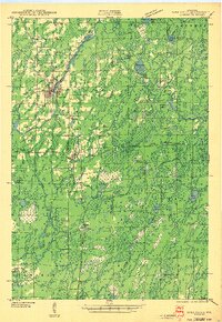
 1941 Park Falls1952 Print · USGSPrice County in the early 1940s is shaped by the river-and-rail economy centered on Park Falls and Fifield. Researchers can trace old rural schoolhouses like Sugarbush Sch and forgotten rail stops at Coolidge and Lugerville.2 unique versions available
 - 1941 Map of Pike Lake, 1952 Print
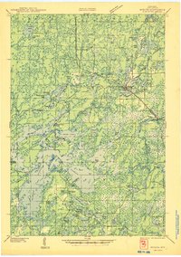
 1941 Pike Lake1952 Print · USGSPrice County timberland and lake country are captured here at the end of the 1930s as the river-and-rail economy transitioned toward forest management. Genealogists and historians can locate the Riley Creek CCC Camp, the Shady Knoll Sch, and landmarks like the South Fork Fire Tower.3 unique versions available
 - 1942 Map of Pike Lake
 1942 Pike Lake1942 Print · USGSPrice County and the surrounding lake country are documented here in the early 1940s, showing a landscape shaped by timber and early recreation. Researchers can trace the Riley Creek CCC Camp, the Shady Knoll Sch, and landmarks like the South Fork Fire Tower.
 - 1943 Map of Park Falls
 1943 Park Falls1943 Print · USGSPrice County timber and river life are frozen in time during the early 1940s, showing the early development of Park Falls and Fifield. Genealogists and historians can trace dozens of rural schoolhouses like Divine Rapids Sch and old landmarks like the Fifield Fire Tower.
 - 1945 Map of Mercer
 1945 Mercer1945 Print · USGSIron County in the mid-1940s is defined by its massive flowage systems and transition from rail to highway travel. Genealogists and researchers can trace the rural infrastructure of Mercer via the Springstead Sch, Mercer Fire Tower, and the Chicago and Northwestern tracks.
 - 1946 Map of Winchester
 1946 Winchester1946 Print · USGSNorthern Wisconsin's lake country was a landscape of remote settlements and timber management during the mid-forties. Genealogists and local historians can trace the footprint of early communities at Winchester and Presque Isle, or locate the Winegar Church and the regional CCC Camp.
 - 1946 Map of Lac Du Flambeau
 1946 Lac Du Flambeau1946 Print · USGSOneida and Vilas counties are seen here in the mid-1940s, a time when the lake country was defined by timber management and rail access. Genealogists can locate the Marlands Sch and Lac du Flambeau Sta along the Chicago and Northwestern line.
 - 1947 Map of Park Falls
 1947 Park Falls1947 Print · USGSThe Northwoods of Price County come alive in the 1940s, centered on the paper-milling hub of Park Falls and the Flambeau River. Genealogists and local historians can trace rural school districts like Sugarbush Sch or locate the site of the Fifield Fire Tower.
 - 1947 Map of Butternut
 1947 Butternut1947 Print · USGSThe village of Butternut and the surrounding timberlands are captured here in the late 1940s. Genealogists and local historians can trace rural schoolhouse locations like Tank Sch and Smart Sch alongside early industry at Teeter Camp.
 - 1947 Map of Mercer
 1947 Mercer1947 Print · USGSIron County’s lake country is captured here during the post-war years as the regional transport network evolved. Researchers can trace family roots through settlements like Mercer and Springstead, or locate landmarks such as the Springstead Sch and the Mercer Fire Tower.
End of results
Showing maps 1-12 of 12
Top cities near Sherman
- Minocqua historical maps
- Lac du Flambeau historical maps
- Mercer historical maps
- Fifield historical maps
- Manitowish Waters historical maps
- Winchester historical maps
Top neighborhoods of Sherman
Frequently asked questions
- What are the different types of historical maps available for Sherman?
- What is the oldest map of Sherman?
- Where can I purchase historical maps of Sherman for my home or office?
- Where can I download high-res historical maps of Sherman?
- Are there historical topographic maps available for Sherman?
- Is there historical aerial imagery available for Sherman?
- Where are historical maps of Sherman sourced from?