1970s Maps of Knapp, Wisconsin
Explore 3 historic maps of Knapp from the 1970s. These maps offer a rare glimpse into what life looked like during the 1970s — showing old roads, neighborhoods, homes, and landmarks that have changed or disappeared over time.
Whether you're researching your family's past, planning a metal detecting trip, or studying how Knapp's landscape evolved across the 1970s, these high-resolution maps are a powerful tool for exploring the history of this region.
- Focus on a specific era: All maps on this page are from the 1970s, giving you a focused view of this time period.
- See what’s changed: Compare century-old streets, trails, and buildings to today's modern landscape using overlays and satellite layers.
- Research with precision: Use these maps for genealogy, historical research, land use analysis, or educational projects.
- View, download, or print: Maps are fully viewable online in high resolution, and can be downloaded or printed for your own records.
Start exploring Knapp's history through authentic maps from the 1970s. This is your window into the past.
Knapp, WI maps
(3)- 1970 Map of Spaulding, 1972 Print
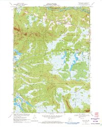 1970 Spaulding1972 Print · USGSJackson County’s cranberry country and railroad corridors are captured here in the early seventies. Genealogists and local historians can trace the tracks through Pray and Spaulding or locate landmarks like Potter Flowage and Saddle Mound.2 unique versions available
 - 1970 Map of Warrens East, 1972 Print
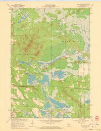 1970 Warrens East1972 Print · USGSIn the early 1970s, the border between Jackson and Monroe counties was defined by industrial cranberry cultivation and vast conservation areas. Genealogists and local historians can trace family-named landmarks like Morman Cem and Miles Peak or locate old transit points such as Bear Bluff Station.
 - 1970 Map of Hatfield SE, 1972 Print
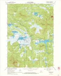 1970 Hatfield SE1972 Print · USGSJackson County's wetland interior is captured here in the early 1970s, showcasing a complex system of state forest lands and managed flowages. Researchers can trace the legacy of regional industry and land use through the Cranberry Bogs, the Old Railroad Grade, and distinctive landmarks like Saddle Mound.2 unique versions available
End of results
Showing maps 1-3 of 3
Top cities near Knapp
- Tomah historical maps
- Brockway historical maps
- Cutler historical maps
- Sherwood historical maps
- Warrens historical maps
- City Point historical maps
See more
Top neighborhoods of Knapp
Frequently asked questions
- What are the different types of historical maps available for Knapp?
- What is the oldest map of Knapp?
- Where can I purchase historical maps of Knapp for my home or office?
- Where can I download high-res historical maps of Knapp?
- Are there historical topographic maps available for Knapp?
- Is there historical aerial imagery available for Knapp?
- Where are historical maps of Knapp sourced from?