2020s Maps of Millston, Wisconsin
Explore 4 historic maps of Millston from the 2020s. These maps offer a rare glimpse into what life looked like during the 2020s — showing old roads, neighborhoods, homes, and landmarks that have changed or disappeared over time.
Whether you're researching your family's past, planning a metal detecting trip, or studying how Millston's landscape evolved across the 2020s, these high-resolution maps are a powerful tool for exploring the history of this region.
- Focus on a specific era: All maps on this page are from the 2020s, giving you a focused view of this time period.
- See what’s changed: Compare century-old streets, trails, and buildings to today's modern landscape using overlays and satellite layers.
- Research with precision: Use these maps for genealogy, historical research, land use analysis, or educational projects.
- View, download, or print: Maps are fully viewable online in high resolution, and can be downloaded or printed for your own records.
Start exploring Millston's history through authentic maps from the 2020s. This is your window into the past.
Millston, WI maps
(4)- 2022 Map of Warrens West, 2022 Print
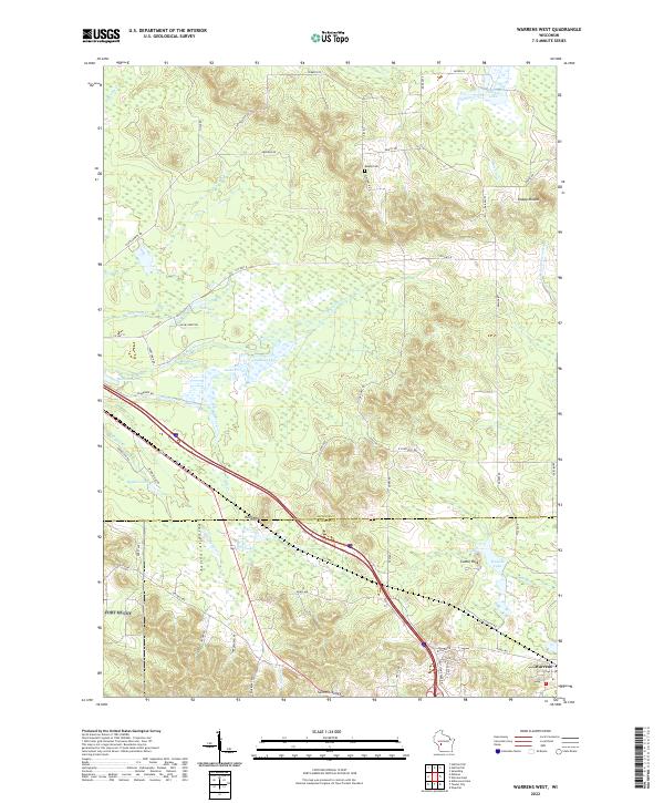 2022 Warrens West2022 Print · USGSJackson and Monroe Counties are shown here during the early 2020s, a landscape defined by cranberry marshes and glacial topography. Researchers can locate family landmarks like Knapp Cem or trace the drainage of the E Fork Lemonweir River and Robinson Pond.
 - 2022 Map of Hatfield SE, 2022 Print
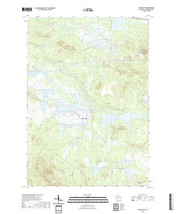 2022 Hatfield SE2022 Print · USGSJackson County's marshlands and glacial mounds are documented in this recent survey of the Central Wisconsin landscape. Researchers can trace intricate water systems like Townline Reservoir and find local landmarks such as Wildcat Mound and Speck Oaks.
 - 2022 Map of Millston, 2022 Print
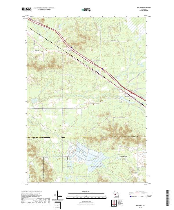 2022 Millston2022 Print · USGSMillston and the surrounding wetlands of Jackson County appear here in the early 2020s, showing a landscape defined by timber roads and flowages. Genealogists and researchers can locate Brookside Cem and trace the paths of Robinson Cr or Wyman Creek through the woods.
 - 2023 Map of Hatfield SW, 2023 Print
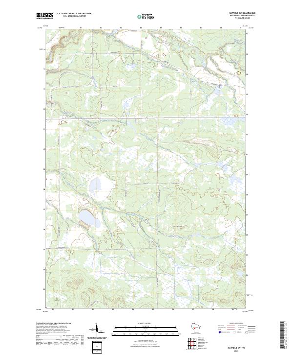 2023 Hatfield SW2023 Print · USGSJackson County's wetlands and timbered ridges are meticulously documented in this recent survey of the Hatfield SW area. Researchers can trace the winding paths of Indian Grave Creek and Morrison Creek or locate landmarks like Levis Mound and Trowe Marsh.
End of results
Showing maps 1-4 of 4
Top cities near Millston
- Sparta historical maps
- Tomah historical maps
- Black River Falls historical maps
- Brockway historical maps
- Merrillan historical maps
- Sherwood historical maps
See more
Top neighborhoods of Millston
Frequently asked questions
- What are the different types of historical maps available for Millston?
- What is the oldest map of Millston?
- Where can I purchase historical maps of Millston for my home or office?
- Where can I download high-res historical maps of Millston?
- Are there historical topographic maps available for Millston?
- Is there historical aerial imagery available for Millston?
- Where are historical maps of Millston sourced from?