Old Maps of Vinnie Ha Ha, Koshkonong for Academic Research
Study the evolution of Vinnie Ha Ha with 15 high-resolution historic maps. Whether you're teaching, researching, or modeling changes in land use, these maps provide essential visual documentation of urban, environmental, and geographic change.
- Analyze long-term change: Track patterns in development, transportation, and natural features.
- Ideal for environmental or urban studies: Support academic projects with primary historical map data.
- Use in the classroom or lab: Educators and researchers rely on these maps to bring historical context to life.
These maps are a powerful tool for teaching, research, and visualizing how Vinnie Ha Ha has changed over the decades.
Vinnie Ha Ha, Koshkonong maps
(15)- 1891 Map of Koshkonong
 1891 Koshkonong1891 Print · USGSJefferson County was an evolving hub of river power and rail transit in the 1890s. Researchers can trace the early footprints of Jefferson and Fort Atkinson or locate rural landmarks like Busseyville and Cold Spring.
 - 1894 Map of Koshkonong
 1894 Koshkonong1894 Print · USGSSouthern Wisconsin at the end of the nineteenth century is defined by its glacial lakes and expanding rail networks. Genealogists can trace family footprints in Fort Atkinson and Milton Junction, or locate small settlements like Busseyville and Cold Spring.2 unique versions available
 - 1906 Map of Koshkonong
 1906 Koshkonong1906 Print · USGSSouthern Wisconsin at the turn of the century was a landscape of expanding rail junctions and river towns. Trace the early footprints of Fort Atkinson and Jefferson, or follow the rail lines connecting Milton Junction and Lima Center.3 unique versions available
 - 1954 Map of Rockford
 1954 Rockford1954 Print · USGSThe Rock River valley and the Illinois-Wisconsin borderlands are captured here in the mid-1950s during a period of robust industrial and agricultural activity. Genealogists and historians can trace rail-era corridors like the Illinois Central RR and locate landmarks from Big Foot Prairie to Lake Geneva.
 - 1955 Map of Rockford
 1955 Rockford1955 Print · USGSThe Rock River valley and southern Wisconsin dairy country are shown here in the mid-fifties as the region's manufacturing centers grew. Genealogists and historians can trace the paths of the Chicago and North Western RR and Illinois Central RR through hubs like Rockford and Beloit.
 - 1958 Map of Rockford, 1974 Print
 1958 Rockford1974 Print · USGSNorthern Illinois and southern Wisconsin are shown here in the mid-twentieth century as rail-dependent industrial towns began to interface with growing lakefront communities. Genealogists can trace family roots through settlements like Saylesville and Tess Corners or locate historical landmarks like the Rockford Ordnance Depot.4 unique versions available
 - 1961 Map of Fort Atkinson, 1963 Print
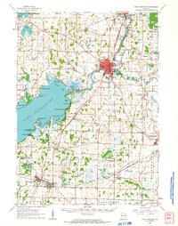 1961 Fort Atkinson1963 Print · USGSJefferson and Rock Counties come alive in the early 1960s, showing a landscape defined by the vast Lake Koshkonong and busy rail corridors. Genealogists can locate family names at Lakeview Cem or trace rural education at the Koshkonong Sch and Burr Oak Sch.2 unique versions available
 - 1961 Map of Busseyville, 1964 Print
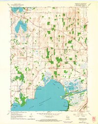 1961 Busseyville1964 Print · USGSJefferson County shoreline communities thrive along the northern edge of Lake Koshkonong in the early sixties. Genealogists and historians can trace family-named landmarks and institutions like Oakland Evergreen Cem, St Johns Ch, and the Sylvan Mounds.2 unique versions available
 - 1963 Map of Rockford
 1963 Rockford1963 Print · USGSThe mid-century industrial corridor along the Rock River is shown here during a period of rapid post-war growth. Researchers can trace the extensive rail lines of the Chicago and North Western or locate local landmarks like the Rockford Ordnance Depot and Holy Hill.
 - 1980 Map of Lake Geneva, 1981 Print
 1980 Lake Geneva1981 Print · USGSSoutheastern Wisconsin at the start of the eighties reveals a landscape of glacial moraines and established lakefront resorts. Researchers can trace historic rail lines like the Chicago and North Western RR or locate landmarks such as Yerkes Observatory and East Lawn Cem.
 - 2010 Map of Busseyville, 2010 Print
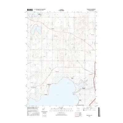
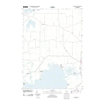 2010 Busseyville2010 Print · USGSCovers Vinnie Ha Ha, including Oakland, North Shore, and other nearby areas
 - 2013 Map of Busseyville, 2013 Print
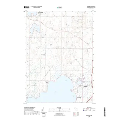
 2013 Busseyville2013 Print · USGSCovers Vinnie Ha Ha, including Oakland, North Shore, and other nearby areas
 - 2016 Map of Busseyville, 2016 Print
 2016 Busseyville2016 Print · USGSCovers Vinnie Ha Ha, including Oakland, North Shore, and other nearby areas
 - 2018 Map of Busseyville, 2018 Print
 2018 Busseyville2018 Print · USGSCovers Vinnie Ha Ha, including Oakland, North Shore, and other nearby areas
 - 2022 Map of Busseyville, 2022 Print
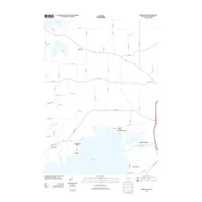
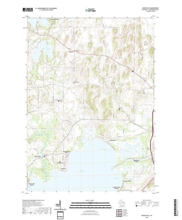 2022 Busseyville2022 Print · USGSJefferson County shorelines and rural townships are captured here in the early twenty-first century. Researchers can trace ancestral sites at Oakland Seventh Day Cem, explore the layout of Busseyville, or locate landmarks like Sylvan Mounds and Blackhawk Island.
End of results
Showing maps 1-15 of 15
Top cities near Vinnie Ha Ha
- Janesville historical maps
- Fort Atkinson historical maps
- Whitewater historical maps
- Jefferson historical maps
- Milton historical maps
- Lake Mills historical maps
See more
Frequently asked questions
- What are the different types of historical maps available for Vinnie Ha Ha?
- What is the oldest map of Vinnie Ha Ha?
- Where can I purchase historical maps of Vinnie Ha Ha for my home or office?
- Where can I download high-res historical maps of Vinnie Ha Ha?
- Are there historical topographic maps available for Vinnie Ha Ha?
- Is there historical aerial imagery available for Vinnie Ha Ha?
- Where are historical maps of Vinnie Ha Ha sourced from?