Old Maps of Palmyra, Wisconsin for Metal Detecting
Plan your next treasure hunt with 35 historic maps of Palmyra. Find old homesites, ghost towns, trails, and gathering spots that may be lost to time — perfect for identifying promising metal detecting locations.
- Locate forgotten sites: Uncover places like long-lost settlements, abandoned rail lines, or gathering spots.
- Plan better hunts: Use map overlays combined with LiDAR or satellite views to narrow in on historically rich areas.
- Made for detectorists: Thousands of hobbyists use these maps to discover relics, coins, and hidden history.
Use these historic maps to boost your research and find new opportunities beneath the surface of Palmyra.
Palmyra, WI maps
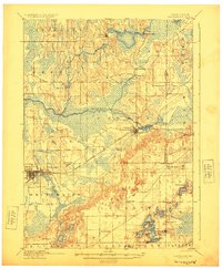
(35)- 1892 Map of Whitewater
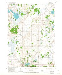
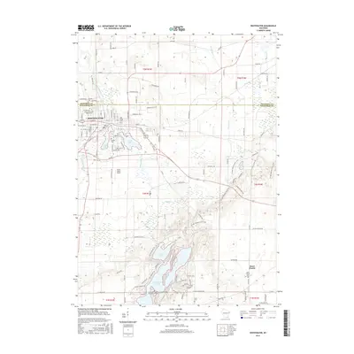
 1892 Whitewater1892 Print · USGSSoutheastern Wisconsin's glaciated landscape is revealed in the late nineteenth century as the rail network began to shape local growth. Trace the path of the Chicago Milwaukee And St. Paul Railroad through Whitewater, Palmyra, and the marshes of the Bark River.
 - 1893 Map of Whitewater
 1893 Whitewater1893 Print · USGSThe dairy lands and glacial lake districts of southeastern Wisconsin are captured here in the late nineteenth century. Trace the early village footprints of Whitewater and Palmyra, or follow the iron path of the Prairie Du Chien Division Railroad past Lauderdale Lakes.7 unique versions available
 - 1903 Map of Whitewater
 1903 Whitewater1903 Print · USGSSoutheastern Wisconsin at the turn of the century reveals a landscape of thriving rail towns and glacial lake systems. Trace the early routes of the Chicago Milwaukee and St Paul railroad between Whitewater and Palmyra, or locate old lakeside settlements like Heart Prairie.5 unique versions available
 - 1924 Map of Whitewater
 1924 Whitewater1924 Print · USGSSoutheastern Wisconsin at the turn of the century shows a landscape of glacial lakes and thriving rail-side towns. Genealogists and historians can trace old homesteads near Heaths Mills, the station at Palmyra, and the early township centers of Rome and Lagrange.4 unique versions available
 - 1954 Map of Rockford
 1954 Rockford1954 Print · USGSThe Rock River valley and the Illinois-Wisconsin borderlands are captured here in the mid-1950s during a period of robust industrial and agricultural activity. Genealogists and historians can trace rail-era corridors like the Illinois Central RR and locate landmarks from Big Foot Prairie to Lake Geneva.
 - 1955 Map of Rockford
 1955 Rockford1955 Print · USGSThe Rock River valley and southern Wisconsin dairy country are shown here in the mid-fifties as the region's manufacturing centers grew. Genealogists and historians can trace the paths of the Chicago and North Western RR and Illinois Central RR through hubs like Rockford and Beloit.
 - 1958 Map of Rockford, 1974 Print
 1958 Rockford1974 Print · USGSNorthern Illinois and southern Wisconsin are shown here in the mid-twentieth century as rail-dependent industrial towns began to interface with growing lakefront communities. Genealogists can trace family roots through settlements like Saylesville and Tess Corners or locate historical landmarks like the Rockford Ordnance Depot.4 unique versions available
 - 1960 Map of Whitewater, 1962 Print
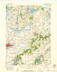 1960 Whitewater1962 Print · USGSThe Whitewater area and its glacial lake country are captured here at the start of the 1960s. Genealogists and local researchers can trace the locations of Wisconsin State College, the Siloam Chapel, and numerous rural schoolhouses.4 unique versions available
 - 1960 Map of Rome, 1964 Print
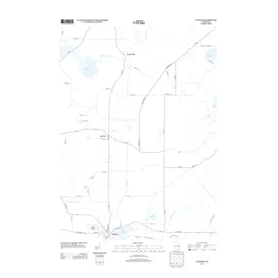
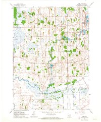 1960 Rome1964 Print · USGSJefferson County in the early sixties is a landscape of winding river bends and small crossroads hamlets. Genealogists and local historians can trace family locations near St Lukes Cem, identify the old Cushman Mill Sch, or locate former homesteads in Slabtown and Hebron.2 unique versions available
 - 1960 Map of Little Prairie, 1964 Print
 1960 Little Prairie1964 Print · USGSGlacial lakes and hardwood forests define this Walworth County landscape in the early sixties. Genealogists and historians can trace the rural layout of Little Prairie and La Grange, or locate family sites near Skoponong Cem and Battle Creek Sch.3 unique versions available
 - 1960 Map of Palmyra, 1964 Print
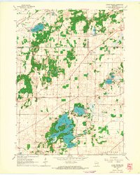
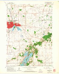
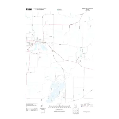
 1960 Palmyra1964 Print · USGSWisconsin's glacial landscape is meticulously detailed in the early 1960s, showing the intersection of the Kettle Moraine State Forest and the Scuppernong River. Researchers can trace rural lineages through family landmarks like Heath Mills and old country burial grounds including Zion Cem and Melindas Prairie Cem.2 unique versions available
 - 1960 Map of Whitewater, 1964 Print
 1960 Whitewater1964 Print · USGSWhitewater and the surrounding prairie lands are captured here at the start of the 1960s as the local college and city expanded. Researchers can trace historic family locations near Heart Prairie, find old rural schools like Lakeview Sch, and locate cemeteries including Oak Grove Cem and Lyons Cem.3 unique versions available
 - 1963 Map of Rockford
 1963 Rockford1963 Print · USGSThe mid-century industrial corridor along the Rock River is shown here during a period of rapid post-war growth. Researchers can trace the extensive rail lines of the Chicago and North Western or locate local landmarks like the Rockford Ordnance Depot and Holy Hill.
 - 1980 Map of Lake Geneva, 1981 Print
 1980 Lake Geneva1981 Print · USGSSoutheastern Wisconsin at the start of the eighties reveals a landscape of glacial moraines and established lakefront resorts. Researchers can trace historic rail lines like the Chicago and North Western RR or locate landmarks such as Yerkes Observatory and East Lawn Cem.
 - 1995 Map of Palmyra, 1999 Print
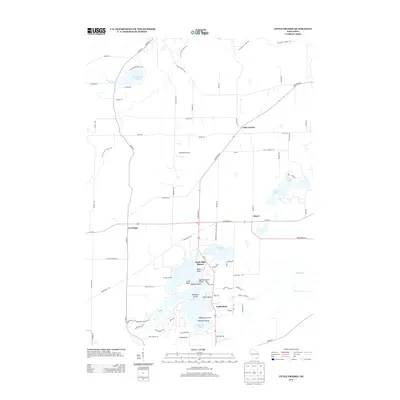
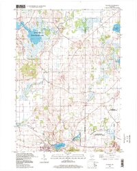 1995 Palmyra1999 Print · USGSSoutheast Wisconsin in the 1990s reveals a landscape of terminal moraines and kettle lakes at the edge of the Kettle Moraine. Researchers can locate family landmarks like Melindas Prairie Cem, trace the community around Oak Hill, or explore the shores of Pretty Lake.
 - 2010 Map of Rome, 2010 Print
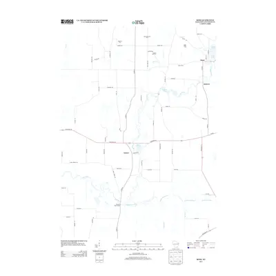
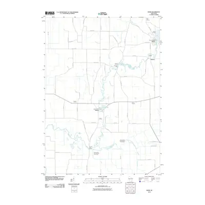 2010 Rome2010 Print · USGSCovers Palmyra, including Hebron, Cold Spring, and other nearby areas
 - 2010 Map of Whitewater, 2010 Print
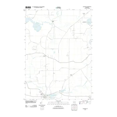
 2010 Whitewater2010 Print · USGSCovers Palmyra, including Whitewater, La Grange, and other nearby areas
 - 2010 Map of Palmyra, 2010 Print
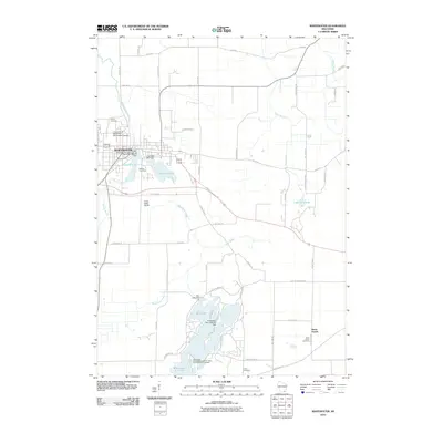
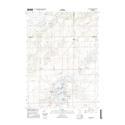
 2010 Palmyra2010 Print · USGSCovers Palmyra, including Ottawa, Eagle, and other nearby areas
 - 2010 Map of Little Prairie, 2010 Print
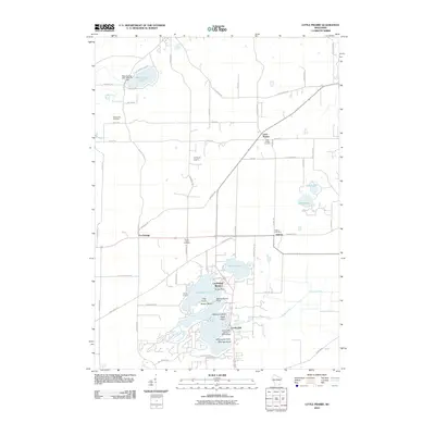 2010 Little Prairie2010 Print · USGSCovers Palmyra, including Eagle, La Grange, and other nearby areas
 - 2013 Map of Rome, 2013 Print
 2013 Rome2013 Print · USGSCovers Palmyra, including Hebron, Cold Spring, and other nearby areas
 - 2013 Map of Whitewater, 2013 Print
 2013 Whitewater2013 Print · USGSCovers Palmyra, including Whitewater, La Grange, and other nearby areas
 - 2013 Map of Palmyra, 2013 Print
 2013 Palmyra2013 Print · USGSCovers Palmyra, including Ottawa, Eagle, and other nearby areas
 - 2013 Map of Little Prairie, 2013 Print
 2013 Little Prairie2013 Print · USGSCovers Palmyra, including Eagle, La Grange, and other nearby areas
 - 2016 Map of Whitewater, 2016 Print
 2016 Whitewater2016 Print · USGSCovers Palmyra, including Whitewater, La Grange, and other nearby areas
 - 2016 Map of Little Prairie, 2016 Print
 2016 Little Prairie2016 Print · USGSCovers Palmyra, including Eagle, La Grange, and other nearby areas
Showing maps 1-25 of 35
Top cities near Palmyra
- Oconomowoc historical maps
- Fort Atkinson historical maps
- Whitewater historical maps
- Elkhorn historical maps
- Merton historical maps
- Mukwonago historical maps
See more
Frequently asked questions
- What are the different types of historical maps available for Palmyra?
- What is the oldest map of Palmyra?
- Where can I purchase historical maps of Palmyra for my home or office?
- Where can I download high-res historical maps of Palmyra?
- Are there historical topographic maps available for Palmyra?
- Is there historical aerial imagery available for Palmyra?
- Where are historical maps of Palmyra sourced from?