Old Maps of Marion, Wisconsin for Academic Research
Study the evolution of Marion with 30 high-resolution historic maps. Whether you're teaching, researching, or modeling changes in land use, these maps provide essential visual documentation of urban, environmental, and geographic change.
- Analyze long-term change: Track patterns in development, transportation, and natural features.
- Ideal for environmental or urban studies: Support academic projects with primary historical map data.
- Use in the classroom or lab: Educators and researchers rely on these maps to bring historical context to life.
These maps are a powerful tool for teaching, research, and visualizing how Marion has changed over the decades.
Marion, WI maps
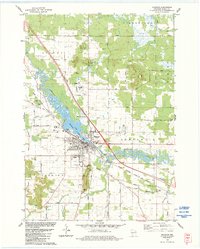
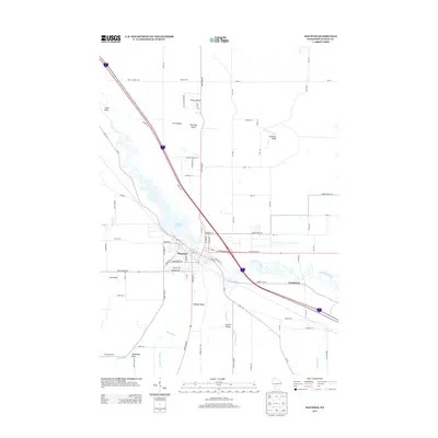
(30)- 1921 Map of Mauston
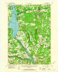
 1921 Mauston1921 Print · USGSJuneau County was a bustling hub of rail transport and rural education in the decade after the Great War. Genealogists can trace family footprints through dozens of rural school sites like Sand Hill School and family-named landmarks such as Buckley's Bridge.2 unique versions available
 - 1957 Map of Madison, 1967 Print
 1957 Madison1967 Print · USGSSouth-central Wisconsin in the mid-fifties reveals a landscape of industrial hubs and glacial lakes linked by a dense rail and highway network. Genealogists and historians can trace the development of lakeside communities and find notable sites like Badger Ordnance Works and the Horicon National Wildlife Refuge.3 unique versions available
 - 1958 Map of La Crosse, 1979 Print
 1958 La Crosse1979 Print · USGSThe Driftless Area of Wisconsin and Iowa is captured here during the late seventies, showing the intricate river valleys and ridge-top settlements. Genealogists and historians can trace the rail corridors of the Soo Line or locate landmarks like Grandad Bluff and Effigy Mounds National Monument.2 unique versions available
 - 1960 Map of Madison
 1960 Madison1960 Print · USGSCentral and Southern Wisconsin are captured in the late fifties, showing the region as its rail-and-river network matured. Trace the paths of the Soo Line RR or locate family roots near Lake Mendota and Horicon National Wildlife Refuge.2 unique versions available
 - 1961 Map of La Crosse
 1961 La Crosse1961 Print · USGSThe Driftless Area at the start of the 1960s reveals a complex network of river towns and rail lines along the Mississippi River. Genealogists and historians can trace old settlements like New Amsterdam and Wyattville or locate major landmarks like Camp McCoy Military Reservation and Effigy Mounds National Monument.
 - 1961 Map of Adams, 1963 Print
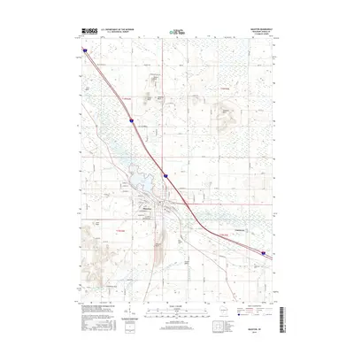
 1961 Adams1963 Print · USGSCentral Wisconsin at the start of the sixties reveals a landscape shaped by the Castle Rock Flowage and prominent glacial mounds. Researchers can locate vanished rural landmarks like Castle Rock Sch, the Woodside Ranch, and historic country cemeteries.2 unique versions available
 - 1962 Map of Mauston, 1964 Print
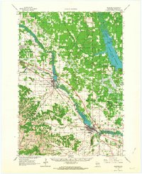 1962 Mauston1964 Print · USGSJuneau County in the early 1960s is defined by the expansive Castle Rock Flowage and the bustling rail corridors of the Lemonweir River valley. Genealogists and local researchers can locate numerous family landmarks, including St Patricks Cem, Baker Sch, and the grounds of Camp Williams.2 unique versions available
 - 1965 Map of La Crosse
 1965 La Crosse1965 Print · USGSThe Driftless Area and the Upper Mississippi valley are captured here during a period of steady mid-century growth. Researchers can trace the rail lines of the Chicago and North Western or locate riverfront sites like Effigy Mounds National Monument and the Camp McCoy Military Reservation.
 - 1976 Map of La Crosse
 1976 La Crosse1976 Print · USGSThe Driftless Area and Mississippi River valley are captured here in the mid-seventies, showing a landscape of deep coulees and river commerce. Genealogists can trace family footprints from La Crosse to smaller hamlets like Newburg Corners and Witoka.
 - 1983 Map of Round Bluff, 1984 Print
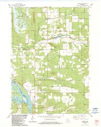
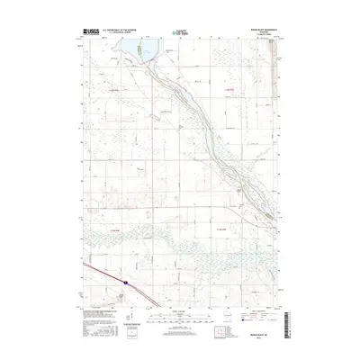
 1983 Round Bluff1984 Print · USGSThe river systems of Juneau and Adams counties are shown in high detail during the early 1980s. Local researchers can trace old property lines and landmarks like St Michaels Cem, the Woodside Ranch, and the rail corridor near Round Bluff.
 - 1983 Map of Easton, 1984 Print
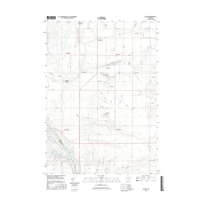
 1983 Easton1984 Print · USGSThe Wisconsin River valley in the early 1980s is captured here, showing the rural communities of Adams County. Local historians can trace family-named sites like Easton Cem, the old Castle Rock Sch, and landmarks like Quincy Bluff.
 - 1983 Map of Mauston, 1984 Print
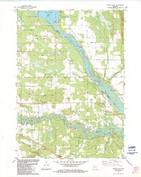
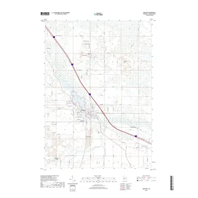
 1983 Mauston1984 Print · USGSJuneau County was characterized by a blend of river-valley agriculture and growing civic centers in the early eighties. You can trace family plots at St Patricks Cem or locate landmarks like the Hess Memorial Hospital and the Milwaukee Road rail line.
 - 1985 Map of Wisconsin Dells
 1985 Wisconsin Dells1985 Print · USGSCentral Wisconsin in the mid-eighties was a landscape of intricate river bends, rail junctions, and sprawling marshlands. Researchers can trace historic routes along the Soo Line or locate family landmarks near Lyndon Station, Buffalo Lake, and Puckaway Lake.
 - 1985 Map of Sparta
 1985 Sparta1985 Print · USGSWestern Wisconsin in the 1980s shows the unique ridge-and-valley terrain of the Driftless Area during a period of transition for its rails and rural hubs. Trace the historic rail tunnels of the Elroy-Sparta State Trail and find local landmarks like St Marys Ch and Castle Rock Lake.2 unique versions available
 - 1990 Map of Wisconsin Dells, 1991 Print
 1990 Wisconsin Dells1991 Print · USGSCentral Wisconsin's river valleys and lake country are captured in detail here during the late twentieth century. Researchers can trace the rail-and-water geography connecting Wisconsin Dells and Portage with landmarks like Blackhawk Island and Buffalo Lake.
 - 2010 Map of Easton, 2010 Print
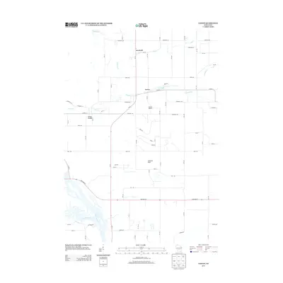
 2010 Easton2010 Print · USGSCovers Marion, including Easton, Quincy, and other nearby areas
 - 2010 Map of Round Bluff, 2010 Print
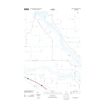
 2010 Round Bluff2010 Print · USGSCovers Marion, including Lemonweir, Easton, and other nearby areas
 - 2010 Map of Mauston, 2010 Print
 2010 Mauston2010 Print · USGSCovers Marion, including Mauston, Lemonweir, and other nearby areas
 - 2013 Map of Mauston, 2013 Print
 2013 Mauston2013 Print · USGSCovers Marion, including Mauston, Lemonweir, and other nearby areas
 - 2013 Map of Easton, 2013 Print
 2013 Easton2013 Print · USGSCovers Marion, including Easton, Quincy, and other nearby areas
 - 2013 Map of Round Bluff, 2013 Print
 2013 Round Bluff2013 Print · USGSCovers Marion, including Lemonweir, Easton, and other nearby areas
 - 2016 Map of Mauston, 2016 Print
 2016 Mauston2016 Print · USGSCovers Marion, including Mauston, Lemonweir, and other nearby areas
 - 2016 Map of Round Bluff, 2016 Print
 2016 Round Bluff2016 Print · USGSCovers Marion, including Lemonweir, Easton, and other nearby areas
 - 2016 Map of Easton, 2016 Print
 2016 Easton2016 Print · USGSCovers Marion, including Easton, Quincy, and other nearby areas
 - 2018 Map of Mauston, 2018 Print
 2018 Mauston2018 Print · USGSCovers Marion, including Mauston, Lemonweir, and other nearby areas
Showing maps 1-25 of 30
Top cities near Marion
- Mauston historical maps
- Lake Delton historical maps
- Wisconsin Dells historical maps
- New Lisbon historical maps
- Adams historical maps
- Lemonweir historical maps
See more
Frequently asked questions
- What are the different types of historical maps available for Marion?
- What is the oldest map of Marion?
- Where can I purchase historical maps of Marion for my home or office?
- Where can I download high-res historical maps of Marion?
- Are there historical topographic maps available for Marion?
- Is there historical aerial imagery available for Marion?
- Where are historical maps of Marion sourced from?