2020s Maps of New Lisbon, Wisconsin
Explore 2 historic maps of New Lisbon from the 2020s. These maps offer a rare glimpse into what life looked like during the 2020s — showing old roads, neighborhoods, homes, and landmarks that have changed or disappeared over time.
Whether you're researching your family's past, planning a metal detecting trip, or studying how New Lisbon's landscape evolved across the 2020s, these high-resolution maps are a powerful tool for exploring the history of this region.
- Focus on a specific era: All maps on this page are from the 2020s, giving you a focused view of this time period.
- See what’s changed: Compare century-old streets, trails, and buildings to today's modern landscape using overlays and satellite layers.
- Research with precision: Use these maps for genealogy, historical research, land use analysis, or educational projects.
- View, download, or print: Maps are fully viewable online in high resolution, and can be downloaded or printed for your own records.
Start exploring New Lisbon's history through authentic maps from the 2020s. This is your window into the past.
New Lisbon, WI maps
(2)- 2022 Map of New Lisbon South, 2022 Print
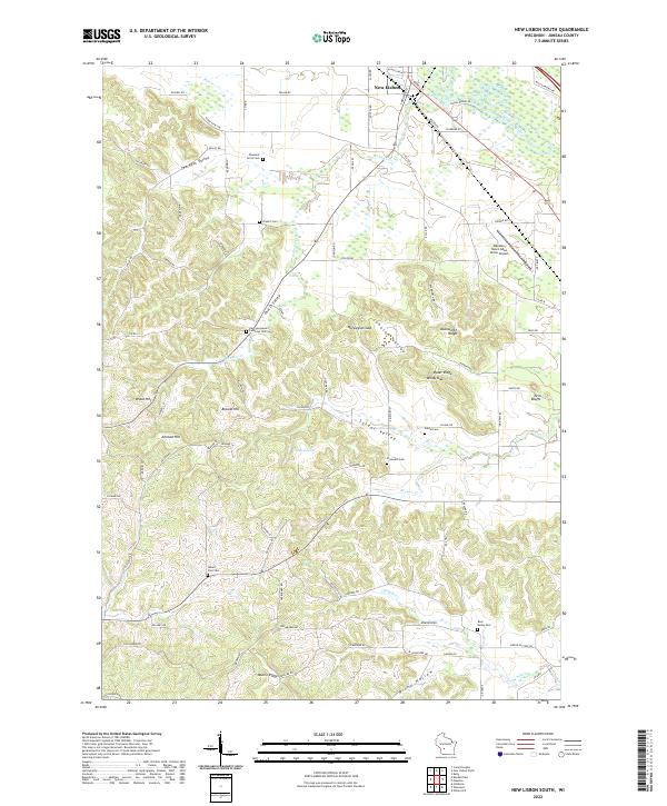 2022 New Lisbon South2022 Print · USGSSouth of New Lisbon in the early 2020s, this landscape reveals a dense network of rural cemeteries and ridge-top settlements. Genealogists can locate family sites like Pleasant Acres Cem or trace the winding waters of Webster Cr and Brewer Cr.
 - 2022 Map of New Lisbon North, 2022 Print
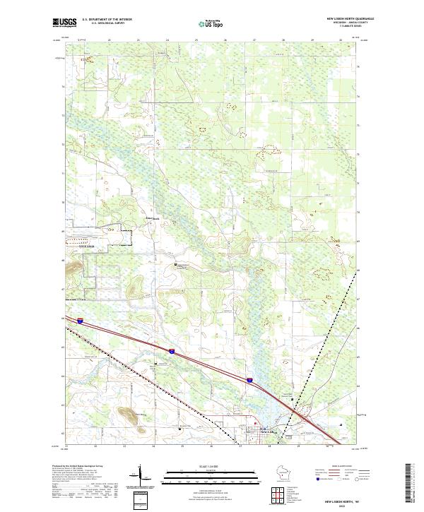 2022 New Lisbon North2022 Print · USGSCentral Wisconsin at the dawn of the 2020s shows a landscape deeply tied to the winding Lemonweir River. Researchers can trace family history through sites like Brewster Cem, Town of Orange Cem, and the prominent Twin Bluffs.
End of results
Showing maps 1-2 of 2
Top cities near New Lisbon
- Mauston historical maps
- Lemonweir historical maps
- Elroy historical maps
- Hillsboro historical maps
- Lyndon historical maps
- Strongs Prairie historical maps
See more
Frequently asked questions
- What are the different types of historical maps available for New Lisbon?
- What is the oldest map of New Lisbon?
- Where can I purchase historical maps of New Lisbon for my home or office?
- Where can I download high-res historical maps of New Lisbon?
- Are there historical topographic maps available for New Lisbon?
- Is there historical aerial imagery available for New Lisbon?
- Where are historical maps of New Lisbon sourced from?