2020s Maps of Tomahawk, Wisconsin
Explore 3 historic maps of Tomahawk from the 2020s. These maps offer a rare glimpse into what life looked like during the 2020s — showing old roads, neighborhoods, homes, and landmarks that have changed or disappeared over time.
Whether you're researching your family's past, planning a metal detecting trip, or studying how Tomahawk's landscape evolved across the 2020s, these high-resolution maps are a powerful tool for exploring the history of this region.
- Focus on a specific era: All maps on this page are from the 2020s, giving you a focused view of this time period.
- See what’s changed: Compare century-old streets, trails, and buildings to today's modern landscape using overlays and satellite layers.
- Research with precision: Use these maps for genealogy, historical research, land use analysis, or educational projects.
- View, download, or print: Maps are fully viewable online in high resolution, and can be downloaded or printed for your own records.
Start exploring Tomahawk's history through authentic maps from the 2020s. This is your window into the past.
Tomahawk, WI maps
(3)- 2022 Map of Coffee Creek, 2022 Print
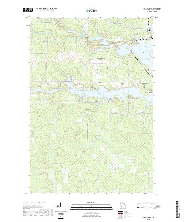 2022 Coffee Creek2022 Print · USGSThe intricate waterways around the city of Tomahawk are documented here in the early twenty-first century. Genealogists and local historians can trace family-named roads and land features around Lake Mohawksin, West Kraft, and the Spirit River Flowage.
 - 2023 Map of Spirit Falls, 2023 Print
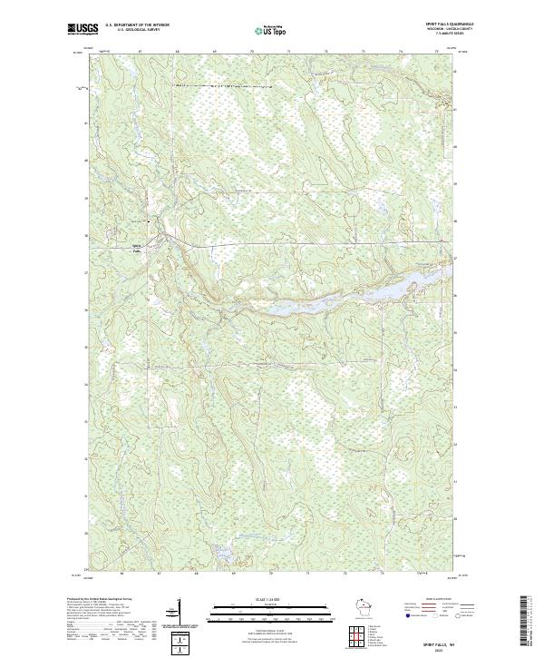 2023 Spirit Falls2023 Print · USGSLincoln County's northwoods character is preserved in this modern survey of the Spirit Falls area. Genealogists and outdoor historians can locate the Spirit Falls Cem and trace the winding paths of the Spirit River and Somo River.
 - 2023 Map of Spirit, 2023 Print
 2023 Spirit2023 Print · USGSNorth-central Wisconsin's timber and farm country is documented here at the convergence of Price, Lincoln, and Taylor counties. Genealogists and local historians can trace family land near Hillcrest Cem or follow the legacy of local industry along Cheese Factory Rd and N German Settlement Rd.
End of results
Showing maps 1-3 of 3
Top cities near Tomahawk
- Merrill historical maps
- Tomahawk historical maps
- Bradley historical maps
- Goodrich historical maps
- Spirit historical maps
Top neighborhoods of Tomahawk
Frequently asked questions
- What are the different types of historical maps available for Tomahawk?
- What is the oldest map of Tomahawk?
- Where can I purchase historical maps of Tomahawk for my home or office?
- Where can I download high-res historical maps of Tomahawk?
- Are there historical topographic maps available for Tomahawk?
- Is there historical aerial imagery available for Tomahawk?
- Where are historical maps of Tomahawk sourced from?