2020s Maps of Silver Cliff, Wisconsin
Explore 7 historic maps of Silver Cliff from the 2020s. These maps offer a rare glimpse into what life looked like during the 2020s — showing old roads, neighborhoods, homes, and landmarks that have changed or disappeared over time.
Whether you're researching your family's past, planning a metal detecting trip, or studying how Silver Cliff's landscape evolved across the 2020s, these high-resolution maps are a powerful tool for exploring the history of this region.
- Focus on a specific era: All maps on this page are from the 2020s, giving you a focused view of this time period.
- See what’s changed: Compare century-old streets, trails, and buildings to today's modern landscape using overlays and satellite layers.
- Research with precision: Use these maps for genealogy, historical research, land use analysis, or educational projects.
- View, download, or print: Maps are fully viewable online in high resolution, and can be downloaded or printed for your own records.
Start exploring Silver Cliff's history through authentic maps from the 2020s. This is your window into the past.
Silver Cliff, WI maps
(7)- 2022 Map of Coleman Lake, 2022 Print
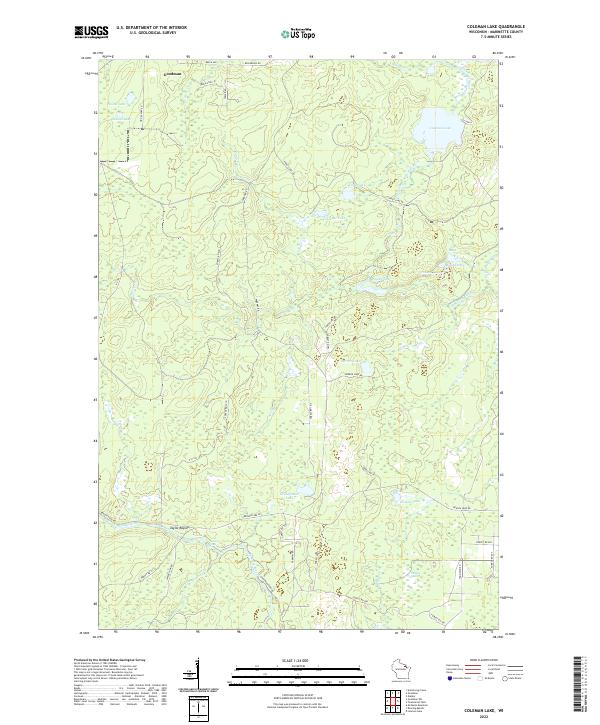 2022 Coleman Lake2022 Print · USGSMarinette County’s northern timberlands and glacial lakes are preserved in this study from the early twenty-first century. Researchers can trace the rugged corridor of the Peshtigo River to find Strong Falls and the riverside site of Taylor Rapids.
 - 2022 Map of Goodman SW, 2022 Print
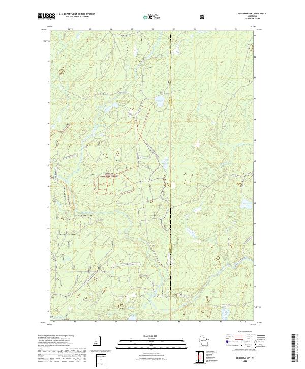 2022 Goodman SW2022 Print · USGSNortheastern Wisconsin's timberlands and river systems are documented here in the early twenty-first century. Researchers can trace the winding course of the Peshtigo River and locate secluded waters such as Camp Six Lake and Valley Lake.
 - 2022 Map of Roaring Rapids, 2022 Print
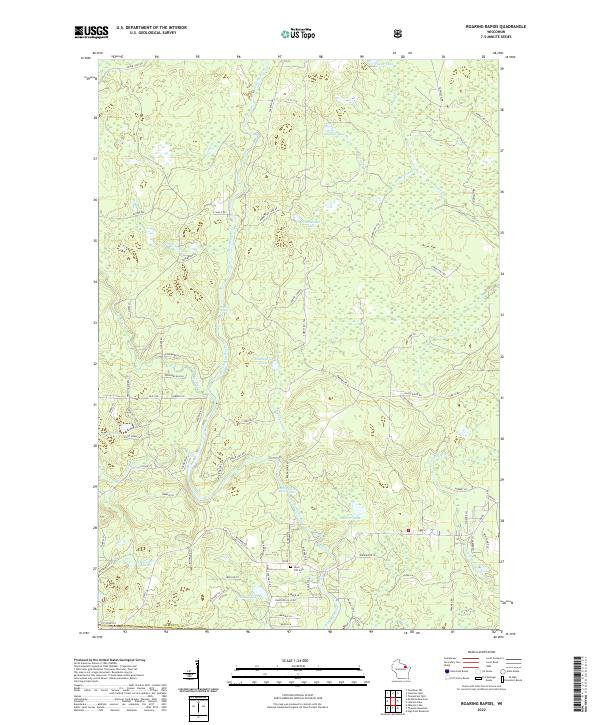 2022 Roaring Rapids2022 Print · USGSMarinette County's river-cut landscape is captured here in the early twenty-first century, centered on the wild waters of the Peshtigo River. Researchers can locate the Silver Cliff Cem and trace historic water features like Roaring Rapids and Jerry Chute.
 - 2022 Map of Lehman Lake, 2022 Print
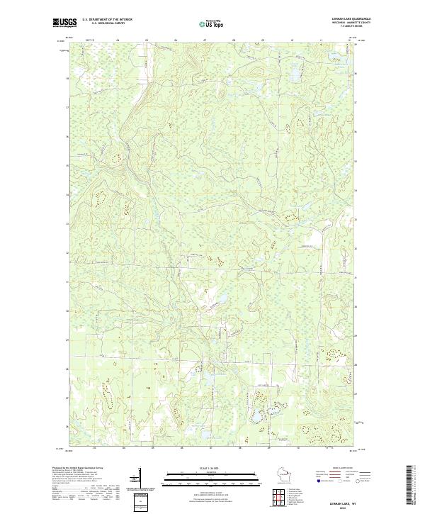 2022 Lehman Lake2022 Print · USGSMarinette County’s lake country is captured here in the early twenty-first century, showcasing a landscape of glacial waters and timber access roads. Outdoor enthusiasts and local historians can trace the course of the Wausaukee River or locate remote spots like Lehman Lake and Horsehead Lake.
 - 2022 Map of Thunder Mountain, 2022 Print
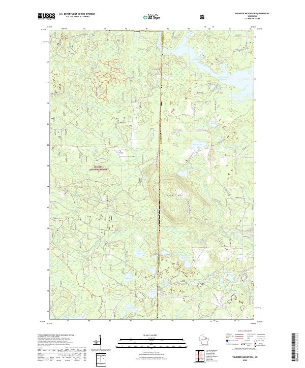 2022 Thunder Mountain2022 Print · USGSThe Northwoods of Oconto and Marinette counties are captured here in the 2020s, showcasing a landscape of timber and glacial water. Outdoor enthusiasts and local historians can trace modern routes like the Pipeline 4x4 Challenge Trl or locate secluded waters such as Wonder Lake and Ledge Lake.
 - 2022 Map of McCaslin Mountain, 2022 Print
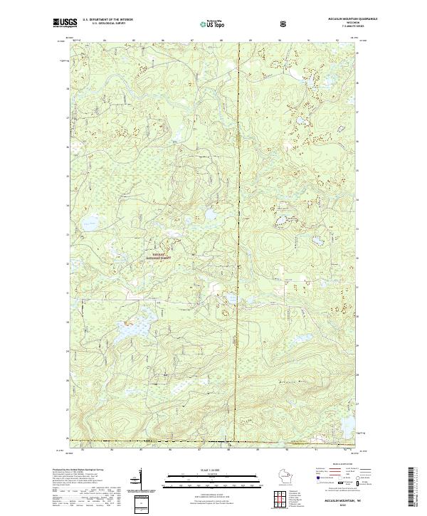 2022 McCaslin Mountain2022 Print · USGSThe northern Wisconsin wilderness comes into focus in this recent survey of the forest-and-lake country within the Nicolet National Forest. You can trace the drainage of the Rat River and locate secluded landings at Harper Lake, Deer Lake, and along the slopes of McCaslin Mtn.
 - 2023 Map of High Falls Reservoir, 2023 Print
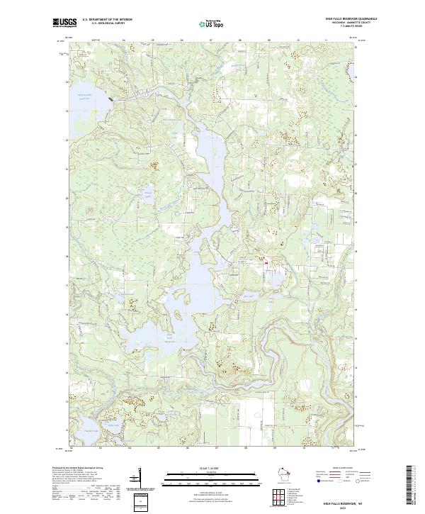 2023 High Falls Reservoir2023 Print · USGSThe Peshtigo River valley in Marinette County shows a landscape of reservoirs and northwoods timber. Trace the shoreline of High Falls Reservoir and find remote points like Old Veterans Lake and Kahles Pond along the network of forest roads.
End of results
Showing maps 1-7 of 7
Top cities near Silver Cliff
- Dunbar historical maps
- Wabeno historical maps
- Lakewood historical maps
- Goodman historical maps
- Athelstane historical maps
- Armstrong Creek historical maps
See more
Frequently asked questions
- What are the different types of historical maps available for Silver Cliff?
- What is the oldest map of Silver Cliff?
- Where can I purchase historical maps of Silver Cliff for my home or office?
- Where can I download high-res historical maps of Silver Cliff?
- Are there historical topographic maps available for Silver Cliff?
- Is there historical aerial imagery available for Silver Cliff?
- Where are historical maps of Silver Cliff sourced from?