Old Maps of Athelstane, Wisconsin
Explore 61 old maps of Athelstane, spanning from 1939 to today. These high-resolution historic maps reveal how streets, neighborhoods, landmarks, and natural features evolved over time — perfect for genealogy, metal detecting, research, and local history exploration.
What you can do with these maps:
- See how Athelstane changed over time: Compare historical maps to modern-day views to trace roads, homesites, rail lines & more.
- View detailed metadata: Each map includes creators, publishers, year, scale, and archive source.
- Overlay maps with satellite & LiDAR: Visualize the past alongside modern tools to explore terrain & human change.
- Trusted historical sources: Maps sourced from the USGS, Library of Congress, and other archives.
- Access maps your way: View online, download high-res files, or order prints for personal or research use.
Start exploring old maps of Athelstane to uncover forgotten places, hidden landmarks, and the deep history beneath your feet.
Athelstane, WI maps
(61)- 1939 Map of Dunbar, 1955 Print
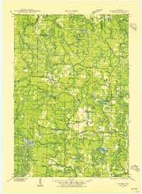 1939 Dunbar1955 Print · USGSThe town of Dunbar and surrounding Marinette County lands are shown here in the late 1930s, caught between the era of heavy rail and emerging forest roads. You can trace early schoolhouses like McKinley Sch, find landmarks like the Dunbar Fire Tower, and locate the crossing at Carney Rapids.2 unique versions available
 - 1939 Map of Goodman, 1956 Print
 1939 Goodman1956 Print · USGSMarinette and Forest counties are shown just before the war when the timber economy and the railroad were the lifeblood of the Northwoods. Genealogists and local historians can trace early settlements at Goodman and Fence, alongside rural landmarks like Engleking Sch and Pine Hill Cem.
 - 1940 Map of Thunder Mtn.
 1940 Thunder Mtn.1940 Print · USGSMarinette County and the surrounding woods are captured here in the early 1940s as a hub of timber production and forestry management. Genealogists and historians can trace rural schools like Silver Cliff Sch, the site of the State Fish Hatchery, and fire lookouts atop Thunder Mountain.2 unique versions available
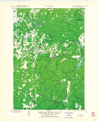
 - 1940 Map of Athelstane, 1969 Print
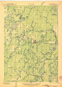
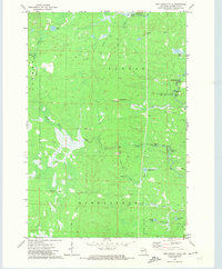
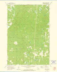
 1940 Athelstane1969 Print · USGSMarinette County was a hub of hydroelectric power and timber management during the 1940s. Researchers can trace rural school districts like Newton Lakes School or locate the specialized Molybdenite Mine near the village of Athelstane.
 - 1941 Map of Dunbar
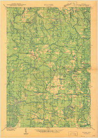
 1941 Dunbar1941 Print · USGSMarinette and Florence Counties are shown here just before the war, when rail lines and rural schools still defined northern Wisconsin life. Genealogists and historians can trace families near Dunbar or locate local landmarks like the Dunbar Fire Tower and Merriman Sch.
 - 1942 Map of Athelstane
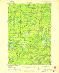
 1942 Athelstane1942 Print · USGSMarinette County was a landscape of timber and hydropower in the early 1940s. Genealogists and historians can trace defunct rural schools like Rector Sch and Konsted Sch, or locate industrial sites such as the Molybdenite Mine.
 - 1946 Map of Goodman
 1946 Goodman1946 Print · USGSMarinette and Florence counties were still deeply tied to the timber industry and rail transit just before the 1940s. Genealogists and historians can trace local family roots at Pine Hill Cem or locate rural landmarks like Engleking Sch and the Goodman Fire Tower.
 - 1947 Map of Dunbar
 1947 Dunbar1947 Print · USGSNortheastern Wisconsin’s logging and rail history is on full display here in the late 1940s, centered on the junction at Dunbar. Local historians can trace the paths of two major railroads and locate vanished community landmarks like the Dunbar Fire Tower and Pike Ridge Sch.
 - 1951 Map of Thunder Mountain, 1953 Print
 1951 Thunder Mountain1953 Print · USGSMarinette and Oconto counties are shown here in the early 1950s, showcasing a landscape of dense timber and river-driven history. Genealogists and historians can locate the Shady Nook Sch, the Fish Hatchery, and fire-watch posts like the Thunder Mountain Lookout Tower.3 unique versions available
 - 1954 Map of Iron Mountain, 1964 Print
 1954 Iron Mountain1964 Print · USGSUpper Michigan and Northeastern Wisconsin are shown in detail during the mid-fifties, when the logging and mining economies still moved by rail. Trace the rail lines of the Soo Line to remote stops like Koepenick Station or explore the Iron Range near Iron Mountain.2 unique versions available
 - 1959 Map of Iron Mountain
 1959 Iron Mountain1959 Print · USGSThe northwoods of Wisconsin and the Michigan border are captured here in the mid-fifties, showing a landscape defined by timber, water, and rail. Researchers can trace historic junctions like Hiles Junction, the expansive Nicolet National Forest, and lakefront settlements from Rhinelander to Tomahawk.2 unique versions available
 - 1972 Map of Town Corner Lake, 1974 Print
 1972 Town Corner Lake1974 Print · USGSMarinette County's glacial lake country is captured here in the early seventies, showing a landscape shaped by conservation and recreation. Genealogists and local historians can trace family-named sites like Lindquist Lake, the remote Holmes Junction, and the Beecher Ch.
 - 1972 Map of Twelvefoot Falls, 1974 Print
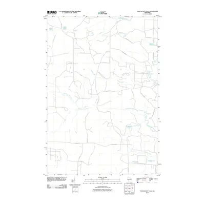
 1972 Twelvefoot Falls1974 Print · USGSMarinette County’s cascading river system is captured here in the early seventies, centered on the townships of Dunbar and Athelstane. Outdoor enthusiasts and local historians can trace the Old Railroad Grade and locate numerous cascades like Twelvefoot Falls and Horseshoe Falls.
 - 1972 Map of Coleman Lake, 1974 Print
 1972 Coleman Lake1974 Print · USGSMarinette County’s northwoods are documented here in the early seventies, showing a landscape defined by river rapids and remote forest camps. Local historians can trace the development of Goodman County Park and landmarks like Strong Falls and the Goodman Lookout Tower.2 unique versions available
 - 1972 Map of High Falls Reservoir, 1975 Print
 1972 High Falls Reservoir1975 Print · USGSMarinette County’s river-driven industry and shoreline recreation are in full focus here during the early seventies. Trace the engineering of the Caldron Falls and High Falls dams or explore local landmarks like Thunder Mountain and Veterans Memorial Park.
 - 1972 Map of Roaring Rapids, 1975 Print
 1972 Roaring Rapids1975 Print · USGSMarinette County was a hub of river activity and forestry in the early seventies, centered on the wild stretches of the Peshtigo River. Researchers can locate St Mary of the Cliff Ch and trace the many rapids and chutes like Jerry Chute and Roaring Rapids.2 unique versions available
 - 1972 Map of Mount Tom, 1975 Print
 1972 Mount Tom1975 Print · USGSMarinette County’s lake-dotted landscape is captured here in the early 1970s, showing the rural intersections of the Northwoods. Genealogists and hikers can trace old routes like Moonshine Hill Road or locate landmarks like the Lookout Tower and Retcof Lake.
 - 1972 Map of Athelstane, 1975 Print
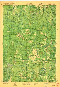
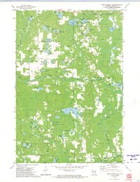
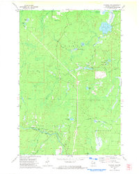
 1972 Athelstane1975 Print · USGSMarinette County's lake-filled woodlands are documented here in the early 1970s, as a rural economy transitioned away from its rail-dependent roots. Genealogists can trace family landmarks like the Athelstane Cem, Assembly of God Ch, and the Old Railroad Grade north of town.
 - 1972 Map of Lehman Lake, 1975 Print
 1972 Lehman Lake1975 Print · USGSMarinette County in the early seventies is a landscape of glacial lakes and timber roads centered on the settlements of Athelstan and Silver Cliff. Researchers can trace the legacy of the logging era via the Old Railroad Grade and landmarks like the Girard Junction Lookout Tower.
 - 1990 Map of Wabeno, 1991 Print
 1990 Wabeno1991 Print · USGSThe Wisconsin Northwoods in the early nineties is a landscape of deep timber, tribal lands, and glacial lakes. Researchers can trace the Chicago and North Western rail line through lumber towns like Wabeno and Townsend or locate the Lakewood State Fish Hatchery.
 - 1991 Map of Iron Mountain
 1991 Iron Mountain1991 Print · USGSThe Michigan-Wisconsin borderlands appear here in the early nineties, centered on the industrial corridor along the Menominee River. Local researchers can trace the Soo Line through remote timber settlements or locate mining sites like the Bradley Mine and Trader Mine.
 - 2010 Map of Coleman Lake, 2010 Print
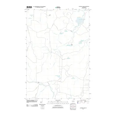 2010 Coleman Lake2010 Print · USGSCovers Athelstane, including Goodman, Silver Cliff, and other nearby areas
 - 2010 Map of Twelvefoot Falls, 2010 Print
 2010 Twelvefoot Falls2010 Print · USGSCovers Athelstane, including Dunbar, Goodman, and other nearby areas
 - 2010 Map of Athelstane, 2010 Print
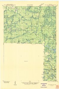
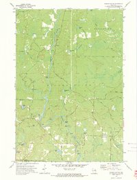
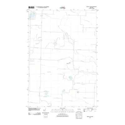
 2010 Athelstane2010 Print · USGSCovers Athelstane, including Amberg, Wausaukee, and other nearby areas
 - 2010 Map of Mount Tom, 2010 Print
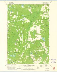
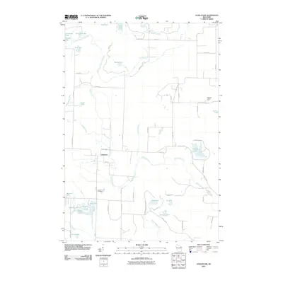
 2010 Mount Tom2010 Print · USGSCovers Athelstane, including Middle Inlet, Wausaukee, and other nearby areas
Showing maps 1-25 of 61
Top cities near Athelstane
- Dunbar historical maps
- Pembine historical maps
- Crivitz historical maps
- Lakewood historical maps
- Amberg historical maps
- Goodman historical maps
See more
Frequently asked questions
- What are the different types of historical maps available for Athelstane?
- What is the oldest map of Athelstane?
- Where can I purchase historical maps of Athelstane for my home or office?
- Where can I download high-res historical maps of Athelstane?
- Are there historical topographic maps available for Athelstane?
- Is there historical aerial imagery available for Athelstane?
- Where are historical maps of Athelstane sourced from?