2020s Maps of Athelstane, Wisconsin
Explore 8 historic maps of Athelstane from the 2020s. These maps offer a rare glimpse into what life looked like during the 2020s — showing old roads, neighborhoods, homes, and landmarks that have changed or disappeared over time.
Whether you're researching your family's past, planning a metal detecting trip, or studying how Athelstane's landscape evolved across the 2020s, these high-resolution maps are a powerful tool for exploring the history of this region.
- Focus on a specific era: All maps on this page are from the 2020s, giving you a focused view of this time period.
- See what’s changed: Compare century-old streets, trails, and buildings to today's modern landscape using overlays and satellite layers.
- Research with precision: Use these maps for genealogy, historical research, land use analysis, or educational projects.
- View, download, or print: Maps are fully viewable online in high resolution, and can be downloaded or printed for your own records.
Start exploring Athelstane's history through authentic maps from the 2020s. This is your window into the past.
Athelstane, WI maps
(8)- 2022 Map of Twelvefoot Falls, 2022 Print
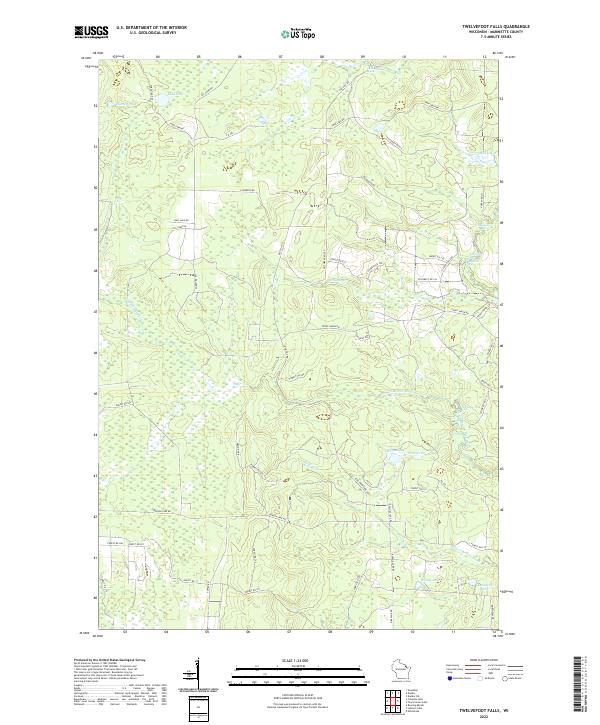 2022 Twelvefoot Falls2022 Print · USGSMarinette County’s river valleys and cataracts are documented in detail during the early 2020s, showing a landscape of dense forests and cascading water. Researchers can trace the paths of the Iron Snowshoe Trl and identify landmarks like Twelvefoot Falls and Annabelle Lake.
 - 2022 Map of Coleman Lake, 2022 Print
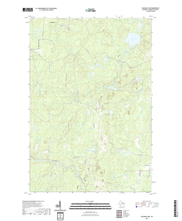 2022 Coleman Lake2022 Print · USGSMarinette County’s northern timberlands and glacial lakes are preserved in this study from the early twenty-first century. Researchers can trace the rugged corridor of the Peshtigo River to find Strong Falls and the riverside site of Taylor Rapids.
 - 2022 Map of Mount Tom, 2022 Print
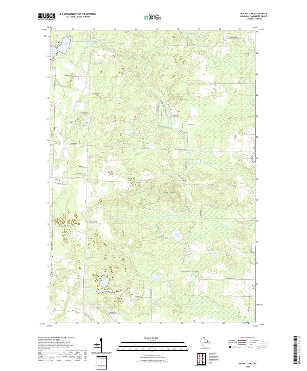 2022 Mount Tom2022 Print · USGSMarinette County’s lake country is mapped in detail here during the early twenty-first century, showcasing a landscape defined by glacial basins and timber lands. Researchers can trace land tracts near Mt Tom or locate lakeside properties around Newton Lake, Retcof Lake, and Star Lake.
 - 2022 Map of Roaring Rapids, 2022 Print
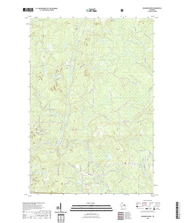 2022 Roaring Rapids2022 Print · USGSMarinette County's river-cut landscape is captured here in the early twenty-first century, centered on the wild waters of the Peshtigo River. Researchers can locate the Silver Cliff Cem and trace historic water features like Roaring Rapids and Jerry Chute.
 - 2022 Map of Lehman Lake, 2022 Print
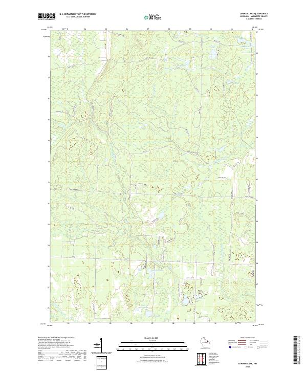 2022 Lehman Lake2022 Print · USGSMarinette County’s lake country is captured here in the early twenty-first century, showcasing a landscape of glacial waters and timber access roads. Outdoor enthusiasts and local historians can trace the course of the Wausaukee River or locate remote spots like Lehman Lake and Horsehead Lake.
 - 2022 Map of Athelstane, 2022 Print
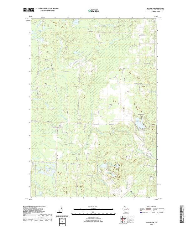 2022 Athelstane2022 Print · USGSThe rural settlement of Athelstane is captured here in the early twenty-first century, surrounded by a complex network of glacial lakes and northern rivers. Researchers can locate the Athelstane Cem or trace family-named roads like Beilak Rd and Sunny Farm Ln.
 - 2022 Map of Town Corner Lake, 2022 Print
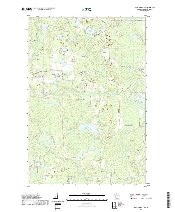 2022 Town Corner Lake2022 Print · USGSMarinette County’s lake country is captured here in the early 2020s, showing a landscape defined by the branching Pike River and dozens of named glacial pools. Researchers can trace local landmarks like Northland Scholars Academy or locate Red Roof Airport and Chipmunk Rapids.
 - 2023 Map of High Falls Reservoir, 2023 Print
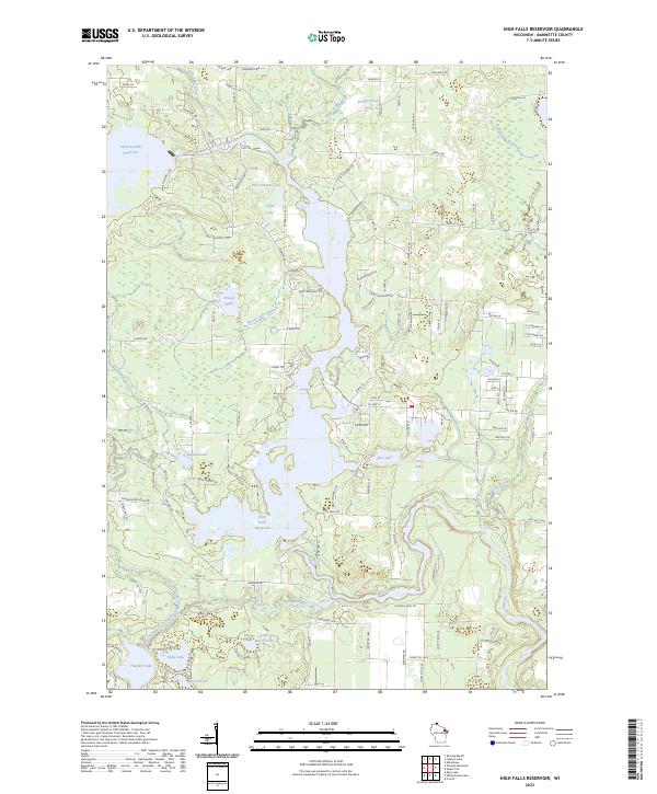 2023 High Falls Reservoir2023 Print · USGSThe Peshtigo River valley in Marinette County shows a landscape of reservoirs and northwoods timber. Trace the shoreline of High Falls Reservoir and find remote points like Old Veterans Lake and Kahles Pond along the network of forest roads.
End of results
Showing maps 1-8 of 8
Top cities near Athelstane
- Dunbar historical maps
- Pembine historical maps
- Crivitz historical maps
- Lakewood historical maps
- Amberg historical maps
- Goodman historical maps
See more
Frequently asked questions
- What are the different types of historical maps available for Athelstane?
- What is the oldest map of Athelstane?
- Where can I purchase historical maps of Athelstane for my home or office?
- Where can I download high-res historical maps of Athelstane?
- Are there historical topographic maps available for Athelstane?
- Is there historical aerial imagery available for Athelstane?
- Where are historical maps of Athelstane sourced from?