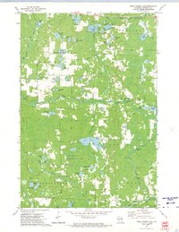
1972 Map of Town Corner Lake
USGS Topo · Published 1974About this map
The South Branch Pemebonwon River and the North Branch Pike River define the hydraulic character of this Marinette County landscape in the early 1970s. The region is marked by a dense concentration of glacial lakes, including Town Corner Lake, Lindquist Lake, and Wiggins Lake, many of which feature public access points and picnic areas indicating their role in local recreation. The map highlights the Town Corner State Wildlife Management Area, a significant conservation tract that dominates the central portion of the survey.
Find a feature on this map
67 named features on this map. Tap any name to fly to it.
Don’t see what you’re looking for? This feature index may not catch every label — zoom into the map to look around manually.
Map Details
Editions of this 1972 Town Corner Lake Map
This is the sole edition of this map. No revisions or reprints were ever made.
Other maps of this area

1939 · Pembine
USGS Topo · 1:48,000

1939 · Dunbar
USGS Topo · 1:48,000

1940 · Athelstane
USGS Topo · 1:48,000

1941 · Dunbar
USGS Topo · 1:48,000

1942 · Athelstane
USGS Topo · 1:48,000

1942 · Wausaukee
USGS Topo · 1:48,000

1947 · Pembine
USGS Topo · 1:48,000

1947 · Dunbar
USGS Topo · 1:48,000

1947 · Wausaukee
USGS Topo · 1:48,000

1954 · Iron Mountain
USGS Topo · 1:250,000