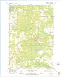
1972 Map of Mount Tom
USGS Topo · Published 1975About this map
Mount Tom rises as a central landmark in this portion of Marinette County, surrounded by the townships of Athelstane, Wausaukee, and Stephenson. The landscape is defined by a complex network of glacial water bodies, including the aptly-named Star Lake, Simpson Lake, and the larger Retcof Lake. Local industry and recreation are evident through the presence of numerous Gravel Pits, a Mine, and a designated Ski Area near the summit of Mount Tom.
Find a feature on this map
34 named features on this map. Tap any name to fly to it.
Don’t see what you’re looking for? This feature index may not catch every label — zoom into the map to look around manually.
Map Details
Editions of this 1972 Mount Tom Map
This is the sole edition of this map. No revisions or reprints were ever made.
Other maps of this area

1939 · Porterfield
USGS Topo · 1:48,000

1940 · Athelstane
USGS Topo · 1:48,000

1941 · Coleman
USGS Topo · 1:48,000

1942 · Athelstane
USGS Topo · 1:48,000

1942 · Coleman
USGS Topo · 1:48,000

1942 · Porterfield
USGS Topo · 1:48,000

1942 · Wausaukee
USGS Topo · 1:48,000

1947 · Wausaukee
USGS Topo · 1:48,000

1950 · Coleman
USGS Topo · 1:48,000

1954 · Iron Mountain
USGS Topo · 1:250,000