Old Maps of Stephenson, Wisconsin
Explore 70 old maps of Stephenson, spanning from 1939 to today. These high-resolution historic maps reveal how streets, neighborhoods, landmarks, and natural features evolved over time — perfect for genealogy, metal detecting, research, and local history exploration.
What you can do with these maps:
- See how Stephenson changed over time: Compare historical maps to modern-day views to trace roads, homesites, rail lines & more.
- View detailed metadata: Each map includes creators, publishers, year, scale, and archive source.
- Overlay maps with satellite & LiDAR: Visualize the past alongside modern tools to explore terrain & human change.
- Trusted historical sources: Maps sourced from the USGS, Library of Congress, and other archives.
- Access maps your way: View online, download high-res files, or order prints for personal or research use.
Start exploring old maps of Stephenson to uncover forgotten places, hidden landmarks, and the deep history beneath your feet.
Stephenson, WI maps
(70)- 1939 Map of Porterfield, 1952 Print
 1939 Porterfield1952 Print · USGSMarinette County was a landscape of timber, power, and scattered rural schoolhouses in the years just before the war. Genealogists can trace family roots through dozens of local landmarks like Behnke Sch, St Johns Ch, and the Harmony Cem.
 - 1940 Map of Thunder Mtn.
 1940 Thunder Mtn.1940 Print · USGSMarinette County and the surrounding woods are captured here in the early 1940s as a hub of timber production and forestry management. Genealogists and historians can trace rural schools like Silver Cliff Sch, the site of the State Fish Hatchery, and fire lookouts atop Thunder Mountain.2 unique versions available
 - 1940 Map of Athelstane, 1969 Print
 1940 Athelstane1969 Print · USGSMarinette County was a hub of hydroelectric power and timber management during the 1940s. Researchers can trace rural school districts like Newton Lakes School or locate the specialized Molybdenite Mine near the village of Athelstane.
 - 1941 Map of Coleman, 1965 Print
 1941 Coleman1965 Print · USGSMarinette and Oconto counties during the early 1940s show a landscape of timber, water power, and tight-knit rural communities. Genealogists can locate family-named landmarks like Gaffney L and numerous local schools such as Woodrow Wilson Sch and Goldfield Sch.2 unique versions available
 - 1942 Map of Athelstane
 1942 Athelstane1942 Print · USGSMarinette County was a landscape of timber and hydropower in the early 1940s. Genealogists and historians can trace defunct rural schools like Rector Sch and Konsted Sch, or locate industrial sites such as the Molybdenite Mine.
 - 1942 Map of Coleman
 1942 Coleman1942 Print · USGSThe rural Marinette and Oconto county lines are captured here in the early 1940s, a landscape defined by timber, small-scale farming, and the Peshtigo River. Researchers can trace old school districts like Woodrow Wilson Sch and historic local landmarks such as St Wenceslaus Ch and Sandstone Dam.
 - 1942 Map of Breed
 1942 Breed1942 Print · USGSMarinette and Oconto counties appear here in the early 1940s, showing a mix of established survey lines and wilder interior lands. Local researchers can trace the early courses of Peshtigo Brook and the West Branch through the township of Stephenson.
 - 1942 Map of Porterfield
 1942 Porterfield1942 Print · USGSMarinette and Oconto counties are documented here in the early 1940s, showing a landscape defined by the Peshtigo River and its many rural school districts. Researchers can find dozens of local landmarks, including Bagley Junction, Harmony Cem, and the Potato Rapids Power Dam.
 - 1942 Map of Wausaukee
 1942 Wausaukee1942 Print · USGSMarinette County in the early 1940s was a landscape of timber-towns and railroads winding toward the Michigan border. Genealogists can locate family-named rural schools like Shanebrook Sch and Gallow Sch or trace the early community at WAUSAUKEE.
 - 1947 Map of Wausaukee
 1947 Wausaukee1947 Print · USGSMarinette County in the late nineteen-forties centers on the village of Wausaukee and its surrounding glacial lake country. Trace the locations of rural schoolhouses like Shanebrook Sch and Gallow Sch, or locate family sites near Cedarville and the Pine Hill Cem.
 - 1950 Map of Coleman
 1950 Coleman1950 Print · USGSNortheastern Wisconsin comes alive in the mid-century as family farms and lakeside communities thrived between Marinette and Oconto counties. Genealogists and local historians can trace legacy sites like the Second Polish Ch, Victory Sch, and the vanished tracks of the St Paul and Pacific RR.
 - 1951 Map of Thunder Mountain, 1953 Print
 1951 Thunder Mountain1953 Print · USGSMarinette and Oconto counties are shown here in the early 1950s, showcasing a landscape of dense timber and river-driven history. Genealogists and historians can locate the Shady Nook Sch, the Fish Hatchery, and fire-watch posts like the Thunder Mountain Lookout Tower.3 unique versions available
 - 1952 Map of Mountain, 1955 Print
 1952 Mountain1955 Print · USGSOconto County in the early fifties shows a patchwork of timberland and early farmsteads connected by the North Western railroad. Trace family sites at Breed and Frostville, or locate rural landmarks like the Breed Cemetery and Mountain Lookout Tower.2 unique versions available
 - 1954 Map of Iron Mountain, 1964 Print
 1954 Iron Mountain1964 Print · USGSUpper Michigan and Northeastern Wisconsin are shown in detail during the mid-fifties, when the logging and mining economies still moved by rail. Trace the rail lines of the Soo Line to remote stops like Koepenick Station or explore the Iron Range near Iron Mountain.2 unique versions available
 - 1954 Map of Escanaba, 1967 Print
 1954 Escanaba1967 Print · USGSThe Upper Peninsula and Door County shorelines meet here in the mid-fifties, showing the vital maritime and timber networks of the Great Lakes. Researchers can trace historic rail lines, old fire lookouts like the Stonington Fire Tower, and island settlements such as Washington Island.2 unique versions available
 - 1957 Map of Escanaba
 1957 Escanaba1957 Print · USGSThe Upper Peninsula and Door County shorelines meet in the mid-fifties, capturing a landscape of timber, iron, and maritime trade. Genealogists and local historians can trace the Chicago & North Western RR through settlements like Hermansville or locate St Vitals Church and the Potawatome Indian Reservation.
 - 1958 Map of Escanaba
 1958 Escanaba1958 Print · USGSNorthern Lake Michigan maritime commerce and timberlands are captured here in the mid-fifties. Genealogists and historians can trace rail networks like the Escanaba and Lake Superior or locate island settlements such as Detroit Harbor and Fish Creek.
 - 1959 Map of Iron Mountain
 1959 Iron Mountain1959 Print · USGSThe northwoods of Wisconsin and the Michigan border are captured here in the mid-fifties, showing a landscape defined by timber, water, and rail. Researchers can trace historic junctions like Hiles Junction, the expansive Nicolet National Forest, and lakefront settlements from Rhinelander to Tomahawk.2 unique versions available
 - 1963 Map of Porterfield, 1964 Print
 1963 Porterfield1964 Print · USGSMarinette County in the early sixties is a landscape of river-powered industry and sprawling rail corridors connecting small farming hamlets. Genealogists can locate family ties at Porterfield Ch Cem or trace the rural school system through the Fairmont Sch and Job Place Sch.2 unique versions available
 - 1963 Map of Wausaukee, 1964 Print
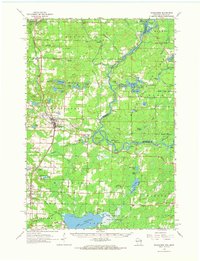 1963 Wausaukee1964 Print · USGSMarinette County was a hub of timber and rail activity in the early 1960s, centered on the Menominee River border. Local historians can trace the Chicago Milwaukee St Paul and Pacific RR through Amberg, Wausaukee, and the small settlement of Sweetheart City.
 - 1972 Map of High Falls Reservoir, 1975 Print
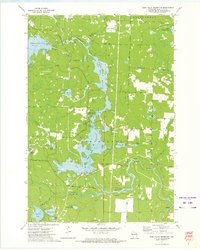 1972 High Falls Reservoir1975 Print · USGSMarinette County’s river-driven industry and shoreline recreation are in full focus here during the early seventies. Trace the engineering of the Caldron Falls and High Falls dams or explore local landmarks like Thunder Mountain and Veterans Memorial Park.
 - 1972 Map of Thunder Mountain, 1975 Print
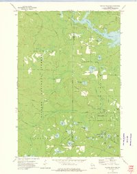 1972 Thunder Mountain1975 Print · USGSThe Marinette and Oconto county line runs through this forested landscape during the 1970s, dominated by the waters of the Peshtigo River. Researchers can trace old forest routes and local landmarks like the Thunder River State Rearing Station and Camp Bird State Youth Recreational Center.2 unique versions available
 - 1972 Map of Mount Tom, 1975 Print
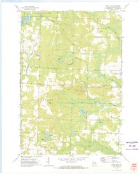 1972 Mount Tom1975 Print · USGSMarinette County’s lake-dotted landscape is captured here in the early 1970s, showing the rural intersections of the Northwoods. Genealogists and hikers can trace old routes like Moonshine Hill Road or locate landmarks like the Lookout Tower and Retcof Lake.
 - 1973 Map of Shay Lake, 1977 Print
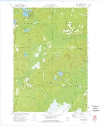 1973 Shay Lake1977 Print · USGSThe Northwoods of Oconto County are shown here in the 1970s, revealing a landscape defined by timber, glacial lakes, and the Nicolet National Forest. Researchers can trace old logging routes and rural landmarks like Butler Rock, St Marys of the Lake Ch, and the remote Landing Strip.
 - 1973 Map of White Potato Lake, 1977 Print
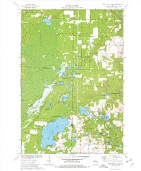 1973 White Potato Lake1977 Print · USGSThe Marinette County lake country is captured here in the early seventies, just as modern conservation efforts were shaping the land. Genealogists and historians can locate Brazeau Cem, the Patz Landing Field, and the many family-named waters like Heisel Lake.
Showing maps 1-25 of 70
Top cities near Stephenson
- Beaver historical maps
- Crivitz historical maps
- Lakewood historical maps
- Amberg historical maps
- Mountain historical maps
- Coleman historical maps
See more
Frequently asked questions
- What are the different types of historical maps available for Stephenson?
- What is the oldest map of Stephenson?
- Where can I purchase historical maps of Stephenson for my home or office?
- Where can I download high-res historical maps of Stephenson?
- Are there historical topographic maps available for Stephenson?
- Is there historical aerial imagery available for Stephenson?
- Where are historical maps of Stephenson sourced from?