2020s Maps of Marquette County, Wisconsin
Explore 12 historic maps of Marquette County from the 2020s. These maps offer a rare glimpse into what life looked like during the 2020s — showing old roads, neighborhoods, homes, and landmarks that have changed or disappeared over time.
Whether you're researching your family's past, planning a metal detecting trip, or studying how Marquette County's landscape evolved across the 2020s, these high-resolution maps are a powerful tool for exploring the history of this region.
- Focus on a specific era: All maps on this page are from the 2020s, giving you a focused view of this time period.
- See what’s changed: Compare century-old streets, trails, and buildings to today's modern landscape using overlays and satellite layers.
- Research with precision: Use these maps for genealogy, historical research, land use analysis, or educational projects.
- View, download, or print: Maps are fully viewable online in high resolution, and can be downloaded or printed for your own records.
Start exploring Marquette County's history through authentic maps from the 2020s. This is your window into the past.
Marquette County, WI maps
(12)- 2022 Map of Montello, 2022 Print
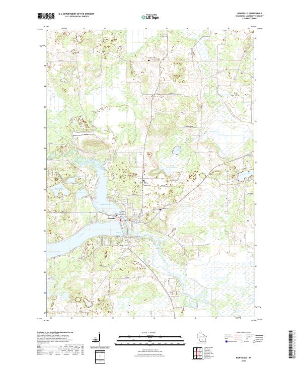 2022 Montello2022 Print · USGSMontello and the Fox River basin are captured here in the early twenty-first century as the county's civic and natural center. Genealogists can locate Marquette County Courthouse and several burial sites including Saint John the Baptist Cem and Shields Cem.
 - 2022 Map of Neshkoro, 2022 Print
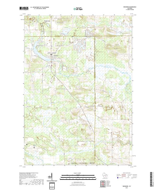 2022 Neshkoro2022 Print · USGSMarquette and Waushara counties meet in this 2022 survey of central Wisconsin's river country. Local historians can trace family burial sites at Germania Cem and Black Creek Cem or locate old property lines near Neshkoro Mill Pond.
 - 2022 Map of Briggsville, 2022 Print
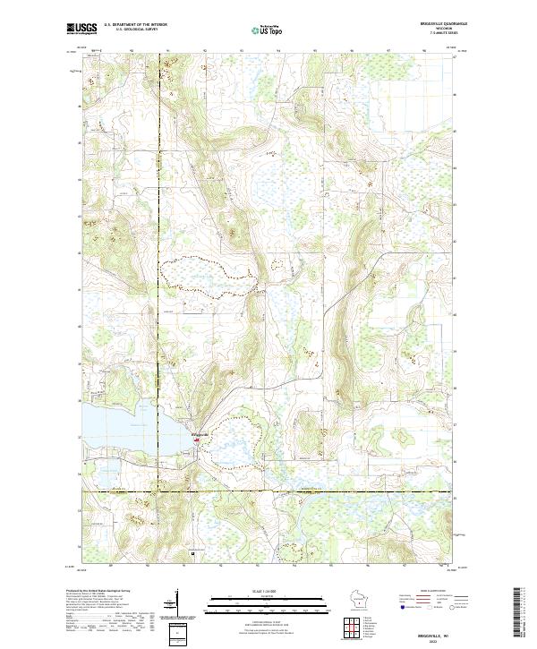 2022 Briggsville2022 Print · USGSBriggsville and the surrounding tri-county marshlands are captured in this recent survey. Local researchers can trace family landmarks and agricultural history near Mason Lake, Greenwood Cem, and the descriptively named Cheese Factory Rd.
 - 2022 Map of Oxford, 2022 Print
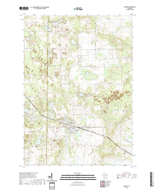 2022 Oxford2022 Print · USGSMarquette County's wetlands and glacial lakes characterize the landscape around Oxford during the early 2020s. Genealogists and historians can locate several family burial sites including Kelly Cem, Oak Hill Cem, and Oxford Village Cem.
 - 2022 Map of Germania, 2022 Print
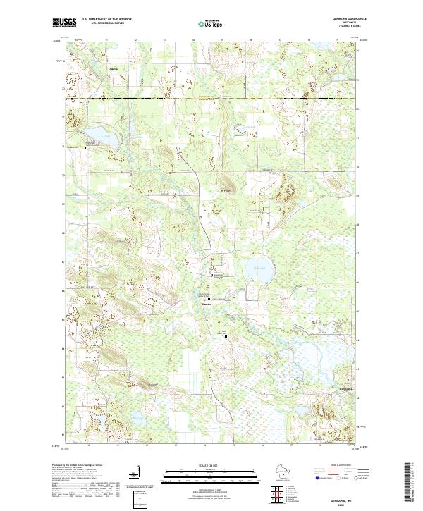 2022 Germania2022 Print · USGSMarquette and Waushara Counties are depicted here in recent years, showing a landscape defined by the Mecan River and quiet lakeside settlements. Genealogists can trace family names and local history at Tagatz Cem, Saint Johns Lutheran Cem, and the village of Budsin.
 - 2022 Map of Marquette, 2022 Print
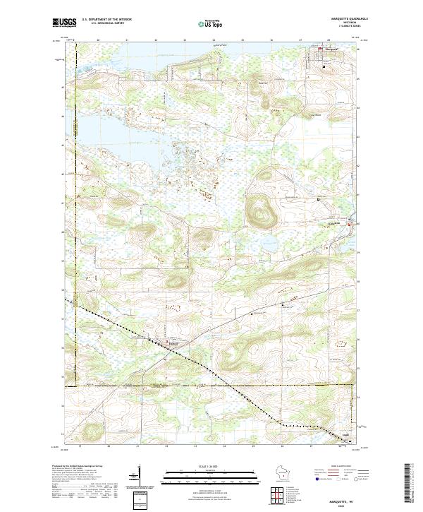 2022 Marquette2022 Print · USGSGreen Lake County at the start of the 2020s shows a landscape still deeply tied to its river and lake geography. You can trace old family names and sites at Grand View Cem or Greenwood Cem while exploring the banks of Puckaway Lake and Grand River.
 - 2022 Map of Westfield West, 2022 Print
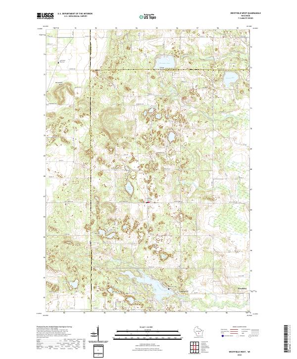 2022 Westfield West2022 Print · USGSThe intersection of Marquette, Adams, and Waushara counties comes into focus in this recent survey of central Wisconsin lake country. Genealogists and local historians can trace family locations near South Burr Oak Cem, Westfield, and the waters of Pleasant Lake.
 - 2022 Map of Packwaukee, 2022 Print
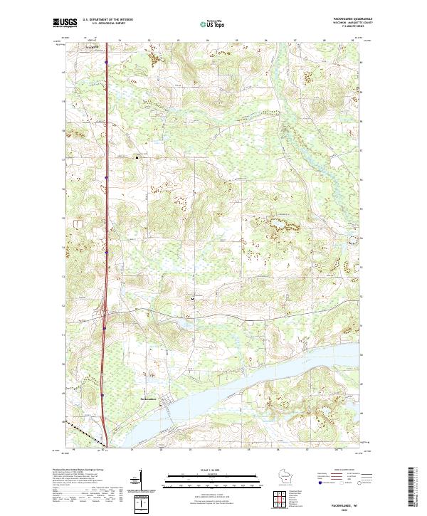 2022 Packwaukee2022 Print · USGSThe Fox River and its complex system of marshes and lakes define this Marquette County landscape as it appeared in 2022. Researchers can trace rural lineages through sites like Oak Hill Cem and Sheldon Cem or follow the waters of Ox Creek and Lake Emery.
 - 2022 Map of Endeavor, 2022 Print
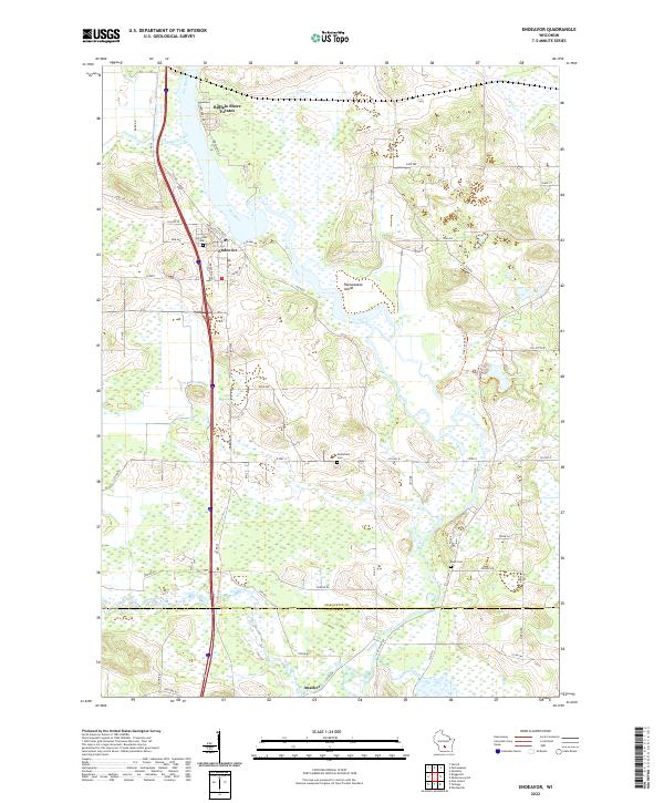 2022 Endeavor2022 Print · USGSEndeavor and the surrounding riverlands of Marquette County are captured here in the early 2020s. Genealogists and local historians can trace family locations near Hill Crest Cem, the southern settlement of Anacker, and the wetlands of the Fox River.
 - 2022 Map of Observatory Hill, 2022 Print
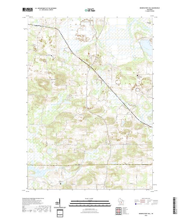 2022 Observatory Hill2022 Print · USGSThe Marquette and Columbia county line comes alive in the early 2020s, showing a rural landscape of glacial hills and river valleys. Genealogists can locate family sites at Oak Lawn Cem or North Marcellon Cem while tracing the Fox River shoreline.
 - 2022 Map of Westfield East, 2022 Print
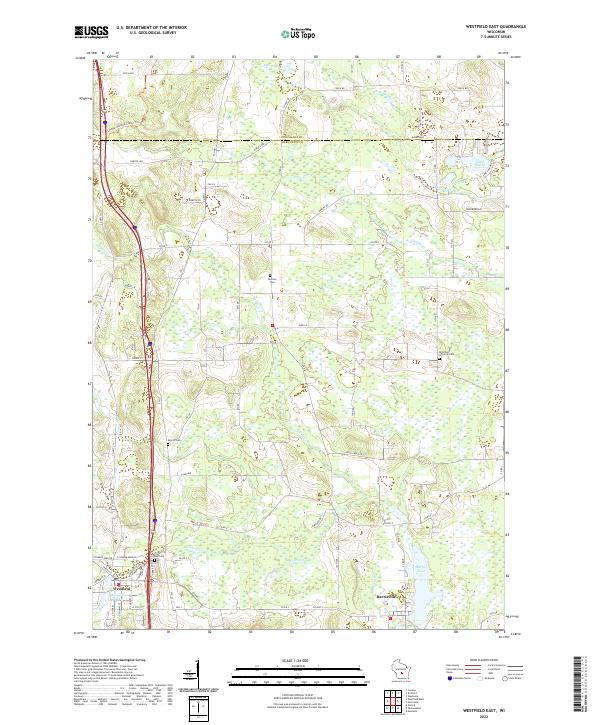 2022 Westfield East2022 Print · USGSMarquette County in the early 2020s shows a landscape defined by glacial waters and rural heritage. Genealogists and local historians can locate several family and church burial sites including Newton Cemetery, Krentz Cemetery, and East Cemetery.
 - 2022 Map of Princeton West, 2022 Print
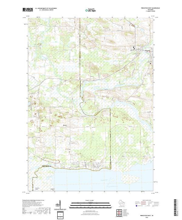 2022 Princeton West2022 Print · USGSGreen Lake and Marquette counties are captured in this modern survey of the Fox River valley. Genealogists can locate Princeton Cem and Saint Johns Lutheran Cem, while tracing the winding paths of the Mecan River and Puckaway Lake.
End of results
Showing maps 1-12 of 12
Top cities of Marquette County
- Montello historical maps
- Packwaukee historical maps
- Oxford historical maps
- Endeavor historical maps
- Neshkoro historical maps
Frequently asked questions
- What are the different types of historical maps available for Marquette County?
- What is the oldest map of Marquette County?
- Where can I purchase historical maps of Marquette County for my home or office?
- Where can I download high-res historical maps of Marquette County?
- Are there historical topographic maps available for Marquette County?
- Is there historical aerial imagery available for Marquette County?
- Where are historical maps of Marquette County sourced from?