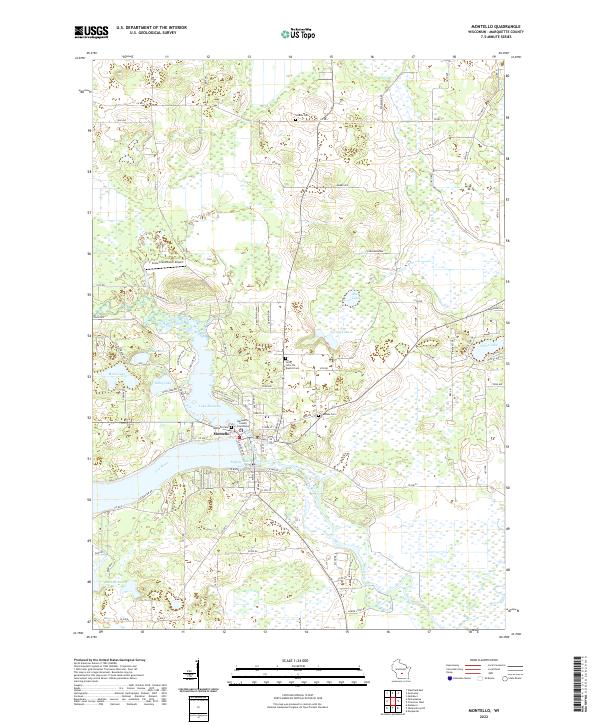
2022 Map of Montello
USGS Topo · Published 2022About this map
Montello serves as the focal point of this Marquette County landscape, where the confluence of the Montello River and the Fox River creates a complex system of waterways and wetlands. The city is tightly integrated with the surrounding water bodies, notably Lake Montello and the eastern reach of Buffalo Lake. This modern survey reveals the civic layout of the county seat, centered on the Marquette County Courthouse and supported by local landmarks like Saint John the Baptist Cem and Montello Cem.
Find a feature on this map
85 named features on this map. Tap any name to fly to it.
Don’t see what you’re looking for? This feature index may not catch every label — zoom into the map to look around manually.
Map Details
Editions of this 2022 Montello Map
This is the sole edition of this map. No revisions or reprints were ever made.
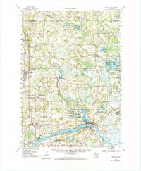
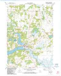
Historical Maps of Montello Through Time
3 maps found