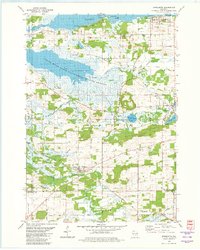
1980 Map of Marquette
USGS Topo · Published 1981About this map
The Grand River Marsh State Public Hunting Grounds dominates the central landscape of this Green Lake County region, where the Grand River and Fox River converge near the southern shore of Puckaway Lake. This 1980 survey illustrates the environmental management of the era, delineating vast marshlands alongside established agricultural settlements. To the north, the village of Marquette sits on the lake's edge, while the southern reaches are marked by the presence of Dalton and Kingston.
Find a feature on this map
42 named features on this map. Tap any name to fly to it.
Don’t see what you’re looking for? This feature index may not catch every label — zoom into the map to look around manually.
Map Details
Editions of this 1980 Marquette Map
This is the sole edition of this map. No revisions or reprints were ever made.
Other maps of this area

1902 · Portage
USGS Topo · 1:62,500

1915 · Neshkoro
USGS Topo · 1:48,000

1918 · Neshkoro
USGS Topo · 1:62,500

1955 · Randolph
USGS Topo · 1:62,500

1957 · Madison
USGS Topo · 1:250,000

1960 · Madison
USGS Topo · 1:250,000

1961 · Montello
USGS Topo · 1:62,500

1962 · Portage
USGS Topo · 1:62,500

1963 · Neshkoro
USGS Topo · 1:62,500
1980 · Manchester
USGS Topo · 1:24,000