1970s Maps of Menominee County, Wisconsin
Explore 7 historic maps of Menominee County from the 1970s. These maps offer a rare glimpse into what life looked like during the 1970s — showing old roads, neighborhoods, homes, and landmarks that have changed or disappeared over time.
Whether you're researching your family's past, planning a metal detecting trip, or studying how Menominee County's landscape evolved across the 1970s, these high-resolution maps are a powerful tool for exploring the history of this region.
- Focus on a specific era: All maps on this page are from the 1970s, giving you a focused view of this time period.
- See what’s changed: Compare century-old streets, trails, and buildings to today's modern landscape using overlays and satellite layers.
- Research with precision: Use these maps for genealogy, historical research, land use analysis, or educational projects.
- View, download, or print: Maps are fully viewable online in high resolution, and can be downloaded or printed for your own records.
Start exploring Menominee County's history through authentic maps from the 1970s. This is your window into the past.
Menominee County, WI maps
(7)- 1973 Map of Fredenberg Lake, 1977 Print
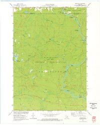
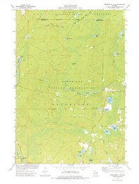 1973 Fredenberg Lake1977 Print · USGSThe Menominee Indian Reservation and Nicolet National Forest meet in this early 1970s survey of Wisconsin's lake country. Researchers can trace the paths of Pecore Creek and the South Branch Oconto River or locate St Joseph Ch and the La Belle Lookout Tower.
 - 1973 Map of Perote Lake, 1977 Print
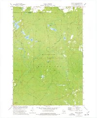 1973 Perote Lake1977 Print · USGSThe Menominee Indian Reservation and surrounding northern woods are captured here in the early 1970s. Researchers can trace the Soo Line railroad, find the Dutchman Lookout Tower, and explore the waters of Perote Lake and the Evergreen River.
 - 1973 Map of Breed, 1977 Print
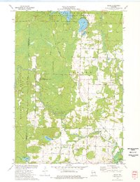 1973 Breed1977 Print · USGSThe Oconto County woodlands were a landscape of managed forests and river wildlife areas in the early 1970s. Local researchers can trace family landmarks and rural infrastructure from the Menominee Indian Reservation to the Union Cem and Piso Landing Strip.
 - 1973 Map of Zoar, 1977 Print
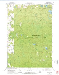 1973 Zoar1977 Print · USGSThe Menominee Indian Reservation and the settlement of Zoar are shown here in the early 1970s amidst a landscape of glacial lakes and northern forests. Researchers can trace the Old Railroad Grade and locate specific features like Chisel Springs and Lake Neconish.
 - 1973 Map of Markton, 1977 Print
 1973 Markton1977 Print · USGSThe Wolf River corridor in the early 1970s reveals a wilderness landscape managed by the Menominee Indian Reservation. Researchers can trace numerous river landmarks including Big Smoky Falls, The Dalles, and the small settlement of Markton.
 - 1974 Map of Cecil, 1977 Print
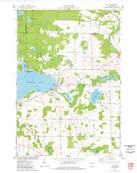 1974 Cecil1977 Print · USGSShawano Lake and the village of Cecil are captured here during the mid-seventies, showing the intersection of resort life and rural farming. Genealogists and local historians can trace the Chicago and North Western rail line and locate family sites like St Martins Cem and Tracy Corners.
 - 1974 Map of Berry Lake, 1977 Print
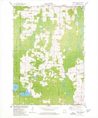 1974 Berry Lake1977 Print · USGSOconto County's river-fed lowlands and the Menominee boundary are captured here in the mid-seventies, showing the rural communities of Suring and Underhill. Researchers can trace old family roads and landmarks like St Michaels Cem, Christ Ch, and the banks of Berry Lake.
End of results
Showing maps 1-7 of 7
Frequently asked questions
- What are the different types of historical maps available for Menominee County?
- What is the oldest map of Menominee County?
- Where can I purchase historical maps of Menominee County for my home or office?
- Where can I download high-res historical maps of Menominee County?
- Are there historical topographic maps available for Menominee County?
- Is there historical aerial imagery available for Menominee County?
- Where are historical maps of Menominee County sourced from?