2000s (21st Century) Maps of Menominee County, Wisconsin
Explore 13 historic maps of Menominee County from the 2000s (21st Century). These maps offer a rare glimpse into what life looked like during the 2000s — showing old roads, neighborhoods, homes, and landmarks that have changed or disappeared over time.
Whether you're researching your family's past, planning a metal detecting trip, or studying how Menominee County's landscape evolved across the 2000s, these high-resolution maps are a powerful tool for exploring the history of this region.
- Focus on a specific era: All maps on this page are from the 2000s, giving you a focused view of this time period.
- See what’s changed: Compare century-old streets, trails, and buildings to today's modern landscape using overlays and satellite layers.
- Research with precision: Use these maps for genealogy, historical research, land use analysis, or educational projects.
- View, download, or print: Maps are fully viewable online in high resolution, and can be downloaded or printed for your own records.
Start exploring Menominee County's history through authentic maps from the 2000s. This is your window into the past.
Menominee County, WI maps
(13)- 2022 Map of Burney Lake, 2022 Print
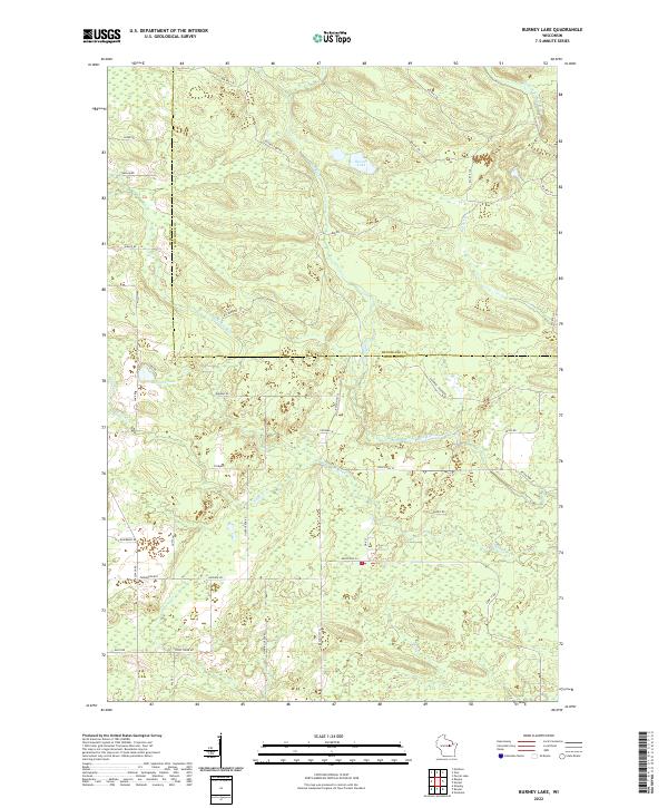 2022 Burney Lake2022 Print · USGSThe Shawano and Menominee county line crosses this northern Wisconsin landscape in the 2020s, featuring the waters of Burney Lake. You can trace the winding Red River and explore local history through family-named routes like Boehms Rd and McCall Camp Rd.
 - 2022 Map of Legend Lake, 2022 Print
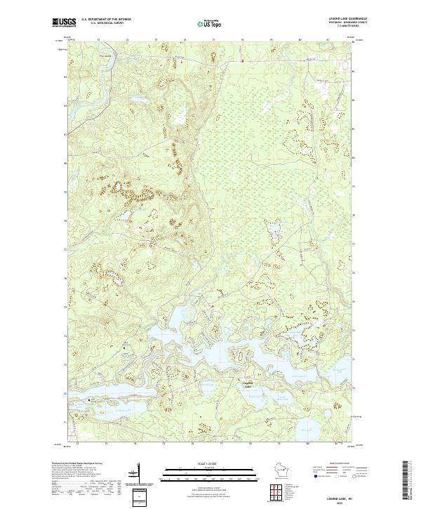 2022 Legend Lake2022 Print · USGSWisconsin's Menominee County is revealed in this contemporary look at its intricate lake systems and river bends. Researchers can trace local landmarks like Saint Michael Cem or follow the path of the Wolf River through Turtle Rapids.
 - 2022 Map of Thornton, 2022 Print
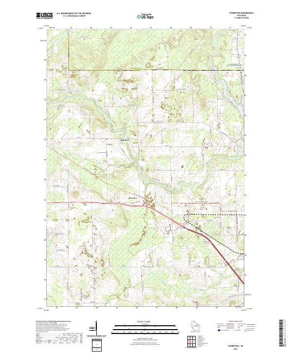 2022 Thornton2022 Print · USGSShawano and Menominee counties are shown here in the early 2020s, centering on the river valleys and tribal lands of northern Wisconsin. Researchers can trace the waterway through Freeman Falls and Gilmer Falls, or locate landmarks like Thornton and Dillenburg's Airport.
 - 2022 Map of Markton, 2022 Print
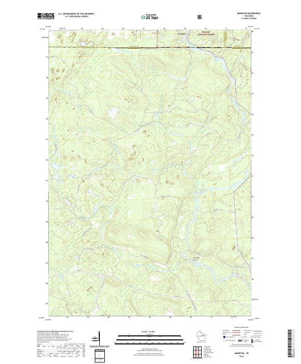 2022 Markton2022 Print · USGSMenominee County is centered on the wild waters of the Wolf River in the early 2020s. Genealogists and river historians can trace the paths of BIA Rte 122 and locate historic river landmarks like Saturday Islands and Evergreen Falls.
 - 2022 Map of Fredenberg Lake, 2022 Print
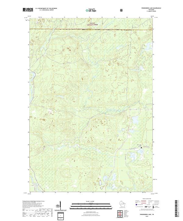 2022 Fredenberg Lake2022 Print · USGSMenominee County’s deep forest and river systems are shown here as they appeared in the early 2020s. Researchers can locate the Saint Joseph of the Lake Cem and trace the S Br Oconto River past the Chipmunk Rapids.
 - 2022 Map of Keshena, 2022 Print
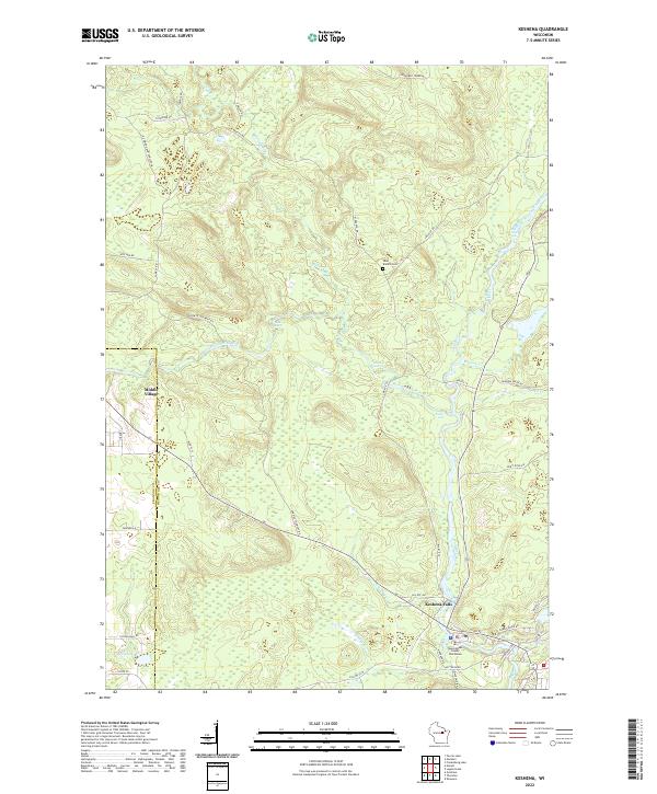 2022 Keshena2022 Print · USGSMenominee County in the early twenty-first century is defined by its powerful river systems and tribal centers. Genealogists and local historians can trace modern infrastructure and older landmarks like Middle Village, West Branch Cem, and the Menominee County Courthouse.
 - 2022 Map of Neopit, 2022 Print
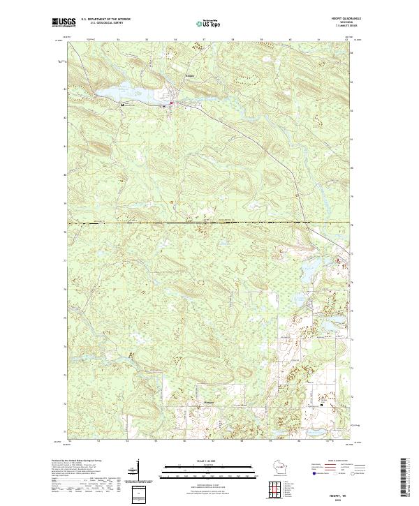 2022 Neopit2022 Print · USGSWisconsin's Menominee and Shawano county borderlands are shown here in the early twenty-first century, centered on the settlement of Neopit. Family historians can locate Saint Anthony Cem and Red Springs Cem, or trace the winding course of the West Branch Wolf River past Rainbow Falls.
 - 2022 Map of Shawano, 2022 Print
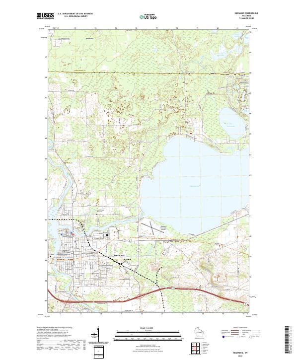 2022 Shawano2022 Print · USGSShawano and the Menominee County line come into focus during this modern era of recreational growth and established civic life. Researchers can trace the development of Shawano around the Shawano County Court House or locate family sites at Woodlawn Cem and Wescott-Lake Drive Cem.
 - 2022 Map of Zoar, 2022 Print
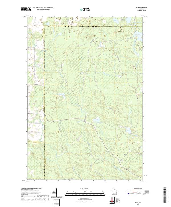 2022 Zoar2022 Print · USGSThe settlement of Zoar and the surrounding Menominee Indian Reservation lands are documented here in the early twenty-first century. Researchers can trace the courses of the Red River and West Branch Wolf River or locate Red Springs and Lake Neconish.
 - 2022 Map of Cecil, 2022 Print
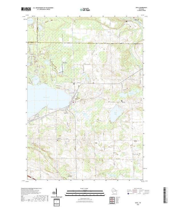 2022 Cecil2022 Print · USGSEastern Shawano County at the start of the 2020s shows a landscape of lakeside villages and deep-rooted rural parishes. Researchers can locate family sites at Saint Martin Catholic Cem, track the shores of Shawano Lake, or find the small Deer Haven Ranch Airport.
 - 2022 Map of Berry Lake, 2022 Print
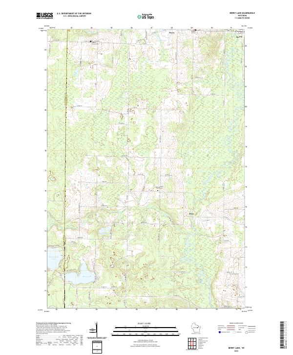 2022 Berry Lake2022 Print · USGSThe Oconto River valley and the village of Suring are captured here in the early twenty-first century. Researchers can trace rural lineages at Saint Michael's Catholic Church Cem and map the shorelines of Moshawquit Lake and Berry Lake.
 - 2022 Map of Breed, 2022 Print
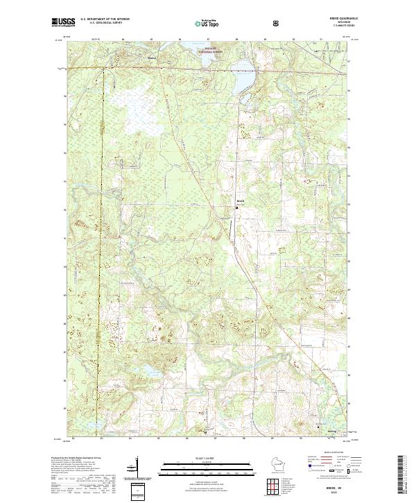 2022 Breed2022 Print · USGSUpper Oconto County and the southern fringes of the national forest appear in this contemporary survey of northern Wisconsin. Researchers can locate remote family sites near Breed, Bonita, and Suring, or trace local lineages at Union Cem and Saint Johns Cem.
 - 2023 Map of Perote Lake, 2023 Print
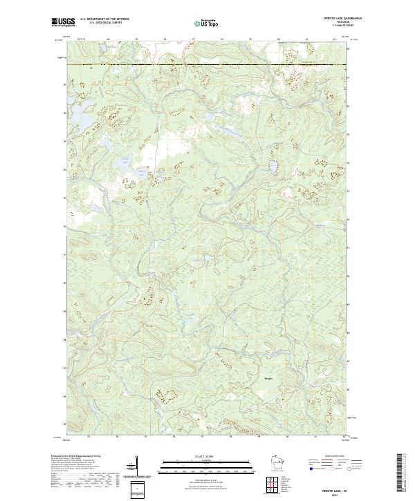 2023 Perote Lake2023 Print · USGSMenominee Indian Reservation lands are documented here in the early twenty-first century, showing the settlement of Neopit and its surrounding forests. Researchers can trace the hydrography of the West Branch Wolf River and find family-named waters like Teabeau Lake and Frechette Lake.
End of results
Showing maps 1-13 of 13
Frequently asked questions
- What are the different types of historical maps available for Menominee County?
- What is the oldest map of Menominee County?
- Where can I purchase historical maps of Menominee County for my home or office?
- Where can I download high-res historical maps of Menominee County?
- Are there historical topographic maps available for Menominee County?
- Is there historical aerial imagery available for Menominee County?
- Where are historical maps of Menominee County sourced from?