Old Maps of South Milwaukee, Wisconsin
Explore 18 old maps of South Milwaukee, spanning from 1891 to today. These high-resolution historic maps reveal how streets, neighborhoods, landmarks, and natural features evolved over time — perfect for genealogy, metal detecting, research, and local history exploration.
What you can do with these maps:
- See how South Milwaukee changed over time: Compare historical maps to modern-day views to trace roads, homesites, rail lines & more.
- View detailed metadata: Each map includes creators, publishers, year, scale, and archive source.
- Overlay maps with satellite & LiDAR: Visualize the past alongside modern tools to explore terrain & human change.
- Trusted historical sources: Maps sourced from the USGS, Library of Congress, and other archives.
- Access maps your way: View online, download high-res files, or order prints for personal or research use.
Start exploring old maps of South Milwaukee to uncover forgotten places, hidden landmarks, and the deep history beneath your feet.
South Milwaukee, WI maps
(18)- 1891 Map of Bayview
 1891 Bayview1891 Print · USGSSouthern Wisconsin at the close of the nineteenth century reveals a landscape of burgeoning rail corridors and quiet farming townships along the Lake Michigan shore. Genealogists and local historians can trace early settlements like Paynesville, Caledonia, and Franksville.2 unique versions available
 - 1901 Map of Bayview
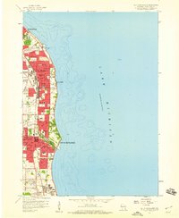
 1901 Bayview1901 Print · USGSThe Lake Michigan shoreline south of Milwaukee comes alive in the late Victorian era as industry and rail lines expand. Trace early coastal growth in Cudahy and South Milwaukee, or locate old interior settlements like New Coeln, Kilbournville, and Lamberton P.O..4 unique versions available
 - 1958 Map of Greendale, 1960 Print
 1958 Greendale1960 Print · USGSSouthern Milwaukee and its neighbors are seen here in the late fifties, as suburban expansion begins to surround major hubs. Genealogists can trace family plots across Forest Home Cemetery and St Adalberts Cemetery, or locate vanished landmarks like the County House of Correction.3 unique versions available
 - 1958 Map of South Milwaukee, 1960 Print
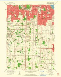
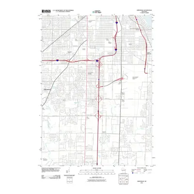
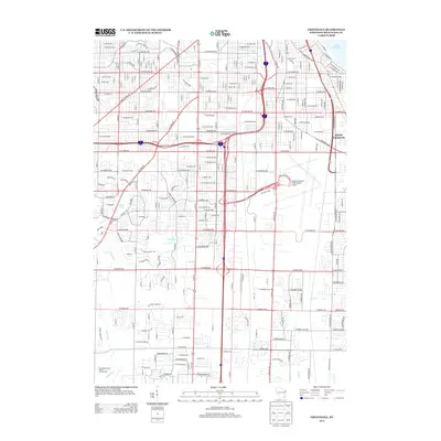
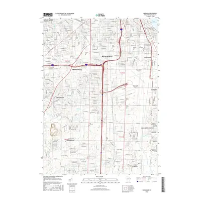
 1958 South Milwaukee1960 Print · USGSThe Milwaukee lakefront in the late fifties shows a dense corridor of industry and education stretching from St Francis down to Carrollville. Researchers can trace the development of numerous schools and churches, including St Pauls Sch, Holy Sepulchre Cemetery, and the lakefront Powerplant.4 unique versions available
 - 1958 Map of South Milwaukee, 1960 Print
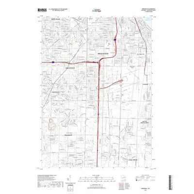
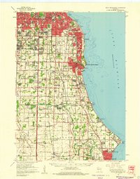 1958 South Milwaukee1960 Print · USGSCoastal Milwaukee County and northern Racine County show a landscape of rapid mid-century development and heavy industry along Lake Michigan. Researchers can trace the layout of family-named roads and rural schools like Caddy Vista Sch, alongside major landmarks like General Mitchell Field and Paynesville Chapel.2 unique versions available
 - 1958 Map of Racine, 1971 Print
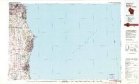
 1958 Racine1971 Print · USGSThe Lake Michigan shoreline in the late fifties was a study in contrasts between the industrial bustle of Kenosha and the quiet woods of the Allegan State Forest. Genealogists and historians can trace the urban footprint of Evanston or locate strategic sites like Fort Sheridan and the Wind Point Light.3 unique versions available
 - 1962 Map of Racine
 1962 Racine1962 Print · USGSThe Lake Michigan shoreline in the early sixties reveals a fascinating contrast between the dense industrial rail hubs of RACINE and CHICAGO and the forested dunes of Michigan. Local historians can trace military installations like Fort Sheridan or explore the numerous inland retreats around Paw Paw Lake and Sister Lakes.
 - 1980 Map of Racine, 1981 Print
 1980 Racine1981 Print · USGSThe Lake Michigan shoreline at the start of the 1980s reveals a bustling industrial corridor from Milwaukee to Kenosha. Genealogists and local historians can trace family roots through numerous sites like Forest Home Cem or locate former rail stops along the C & N W and C M St P & P lines.
 - 2010 Map of Greendale, 2010 Print
 2010 Greendale2010 Print · USGSCovers South Milwaukee, including Milwaukee, West Allis, and other nearby areas
 - 2010 Map of South Milwaukee, 2010 Print
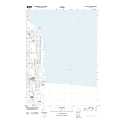 2010 South Milwaukee2010 Print · USGSCovers South Milwaukee, including Milwaukee, Oak Creek, and other nearby areas
 - 2013 Map of South Milwaukee, 2013 Print
 2013 South Milwaukee2013 Print · USGSCovers South Milwaukee, including Milwaukee, Oak Creek, and other nearby areas
 - 2013 Map of Greendale, 2013 Print
 2013 Greendale2013 Print · USGSCovers South Milwaukee, including Milwaukee, West Allis, and other nearby areas
 - 2016 Map of Greendale, 2016 Print
 2016 Greendale2016 Print · USGSCovers South Milwaukee, including Milwaukee, West Allis, and other nearby areas
 - 2016 Map of South Milwaukee, 2016 Print
 2016 South Milwaukee2016 Print · USGSCovers South Milwaukee, including Milwaukee, Oak Creek, and other nearby areas
 - 2018 Map of Greendale, 2018 Print
 2018 Greendale2018 Print · USGSCovers South Milwaukee, including Milwaukee, West Allis, and other nearby areas
 - 2018 Map of South Milwaukee, 2018 Print
 2018 South Milwaukee2018 Print · USGSCovers South Milwaukee, including Milwaukee, Oak Creek, and other nearby areas
 - 2022 Map of South Milwaukee, 2022 Print
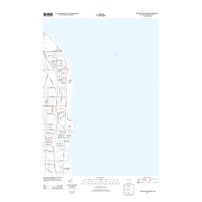
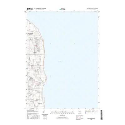
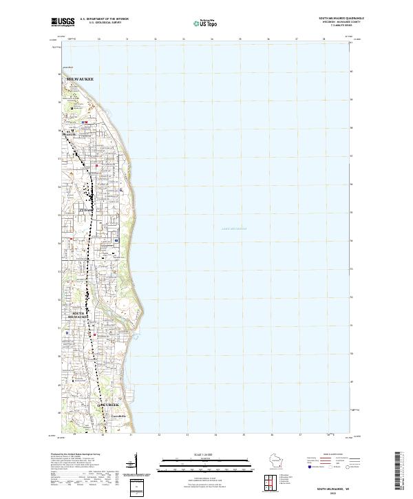 2022 South Milwaukee2022 Print · USGSSouthern Milwaukee County’s lakeshore communities are shown here in the early twenty-first century, spanning the suburbs from Cudahy to Oak Creek. Researchers can trace historic church properties and resting places like the Saint Francis de Sales Seminary, Holy Sepulcher Cem, and the settlement of Carrollville.
 - 2022 Map of Greendale, 2022 Print
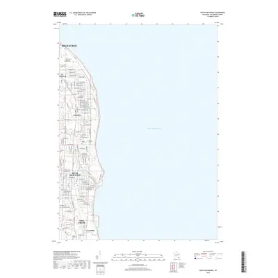
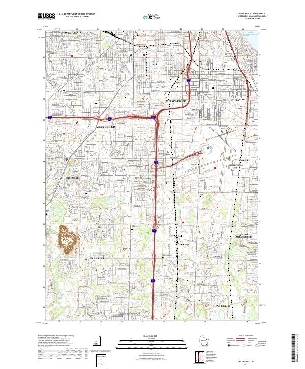 2022 Greendale2022 Print · USGSSouthern Milwaukee County in the early 2020s showcases a mature suburban grid bordered by heavy industry and aviation hubs. Genealogists and local historians can trace legacy sites like Mount Olivet Cem, Alverno College, and the sprawling General Mitchell International Airport.
End of results
Showing maps 1-18 of 18
Top cities near South Milwaukee
- Milwaukee historical maps
- Racine historical maps
- West Allis historical maps
- Wauwatosa historical maps
- Brookfield historical maps
- New Berlin historical maps
See more
Top neighborhoods of South Milwaukee
- Lakeview historical maps
- Blakewood historical maps
- Historic Grant Park historical maps
- South Chicago Avenue historical maps
- Historic Lakeview historical maps
- Parkway Heights historical maps
See more
Frequently asked questions
- What are the different types of historical maps available for South Milwaukee?
- What is the oldest map of South Milwaukee?
- Where can I purchase historical maps of South Milwaukee for my home or office?
- Where can I download high-res historical maps of South Milwaukee?
- Are there historical topographic maps available for South Milwaukee?
- Is there historical aerial imagery available for South Milwaukee?
- Where are historical maps of South Milwaukee sourced from?