1900s (20th Century) Maps of Lincoln Heights Terrace, West Allis
Explore 29 historic maps of Lincoln Heights Terrace from the 1900s (20th Century). These maps offer a rare glimpse into what life looked like during the 1900s — showing old roads, neighborhoods, homes, and landmarks that have changed or disappeared over time.
Whether you're researching your family's past, planning a metal detecting trip, or studying how Lincoln Heights Terrace's landscape evolved across the 1900s, these high-resolution maps are a powerful tool for exploring the history of this region.
- Focus on a specific era: All maps on this page are from the 1900s, giving you a focused view of this time period.
- See what’s changed: Compare century-old streets, trails, and buildings to today's modern landscape using overlays and satellite layers.
- Research with precision: Use these maps for genealogy, historical research, land use analysis, or educational projects.
- View, download, or print: Maps are fully viewable online in high resolution, and can be downloaded or printed for your own records.
Start exploring Lincoln Heights Terrace's history through authentic maps from the 1900s. This is your window into the past.
Lincoln Heights Terrace, West Allis maps
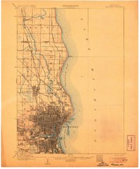
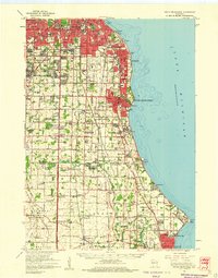
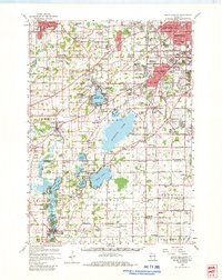
(29)- 1901 Map of Milwaukee
 1901 Milwaukee1901 Print · USGSCovers Lincoln Heights Terrace, including Milwaukee, West Allis, and other nearby areas
 - 1901 Map of Waukesha
 1901 Waukesha1901 Print · USGSCovers Lincoln Heights Terrace, including Milwaukee, Waukesha, and other nearby areas
 - 1901 Map of Bayview
 1901 Bayview1901 Print · USGSCovers Lincoln Heights Terrace, including Milwaukee, Racine, and other nearby areas4 unique versions available
 - 1901 Map of Muskego
 1901 Muskego1901 Print · USGSCovers Lincoln Heights Terrace, including Milwaukee, Waukesha, and other nearby areas4 unique versions available
 - 1906 Map of Waukesha
 1906 Waukesha1906 Print · USGSCovers Lincoln Heights Terrace, including Milwaukee, Waukesha, and other nearby areas4 unique versions available
 - 1906 Map of Milwaukee
 1906 Milwaukee1906 Print · USGSCovers Lincoln Heights Terrace, including Milwaukee, West Allis, and other nearby areas4 unique versions available
 - 1954 Map of Rockford
 1954 Rockford1954 Print · USGSCovers Lincoln Heights Terrace, including Milwaukee, Madison, and other nearby areas
 - 1954 Map of Milwaukee, 1967 Print
 1954 Milwaukee1967 Print · USGSCovers Lincoln Heights Terrace, including Milwaukee, West Allis, and other nearby areas3 unique versions available
 - 1955 Map of Rockford
 1955 Rockford1955 Print · USGSCovers Lincoln Heights Terrace, including Milwaukee, Madison, and other nearby areas
 - 1957 Map of Madison, 1967 Print
 1957 Madison1967 Print · USGSCovers Lincoln Heights Terrace, including Milwaukee, Madison, and other nearby areas3 unique versions available
 - 1958 Map of Milwaukee
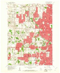
 1958 Milwaukee1958 Print · USGSCovers Lincoln Heights Terrace, including Milwaukee, West Allis, and other nearby areas
 - 1958 Map of Milwaukee, 1960 Print
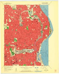 1958 Milwaukee1960 Print · USGSCovers Lincoln Heights Terrace, including Milwaukee, West Allis, and other nearby areas3 unique versions available
 - 1958 Map of Milwaukee, 1960 Print
 1958 Milwaukee1960 Print · USGSCovers Lincoln Heights Terrace, including Milwaukee, West Allis, and other nearby areas3 unique versions available
 - 1958 Map of Greendale, 1960 Print
 1958 Greendale1960 Print · USGSCovers Lincoln Heights Terrace, including Milwaukee, West Allis, and other nearby areas3 unique versions available
 - 1958 Map of South Milwaukee, 1960 Print
 1958 South Milwaukee1960 Print · USGSCovers Lincoln Heights Terrace, including Milwaukee, Racine, and other nearby areas2 unique versions available
 - 1958 Map of Wauwatosa, 1961 Print
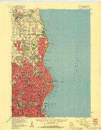
 1958 Wauwatosa1961 Print · USGSCovers Lincoln Heights Terrace, including Milwaukee, West Allis, and other nearby areas4 unique versions available
 - 1958 Map of Racine, 1971 Print
 1958 Racine1971 Print · USGSCovers Lincoln Heights Terrace, including Chicago, Milwaukee, and other nearby areas3 unique versions available
 - 1958 Map of Rockford, 1974 Print
 1958 Rockford1974 Print · USGSCovers Lincoln Heights Terrace, including Milwaukee, Madison, and other nearby areas4 unique versions available
 - 1959 Map of Hales Corners, 1960 Print
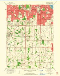
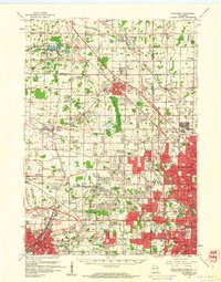
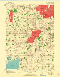 1959 Hales Corners1960 Print · USGSCovers Lincoln Heights Terrace, including Milwaukee, West Allis, and other nearby areas4 unique versions available
 - 1959 Map of Waukesha, 1961 Print
 1959 Waukesha1961 Print · USGSCovers Lincoln Heights Terrace, including Milwaukee, Waukesha, and other nearby areas3 unique versions available
 - 1959 Map of Hales Corners, 1980 Print
 1959 Hales Corners1980 Print · USGSCovers Lincoln Heights Terrace, including Milwaukee, Waukesha, and other nearby areas
 - 1960 Map of Madison
 1960 Madison1960 Print · USGSCovers Lincoln Heights Terrace, including Milwaukee, Madison, and other nearby areas2 unique versions available
 - 1962 Map of Racine
 1962 Racine1962 Print · USGSCovers Lincoln Heights Terrace, including Chicago, Milwaukee, and other nearby areas
 - 1963 Map of Rockford
 1963 Rockford1963 Print · USGSCovers Lincoln Heights Terrace, including Milwaukee, Madison, and other nearby areas
 - 1980 Map of Milwaukee, 1981 Print
 1980 Milwaukee1981 Print · USGSCovers Lincoln Heights Terrace, including Milwaukee, West Allis, and other nearby areas
Showing maps 1-25 of 29
Frequently asked questions
- What are the different types of historical maps available for Lincoln Heights Terrace?
- What is the oldest map of Lincoln Heights Terrace?
- Where can I purchase historical maps of Lincoln Heights Terrace for my home or office?
- Where can I download high-res historical maps of Lincoln Heights Terrace?
- Are there historical topographic maps available for Lincoln Heights Terrace?
- Is there historical aerial imagery available for Lincoln Heights Terrace?
- Where are historical maps of Lincoln Heights Terrace sourced from?