2000s (21st Century) Maps of Clifton, Wisconsin
Explore 4 historic maps of Clifton from the 2000s (21st Century). These maps offer a rare glimpse into what life looked like during the 2000s — showing old roads, neighborhoods, homes, and landmarks that have changed or disappeared over time.
Whether you're researching your family's past, planning a metal detecting trip, or studying how Clifton's landscape evolved across the 2000s, these high-resolution maps are a powerful tool for exploring the history of this region.
- Focus on a specific era: All maps on this page are from the 2000s, giving you a focused view of this time period.
- See what’s changed: Compare century-old streets, trails, and buildings to today's modern landscape using overlays and satellite layers.
- Research with precision: Use these maps for genealogy, historical research, land use analysis, or educational projects.
- View, download, or print: Maps are fully viewable online in high resolution, and can be downloaded or printed for your own records.
Start exploring Clifton's history through authentic maps from the 2000s. This is your window into the past.
Clifton, WI maps
(4)- 2022 Map of Oakdale, 2022 Print
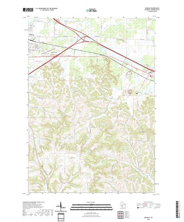 2022 Oakdale2022 Print · USGSMonroe County’s driftless edge and agricultural valleys are revealed in this recent survey of the corridor between Tomah and Oakdale. Researchers can trace the local landscape through landmarks like Stone Bluff, find family plots at Oakdale Cem, or locate the spring-fed waters of Council Creek Spring.
 - 2022 Map of Kendall East, 2022 Print
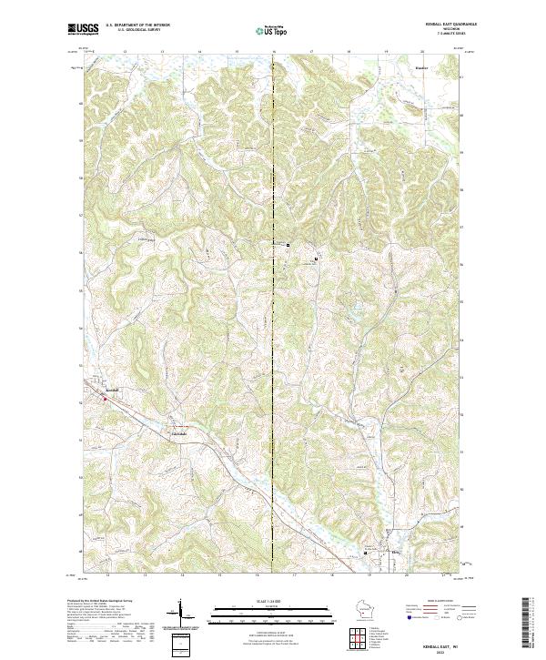 2022 Kendall East2022 Print · USGSThe Baraboo River valley in Monroe and Juneau Counties is captured here in recent years, showing the area's transition from rail to recreation. Genealogists can trace family connections at Fountain Lutheran Cemetery or locate old homesteads near Glendale and Clifton Ridge.
 - 2022 Map of Kendall West, 2022 Print
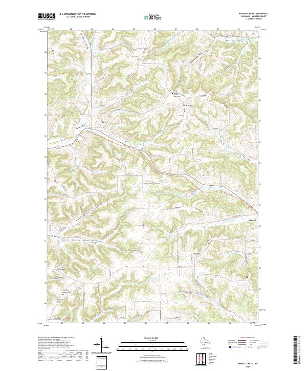 2022 Kendall West2022 Print · USGSMonroe County’s ridge-and-valley landscape is shown here in the 2020s, highlighting the unique divide between the Baraboo and Kickapoo watersheds. Genealogists can locate family burial sites at Immanuel German Lutheran Church Cem or trace the path of the Elroy-Sparta State Trl near Kendall.
 - 2022 Map of Camp Douglas, 2022 Print
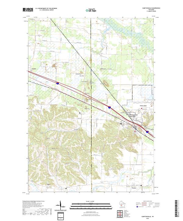 2022 Camp Douglas2022 Print · USGSThe Juneau County landscape at the start of the 2020s shows a unique topography of isolated sandstone bluffs and winding valley floors. Researchers can trace the proximity of local settlements like Hustler and Oakdale to landmarks such as Mill Bluff, Round Bluff, and Devils Monument.
End of results
Showing maps 1-4 of 4
Top cities near Clifton
- Tomah historical maps
- New Lisbon historical maps
- Elroy historical maps
- Hillsboro historical maps
- Greenwood historical maps
- Wonewoc historical maps
See more
Frequently asked questions
- What are the different types of historical maps available for Clifton?
- What is the oldest map of Clifton?
- Where can I purchase historical maps of Clifton for my home or office?
- Where can I download high-res historical maps of Clifton?
- Are there historical topographic maps available for Clifton?
- Is there historical aerial imagery available for Clifton?
- Where are historical maps of Clifton sourced from?