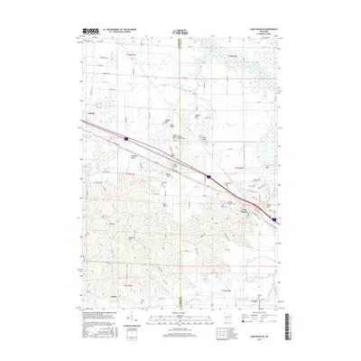
2016 Map of Camp Douglas
USGS Topo · Published 2016About this map
Wildcat Bluff, Bee Bluff, and Mill Bluff rise sharply from the central landscape along the border of Monroe and Juneau counties. This portion of Wisconsin is defined by these prominent sandstone buttes and mesas, which create a striking contrast against the low-lying wetlands and the drainage of Bear Creek and the Little Lemonweir River. The settlement of Camp Douglas serves as a local hub near Volk Field, while smaller communities such as Oakdale, Clifton, and Hustler are connected by a network of county highways and roads like E Badger Dr. Genealogy researchers will find several well-preserved burial sites, including Sorenson Cem and Saint James Cem, providing a window into the area’s settlement history. The terrain transitions from the marshy north to the complex ridges and valleys of Diamond Valley and Tug Hollow in the south, where Bellevue Hill and Mt Eve overlook the winding CO Hwy W.
Find a feature on this map
98 named features on this map. Tap any name to fly to it.
Don’t see what you’re looking for? This feature index may not catch every label — zoom into the map to look around manually.
Map Details
Editions of this 2016 Camp Douglas Map
This is the sole edition of this map. No revisions or reprints were ever made.
Other maps of this area

1919 · Kendall
USGS Topo · 1:62,500

1921 · Mauston
USGS Topo · 1:62,500

1921 · Kendall
USGS Topo · 1:62,500

1953 · Eau Claire
USGS Topo · 1:250,000

1958 · Eau Claire
USGS Topo · 1:250,000

1958 · Necedah
USGS Topo · 1:48,000

1958 · Wyeville
USGS Topo · 1:48,000

1958 · La Crosse
USGS Topo · 1:250,000

1961 · La Crosse
USGS Topo · 1:250,000

1962 · Kendall
USGS Topo · 1:62,500