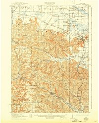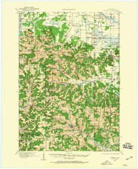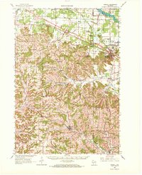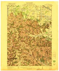
1921 Map of Kendall
USGS Topo · Published 1921About this map
Kendall and the surrounding driftless-area highlands of Monroe Co and Juneau Co are defined by a dramatic landscape of isolated bluffs and deep agricultural valleys. In the north, striking formations like Devils Monument, Sugar Bowl Bluff, and Mill Bluff rise sharply from the plains near Camp Douglas, which borders the Wisconsin Military Reservation. The southern half of the sheet shows a dense network of upland ridges and valleys, including Dorset Ridge and Homewood Valley, where rural life centered on local institutions like the Dorset Ridge Church and numerous numbered schoolhouses.
Find a feature on this map
98 named features on this map. Tap any name to fly to it.
Don’t see what you’re looking for? This feature index may not catch every label — zoom into the map to look around manually.
Map Details
Editions of this 1921 Kendall Map
2 editions found