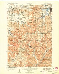
1921 Map of Kendall
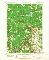
USGS Topo · Published 1943About this map
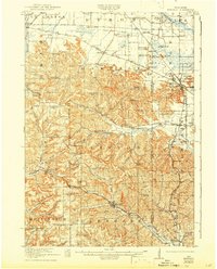
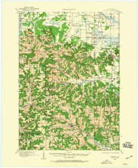
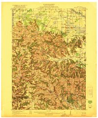
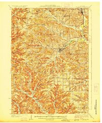
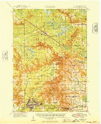
The Lemonweir River and its numerous tributaries carve through the driftless landscape of west-central Wisconsin, creating a dramatic topography of bluffs and ridges. This 1919 survey documents a landscape defined by the intersection of rail and agriculture, with the Chicago Milwaukee and St Paul RR and the Chicago and Northwestern RR connecting settlements like Kendall, Oakdale, and Camp Douglas. The northeastern portion of the sheet is dominated by the Wisconsin Military Reservation and a cluster of distinctive geologic formations, including Devils Monument, Mill Bluff, and Castle Bluff.
Find a feature on this map
113 named features on this map. Tap any name to fly to it.
Don’t see what you’re looking for? This feature index may not catch every label — zoom into the map to look around manually.
Map Details
Editions of this 1921 Kendall Map
2 editions found
Other maps of this area

1916 · Tomah
USGS Topo · 1:62,500
1919 · Kendall
USGS Topo · 1:62,500

1921 · Mauston
USGS Topo · 1:62,500
1921 · Kendall
USGS Topo · 1:62,500

1926 · La Farge
USGS Topo · 1:62,500
1927 · Hillsboro
USGS Topo · 1:62,500
1947 · Millston
USGS Topo · 1:62,500
1949 · Millston
USGS Topo · 1:62,500
1949 · Tomah
USGS Topo · 1:62,500

1953 · Eau Claire
USGS Topo · 1:250,000