Old Maps of Pepin, Wisconsin for Hiking & Exploration
Hike through history with 12 historic maps of Pepin. Explore old trails, ghost towns, and forgotten backroads — perfect for outdoor adventurers and local explorers.
- Rediscover forgotten places: Map out old mining camps, roads, and footpaths that no longer exist on modern maps.
- Layer with modern tools: Combine with LiDAR or satellite views to plan hikes through historical terrain.
- Made for exploration: Popular among hikers, overlanders, and local history lovers.
Use these maps to find adventure and explore the hidden past of Pepin.
Pepin, WI maps
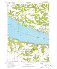
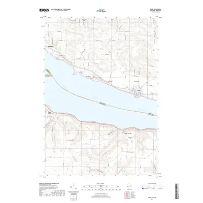
(12)- 1932 Map of Wabasha
 1932 Wabasha1932 Print · USGSThe Mississippi River valley near the Chippewa delta was a thriving hub of rail and river commerce in the early thirties. Genealogists can trace early homesteads and community hubs through landmarks like Hicks Valley Sch, Stockholm, and the river crossing at Nelson.2 unique versions available
 - 1951 Map of Wabasha
 1951 Wabasha1951 Print · USGSThe Mississippi River valley and Lake Pepin define this mid-century landscape at the border of Minnesota and Wisconsin. Researchers can trace rural school districts like Scott Settlement Sch and old river settlements from Stockholm to Wabasha.3 unique versions available
 - 1953 Map of Saint Paul, 1964 Print
 1953 Saint Paul1964 Print · USGSThe Twin Cities and the Mississippi River valley are captured here at a mid-century turning point. Trace the early growth of Minneapolis and Saint Paul alongside landmarks like Lake Minnetonka and the St Croix River.4 unique versions available
 - 1959 Map of Saint Paul
 1959 Saint Paul1959 Print · USGSThe Twin Cities and southeastern Minnesota appear here in the late fifties, showing the peak of the rail era and post-war suburban growth. Genealogists can trace family footprints near Lake Minnetonka, the Univ Of Minn Rosemount Research Center, or the growing neighborhoods of Richfield.2 unique versions available
 - 1974 Map of Pepin, 1976 Print
 1974 Pepin1976 Print · USGSThe Mississippi River valley at Lake Pepin comes to life in the mid-1970s, showcasing the river-and-rail corridor connecting Wisconsin and Minnesota. Genealogists and historians can trace riverside settlements like Stockholm and Pepin, and locate rural landmarks such as Oakwood Cem and Bogus Bluff.
 - 1985 Map of Rochester
 1985 Rochester1985 Print · USGSSoutheastern Minnesota in the mid-eighties centers on the growth of Rochester and its surrounding river valleys. Trace family roots and old rail lines through Mantorville, Pine Island, and along the Mississippi River near Lake Pepin.
 - 1989 Map of Rochester
 1989 Rochester1989 Print · USGSSoutheastern Minnesota and the Mississippi River bluffs are captured here in the late eighties as the region balanced urban growth with its river-and-rail heritage. Researchers can trace the development of Rochester and find smaller rail towns like Kasson, Dodge Center, and Zumbrota.2 unique versions available
 - 2010 Map of Pepin, 2010 Print
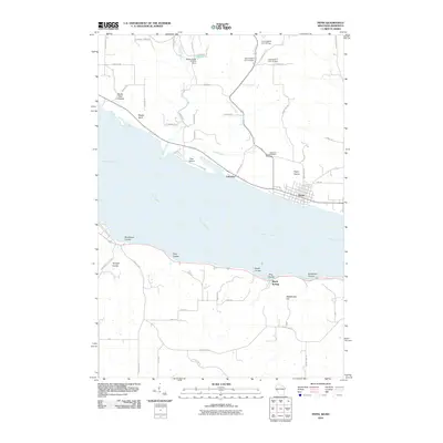 2010 Pepin2010 Print · USGSCovers Pepin, including Lake City, Stockholm, and other nearby areas
 - 2013 Map of Pepin, 2013 Print
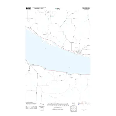 2013 Pepin2013 Print · USGSCovers Pepin, including Lake City, Stockholm, and other nearby areas
 - 2015 Map of Pepin, 2015 Print
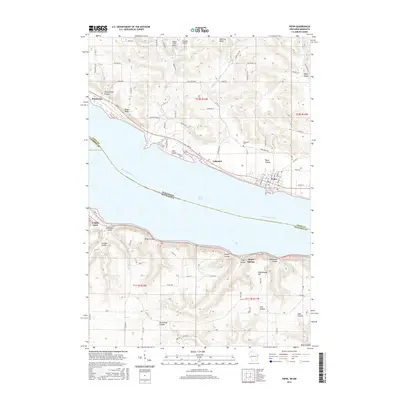 2015 Pepin2015 Print · USGSCovers Pepin, including Lake City, Stockholm, and other nearby areas
 - 2018 Map of Pepin, 2018 Print
 2018 Pepin2018 Print · USGSCovers Pepin, including Lake City, Stockholm, and other nearby areas
 - 2022 Map of Pepin, 2022 Print
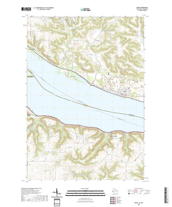 2022 Pepin2022 Print · USGSThe widening Mississippi River defines the border between Wisconsin and Minnesota in this contemporary survey of the Lake Pepin region. Researchers can trace the layout of Pepin and Stockholm or locate rural landmarks like Oakwood Cem and Maple Springs.
End of results
Showing maps 1-12 of 12
Top cities near Pepin
- Lake City historical maps
- Wabasha historical maps
- Durand historical maps
- Alma historical maps
- Plum City historical maps
- Salem historical maps
See more
Frequently asked questions
- What are the different types of historical maps available for Pepin?
- What is the oldest map of Pepin?
- Where can I purchase historical maps of Pepin for my home or office?
- Where can I download high-res historical maps of Pepin?
- Are there historical topographic maps available for Pepin?
- Is there historical aerial imagery available for Pepin?
- Where are historical maps of Pepin sourced from?