1900s (20th Century) Maps of Clifton, Wisconsin
Explore 11 historic maps of Clifton from the 1900s (20th Century). These maps offer a rare glimpse into what life looked like during the 1900s — showing old roads, neighborhoods, homes, and landmarks that have changed or disappeared over time.
Whether you're researching your family's past, planning a metal detecting trip, or studying how Clifton's landscape evolved across the 1900s, these high-resolution maps are a powerful tool for exploring the history of this region.
- Focus on a specific era: All maps on this page are from the 1900s, giving you a focused view of this time period.
- See what’s changed: Compare century-old streets, trails, and buildings to today's modern landscape using overlays and satellite layers.
- Research with precision: Use these maps for genealogy, historical research, land use analysis, or educational projects.
- View, download, or print: Maps are fully viewable online in high resolution, and can be downloaded or printed for your own records.
Start exploring Clifton's history through authentic maps from the 1900s. This is your window into the past.
Clifton, WI maps
(11)- 1946 Map of Hudson, 1954 Print
 1946 Hudson1954 Print · USGSThe riverfront communities of the St. Croix Valley are captured here just after the war, showing the distinct border towns of Wisconsin. Genealogists and local historians can trace the streets and benchmarks of Hudson, North Hudson, and Prescott.
 - 1946 Map of River Falls, 1968 Print
 1946 River Falls1968 Print · USGSPierce and St. Croix counties come alive in the mid-1940s, centered on the river-fed hub of River Falls. Genealogists and historians can trace dozens of rural schoolhouses and country churches, including Cherma Ch, Lafette Sch, and Glover.
 - 1949 Map of River Falls
 1949 River Falls1949 Print · USGSThe St. Croix and Pierce County borderlands near the late 1940s reveal a landscape of tight-knit rural communities and bustling riverside towns. Genealogists can trace family roots through dozens of local landmarks like Cherma Ch, Warren Cem, and the Nineteen Hundred Sch.2 unique versions available
 - 1949 Map of Hudson
 1949 Hudson1949 Print · USGSThe riverfront communities of St. Croix and Pierce counties are captured here in the late 1940s as the rail-and-river economy flourished. Genealogists and historians can trace the paths of the Chicago St Paul Minneapolis and Omaha line through Hudson and down to the river junction at Prescott.
 - 1951 Map of Prescott
 1951 Prescott1951 Print · USGSThe river confluence at the Minnesota-Wisconsin border in the early fifties shows a landscape of busy waterways and rural school districts. Genealogists can locate family landmarks like the Johnson Cem and Barkley Sch near the Kinnickinnic River bluffs.4 unique versions available
 - 1953 Map of Saint Paul, 1964 Print
 1953 Saint Paul1964 Print · USGSThe Twin Cities and the Mississippi River valley are captured here at a mid-century turning point. Trace the early growth of Minneapolis and Saint Paul alongside landmarks like Lake Minnetonka and the St Croix River.4 unique versions available
 - 1959 Map of Saint Paul
 1959 Saint Paul1959 Print · USGSThe Twin Cities and southeastern Minnesota appear here in the late fifties, showing the peak of the rail era and post-war suburban growth. Genealogists can trace family footprints near Lake Minnetonka, the Univ Of Minn Rosemount Research Center, or the growing neighborhoods of Richfield.2 unique versions available
 - 1967 Map of Prescott, 1969 Print
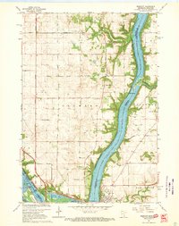 1967 Prescott1969 Print · USGSThe confluence of the Mississippi and St. Croix Rivers is captured here in the late sixties, highlighting the border towns of Prescott and Point Douglas. Researchers can trace genealogical landmarks like Evergreen Cemetery and family-named features like Starks Mound.4 unique versions available
 - 1974 Map of River Falls West, 1977 Print
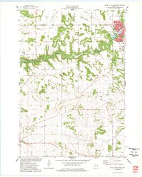 1974 River Falls West1977 Print · USGSThe bluffs and river valleys of Pierce County are captured here in the mid-seventies as River Falls expands westward. Genealogists and local historians can locate early cemeteries like Mann Valley Cem and landmarks such as the Townhall and West Side Sch.
 - 1985 Map of Hastings
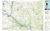 1985 Hastings1985 Print · USGSThe river valleys of the St. Croix and Mississippi dominate this mid-eighties landscape as they border Minnesota and Wisconsin. You can trace the boundaries of the Prairie Island Indian Res, find the old rail alignments of the SOO LINE, and locate remote bluffs like Rattlesnake Point.
 - 1990 Map of Hastings, 1991 Print
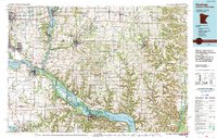 1990 Hastings1991 Print · USGSThe river confluence at Hastings and Prescott is captured here in the final decade of the twentieth century, showing a landscape defined by the Mississippi River and St Croix River. Genealogists and historians can trace rail corridors like the Soo RR and find smaller settlements such as Miesville, Wacouta, and Diamond Bluff.
End of results
Showing maps 1-11 of 11
Top cities near Clifton
- Woodbury historical maps
- Cottage Grove historical maps
- Hastings historical maps
- Stillwater historical maps
- Red Wing historical maps
- River Falls historical maps
See more
Top neighborhoods of Clifton
Frequently asked questions
- What are the different types of historical maps available for Clifton?
- What is the oldest map of Clifton?
- Where can I purchase historical maps of Clifton for my home or office?
- Where can I download high-res historical maps of Clifton?
- Are there historical topographic maps available for Clifton?
- Is there historical aerial imagery available for Clifton?
- Where are historical maps of Clifton sourced from?