Old Maps of Balsam Lake, Wisconsin for Genealogy
Trace your family roots with 16 historic maps of Balsam Lake. These high-res maps reveal old neighborhoods, homesites, landmarks, and streets — helping you uncover where your ancestors lived and how the area evolved over time.
- Explore historic neighborhoods: Identify where your relatives may have lived in the 1800s or 1900s.
- Compare maps over time: Trace the changes in streets, buildings, and landmarks for multi-generational research.
- Perfect for genealogy & ancestry research: Used by family historians and researchers to map out lineage and migration.
These maps are an incredible resource for exploring your personal connection to Balsam Lake's past.
Balsam Lake, WI maps
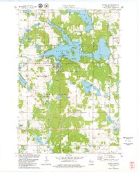
(16)- 1900 Map of St Croix Dalles
 1900 St Croix Dalles1900 Print · USGSCovers Balsam Lake, including Osceola, Town of Osceola, and other nearby areas
 - 1901 Map of St Croix Dalles
 1901 St Croix Dalles1901 Print · USGSCovers Balsam Lake, including Osceola, Town of Osceola, and other nearby areas6 unique versions available
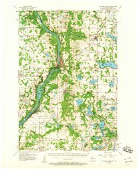
 - 1950 Map of Balsam Lake, 1952 Print
 1950 Balsam Lake1952 Print · USGSCovers Balsam Lake, including Amery, Town of Lincoln, and other nearby areas3 unique versions available
 - 1953 Map of Stillwater, 1980 Print
 1953 Stillwater1980 Print · USGSCovers Balsam Lake, including Minneapolis, Brooklyn Park, and other nearby areas
 - 1955 Map of St. Croix Dalles
 1955 St. Croix Dalles1955 Print · USGSCovers Balsam Lake, including Osceola, Town of Osceola, and other nearby areas4 unique versions available
 - 1955 Map of Stillwater, 1965 Print
 1955 Stillwater1965 Print · USGSCovers Balsam Lake, including Minneapolis, Brooklyn Park, and other nearby areas
 - 1958 Map of Stillwater
 1958 Stillwater1958 Print · USGSCovers Balsam Lake, including Minneapolis, Brooklyn Park, and other nearby areas2 unique versions available
 - 1965 Map of Stillwater
 1965 Stillwater1965 Print · USGSCovers Balsam Lake, including Minneapolis, Brooklyn Park, and other nearby areas
 - 1974 Map of Balsam Lake NW, 1976 Print
 1974 Balsam Lake NW1976 Print · USGSCovers Balsam Lake, including Garfield, Apple River, and other nearby areas
 - 1974 Map of St. Croix Dalles NE, 1976 Print
 1974 St. Croix Dalles NE1976 Print · USGSCovers Balsam Lake, including Centuria, Garfield, and other nearby areas
 - 1975 Map of Stillwater
 1975 Stillwater1975 Print · USGSCovers Balsam Lake, including Minneapolis, Brooklyn Park, and other nearby areas2 unique versions available
 - 1978 Map of Centuria, 1979 Print
 1978 Centuria1979 Print · USGSCovers Balsam Lake, including Centuria, Garfield, and other nearby areas
 - 1978 Map of Balsam Lake, 1979 Print
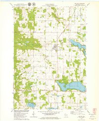
 1978 Balsam Lake1979 Print · USGSCovers Balsam Lake, including Garfield, Apple River, and other nearby areas
 - 1985 Map of Stillwater
 1985 Stillwater1985 Print · USGSCovers Balsam Lake, including Maplewood, White Bear Lake, and other nearby areas2 unique versions available
 - 2022 Map of Centuria, 2022 Print
 2022 Centuria2022 Print · USGSCovers Balsam Lake, including Centuria, Garfield, and other nearby areas
 - 2022 Map of Balsam Lake, 2022 Print
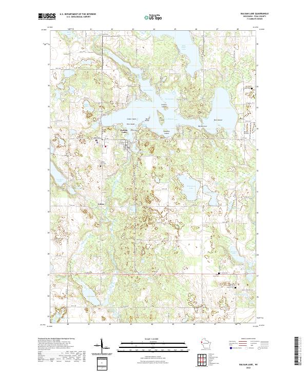 2022 Balsam Lake2022 Print · USGSCovers Balsam Lake, including Apple River, Garfield, and other nearby areas
End of results
Showing maps 1-16 of 16
Top cities near Balsam Lake
- Amery historical maps
- Osceola historical maps
- Town of Alden historical maps
- Town of Lincoln historical maps
- Franconia historical maps
- Town of Black Brook historical maps
See more
Top neighborhoods of Balsam Lake
Frequently asked questions
- What are the different types of historical maps available for Balsam Lake?
- What is the oldest map of Balsam Lake?
- Where can I purchase historical maps of Balsam Lake for my home or office?
- Where can I download high-res historical maps of Balsam Lake?
- Are there historical topographic maps available for Balsam Lake?
- Is there historical aerial imagery available for Balsam Lake?
- Where are historical maps of Balsam Lake sourced from?