2020s Maps of Dewey, Wisconsin
Explore 6 historic maps of Dewey from the 2020s. These maps offer a rare glimpse into what life looked like during the 2020s — showing old roads, neighborhoods, homes, and landmarks that have changed or disappeared over time.
Whether you're researching your family's past, planning a metal detecting trip, or studying how Dewey's landscape evolved across the 2020s, these high-resolution maps are a powerful tool for exploring the history of this region.
- Focus on a specific era: All maps on this page are from the 2020s, giving you a focused view of this time period.
- See what’s changed: Compare century-old streets, trails, and buildings to today's modern landscape using overlays and satellite layers.
- Research with precision: Use these maps for genealogy, historical research, land use analysis, or educational projects.
- View, download, or print: Maps are fully viewable online in high resolution, and can be downloaded or printed for your own records.
Start exploring Dewey's history through authentic maps from the 2020s. This is your window into the past.
Dewey, WI maps
(6)- 2022 Map of Polonia, 2022 Print
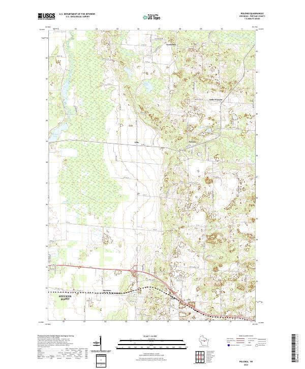 2022 Polonia2022 Print · USGSPortage County at the start of the 2020s reveals a patchwork of small crossroads communities and glacial water bodies. Genealogists and local historians can trace family-named routes and longstanding hamlets like Polonia, Ellis, and Custer.
 - 2022 Map of Rosholt NW, 2022 Print
 2022 Rosholt NW2022 Print · USGSMarathon and Portage counties are shown here in the 2020s, where the winding Plover River cuts through a dense glacial landscape. Researchers can locate the rural settlement of Shantytown and trace local access to Big Bass Lake and Twin Lakes.
 - 2022 Map of Dewey Marsh, 2022 Print
 2022 Dewey Marsh2022 Print · USGSMarathon and Portage counties come together in this 2020s study of the central Wisconsin wetlands and rural crossroads. Researchers can trace family-named routes like Zoromski Rd or locate small settlements at Rocky Corners and Ashley.
 - 2022 Map of Stevens Point, 2022 Print
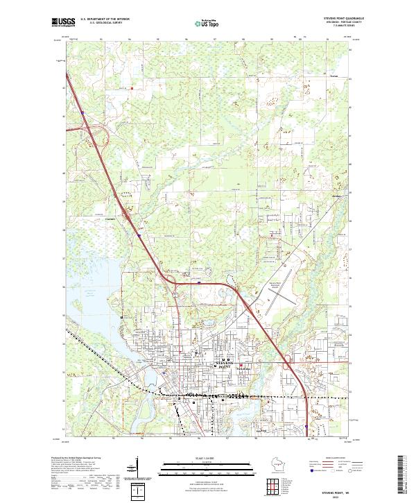 2022 Stevens Point2022 Print · USGSThe Wisconsin River corridor and the educational center of Stevens Point are shown here in the early 2020s. Genealogists and local historians can trace the area's development through the Portage County Courthouse, Soo Line RR, and several parish sites like Saint Josephs Cem.
 - 2022 Map of Rocky Run, 2022 Print
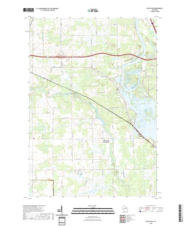 2022 Rocky Run2022 Print · USGSThe Wisconsin River shoreline and the quiet interior of Portage and Wood Counties are captured here as they appeared in 2022. Researchers can trace the local landscape from the Mill Creek Community to the wetlands of Fogarty Marsh and the waters of First Lake.
 - 2022 Map of Dancy, 2022 Print
 2022 Dancy2022 Print · USGSMarathon and Portage counties meet along the sprawling waters of the Wisconsin River in the early twenty-first century. Genealogists and local historians can trace the sites of Saint John the Baptist Cem, Knowlton, and Dancy.
End of results
Showing maps 1-6 of 6
Top cities near Dewey
- Stevens Point historical maps
- Wisconsin Rapids historical maps
- Weston historical maps
- Plover historical maps
- Kronenwetter historical maps
- Rib Mountain historical maps
See more
Top neighborhoods of Dewey
Frequently asked questions
- What are the different types of historical maps available for Dewey?
- What is the oldest map of Dewey?
- Where can I purchase historical maps of Dewey for my home or office?
- Where can I download high-res historical maps of Dewey?
- Are there historical topographic maps available for Dewey?
- Is there historical aerial imagery available for Dewey?
- Where are historical maps of Dewey sourced from?