2020s Maps of Grant, Wisconsin
Explore 6 historic maps of Grant from the 2020s. These maps offer a rare glimpse into what life looked like during the 2020s — showing old roads, neighborhoods, homes, and landmarks that have changed or disappeared over time.
Whether you're researching your family's past, planning a metal detecting trip, or studying how Grant's landscape evolved across the 2020s, these high-resolution maps are a powerful tool for exploring the history of this region.
- Focus on a specific era: All maps on this page are from the 2020s, giving you a focused view of this time period.
- See what’s changed: Compare century-old streets, trails, and buildings to today's modern landscape using overlays and satellite layers.
- Research with precision: Use these maps for genealogy, historical research, land use analysis, or educational projects.
- View, download, or print: Maps are fully viewable online in high resolution, and can be downloaded or printed for your own records.
Start exploring Grant's history through authentic maps from the 2020s. This is your window into the past.
Grant, WI maps
(6)- 2022 Map of Hancock, 2022 Print
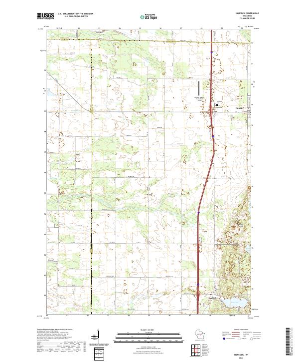 2022 Hancock2022 Print · USGSThe village of Plainfield and its surrounding marshlands are documented here in the early twenty-first century. Genealogists and local historians can trace family locations near Plainfield Cem or locate rural landmarks like Lone Rock and Goose Lake.
 - 2022 Map of Coloma NW, 2022 Print
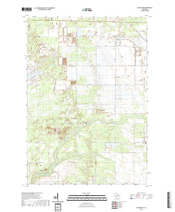 2022 Coloma NW2022 Print · USGSThe borderlands of Adams, Wood, and Portage counties come into focus in this recent survey of the central Wisconsin plains. Family historians can locate Holiday Cem and Coloma-Leola Cem or trace landmarks like Owens Rock and Big Roche-a-Cri Cr.
 - 2022 Map of Whiting, 2022 Print
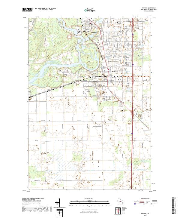 2022 Whiting2022 Print · USGSWhiting and Plover sit at the historic confluence of the Wisconsin and Plover Rivers in the early 2020s. Researchers can locate family plots at McDill Cem or Maine Cem and trace the modern expansion around Lake Pacawa and the Runway Leasing Inc Number 2 Airport.
 - 2022 Map of Bancroft, 2022 Print
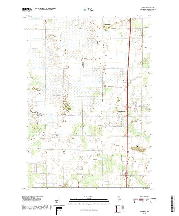 2022 Bancroft2022 Print · USGSPortage County at the start of the 2020s shows a landscape of engineered drainage and quiet rural hubs. Researchers can trace the local road network and find sites like the Pine Grove Cem, Mosquito Bluff, and the settlement of Bancroft.
 - 2022 Map of Meehan, 2022 Print
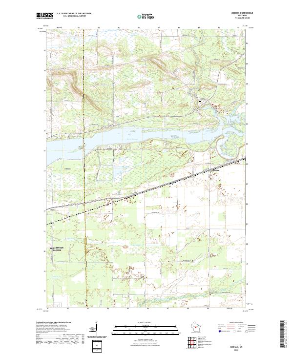 2022 Meehan2022 Print · USGSPortage and Wood counties meet along the Wisconsin River in the early 2020s, showing a mix of riverside development and vast marshland. You can trace the boundaries of Biron and Meehan, locate the Linwood Union Cem, and follow the banks of Biron Flowage.
 - 2022 Map of Kellner, 2022 Print
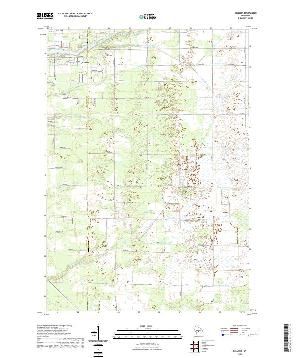 2022 Kellner2022 Print · USGSThe community of Kellner and the border between Wood and Portage counties are captured here in the early twenty-first century. Genealogists and local historians can trace the grounds of Saint Johns Cem and the complex drainage networks of Tenmile Cr and Bloody Run.
End of results
Showing maps 1-6 of 6
Top cities near Grant
- Stevens Point historical maps
- Wisconsin Rapids historical maps
- Plover historical maps
- Stockton historical maps
- Nekoosa historical maps
- Port Edwards historical maps
See more
Frequently asked questions
- What are the different types of historical maps available for Grant?
- What is the oldest map of Grant?
- Where can I purchase historical maps of Grant for my home or office?
- Where can I download high-res historical maps of Grant?
- Are there historical topographic maps available for Grant?
- Is there historical aerial imagery available for Grant?
- Where are historical maps of Grant sourced from?