Old Maps of Kennedy, Lake for Academic Research
Study the evolution of Kennedy with 12 high-resolution historic maps. Whether you're teaching, researching, or modeling changes in land use, these maps provide essential visual documentation of urban, environmental, and geographic change.
- Analyze long-term change: Track patterns in development, transportation, and natural features.
- Ideal for environmental or urban studies: Support academic projects with primary historical map data.
- Use in the classroom or lab: Educators and researchers rely on these maps to bring historical context to life.
These maps are a powerful tool for teaching, research, and visualizing how Kennedy has changed over the decades.
Kennedy, Lake maps
(12)- 1941 Map of Kennedy, 1959 Print
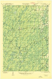
 1941 Kennedy1959 Print · USGSIn the early 1940s, this portion of Price and Sawyer counties was a landscape of timber management and rail-side settlements. Genealogists can locate rural schoolhouses like Poplar Hill Sch and trace industrial sites such as Pixley Dam or the Old Mill Dam.2 unique versions available
 - 1945 Map of Kennedy
 1945 Kennedy1945 Print · USGSThe Wisconsin Northwoods come alive in the 1940s, showing a landscape of timber, rail, and remote settlements. Genealogists and local historians can trace rural schoolhouses like Arnold Sch and family landmarks near Lugerville and Kaiser.2 unique versions available
 - 1953 Map of Rice Lake, 1967 Print
 1953 Rice Lake1967 Print · USGSNorthwest Wisconsin during the mid-fifties reveals a landscape defined by timber, rail, and water. Genealogists and historians can trace the development of river towns like Ladysmith and Rice Lake along the Soo Line and Chicago and North Western railroads.2 unique versions available
 - 1959 Map of Rice Lake
 1959 Rice Lake1959 Print · USGSNorthwest Wisconsin in the late fifties was a land of expanding road networks and deep-seated timber history. Genealogists and historians can trace rail lines like the Soo Line RR and Chicago St Paul Minneapolis and Omaha Ry as they link settlements from Spooner to Medford.
 - 1970 Map of Kennedy, 1972 Print
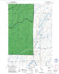 1970 Kennedy1972 Print · USGSSawyer and Ashland counties are shown in the early 1970s as centers of Wisconsin timber and recreation. Researchers can locate the settlement of Kennedy, follow the Tuscobia State Forest Trail, and trace the shoreline of Lake Alice.3 unique versions available
 - 1980 Map of Park Falls
 1980 Park Falls1980 Print · USGSNorthern Wisconsin's timber and rail corridor is meticulously detailed here in the early eighties. Researchers can trace the Soo Line through forest-bound towns like Park Falls, Phillips, and Lugerville while exploring the vast Chequamegon National Forest.
 - 2005 Map of Kennedy, 2006 Print
 2005 Kennedy2006 Print · USGSNorthern Wisconsin's deep woods and glacial lakes are mapped here in the early twenty-first century. Genealogists and researchers can trace the settlement of Kennedy and the remote forest roads near Lake Alice and Oxbo Lake.
 - 2011 Map of Kennedy, 2011 Print
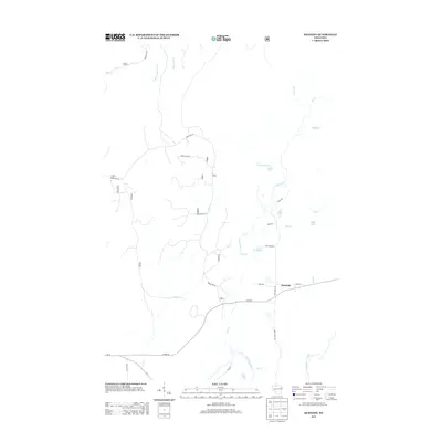
 2011 Kennedy2011 Print · USGSCovers Kennedy, including Draper, Chippewa, and other nearby areas
 - 2013 Map of Kennedy, 2013 Print
 2013 Kennedy2013 Print · USGSCovers Kennedy, including Draper, Chippewa, and other nearby areas
 - 2015 Map of Kennedy, 2015 Print
 2015 Kennedy2015 Print · USGSCovers Kennedy, including Draper, Chippewa, and other nearby areas
 - 2018 Map of Kennedy, 2018 Print
 2018 Kennedy2018 Print · USGSCovers Kennedy, including Draper, Chippewa, and other nearby areas
 - 2022 Map of Kennedy, 2022 Print
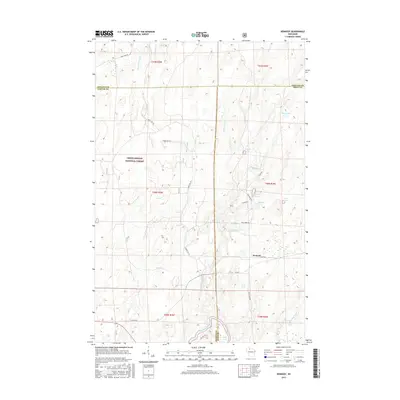
 2022 Kennedy2022 Print · USGSSawyer County and the surrounding northwoods are captured in this contemporary survey of the Chequamegon National Forest. Outdoor enthusiasts and historians can trace the Tuscobia State Trl as it passes near the settlement of Kennedy and the banks of the Flambeau River.
End of results
Showing maps 1-12 of 12
Top cities near Kennedy
- Park Falls historical maps
- Phillips historical maps
- Fifield historical maps
- Butternut historical maps
- Draper historical maps
- Shanagolden historical maps
Frequently asked questions
- What are the different types of historical maps available for Kennedy?
- What is the oldest map of Kennedy?
- Where can I purchase historical maps of Kennedy for my home or office?
- Where can I download high-res historical maps of Kennedy?
- Are there historical topographic maps available for Kennedy?
- Is there historical aerial imagery available for Kennedy?
- Where are historical maps of Kennedy sourced from?