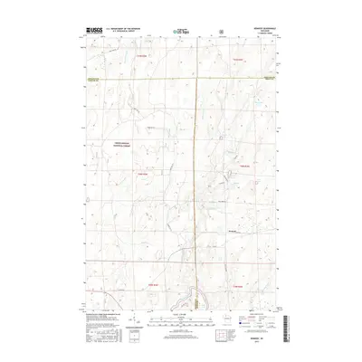
2015 Map of Kennedy
USGS Topo · Published 2015About this map
Chequamegon National Forest encompasses the vast majority of this landscape, where the borders of Sawyer, Price, and Ashland counties converge. The small settlement of Kennedy sits at the junction of Kemp Rd and Co Rd E, serving as a remote outpost in a region defined by its complex hydrography. The southern edge of the map is dominated by the winding course of the Flambeau River and the nearby Oxbo Lake. This area is dense with glacial water bodies, including Lake Annie, Lake Alice, and Round Lake, along with specialized man-made features like the 0.2 Reservoir and 0.3 Reservoir. A network of Forest Service roads, such as Forest Rd 161 and Forest Rd 307, provides the primary access through the wooded terrain and across numerous drainages like Pine Creek and Butternut Creek.
Find a feature on this map
44 named features on this map. Tap any name to fly to it.
Don’t see what you’re looking for? This feature index may not catch every label — zoom into the map to look around manually.
Map Details
Editions of this 2015 Kennedy Map
This is the sole edition of this map. No revisions or reprints were ever made.
Other maps of this area

1941 · Kennedy
USGS Topo · 1:48,000

1942 · Glidden
USGS Topo · 1:48,000

1942 · Clam Lake
USGS Topo · 1:48,000

1944 · Draper
USGS Topo · 1:48,000

1945 · Kennedy
USGS Topo · 1:48,000

1945 · Clam Lake
USGS Topo · 1:48,000

1945 · Glidden
USGS Topo · 1:48,000

1947 · Draper
USGS Topo · 1:48,000

1953 · Ashland
USGS Topo · 1:250,000

1953 · Rice Lake
USGS Topo · 1:250,000