2020s Maps of Union, Wisconsin
Explore 2 historic maps of Union from the 2020s. These maps offer a rare glimpse into what life looked like during the 2020s — showing old roads, neighborhoods, homes, and landmarks that have changed or disappeared over time.
Whether you're researching your family's past, planning a metal detecting trip, or studying how Union's landscape evolved across the 2020s, these high-resolution maps are a powerful tool for exploring the history of this region.
- Focus on a specific era: All maps on this page are from the 2020s, giving you a focused view of this time period.
- See what’s changed: Compare century-old streets, trails, and buildings to today's modern landscape using overlays and satellite layers.
- Research with precision: Use these maps for genealogy, historical research, land use analysis, or educational projects.
- View, download, or print: Maps are fully viewable online in high resolution, and can be downloaded or printed for your own records.
Start exploring Union's history through authentic maps from the 2020s. This is your window into the past.
Union, WI maps
(2)- 2022 Map of Evansville, 2022 Print
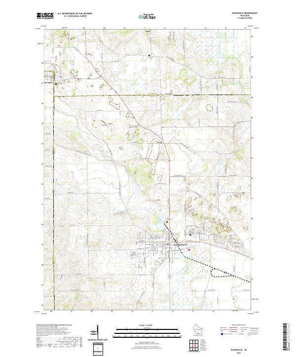 2022 Evansville2022 Print · USGSSouthern Wisconsin farmland meets the growing city of Evansville in the early 2020s. Researchers can trace historic property boundaries and cemetery locations like Mount Hope Cem and Maple Hill Cem along the Allen Creek corridor.
 - 2022 Map of Cooksville, 2022 Print
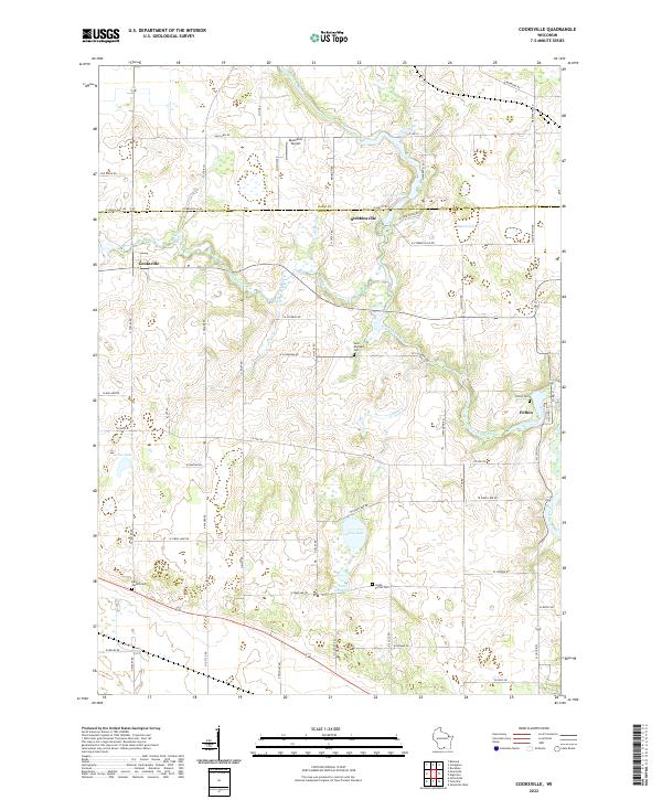 2022 Cooksville2022 Print · USGSThe rural borderlands of Dane and Rock County appear here in the early twenty-first century, centered on the river valleys and prairie farms. Genealogists can trace family names through burial sites like Fulton Cem and the waters of Gibbs Lake or the Yahara River.
End of results
Showing maps 1-2 of 2
Top cities near Union
- Madison historical maps
- Fitchburg historical maps
- Stoughton historical maps
- Verona historical maps
- Oregon historical maps
- McFarland historical maps
See more
Frequently asked questions
- What are the different types of historical maps available for Union?
- What is the oldest map of Union?
- Where can I purchase historical maps of Union for my home or office?
- Where can I download high-res historical maps of Union?
- Are there historical topographic maps available for Union?
- Is there historical aerial imagery available for Union?
- Where are historical maps of Union sourced from?