1980s Maps of Rusk County, Wisconsin
Explore 6 historic maps of Rusk County from the 1980s. These maps offer a rare glimpse into what life looked like during the 1980s — showing old roads, neighborhoods, homes, and landmarks that have changed or disappeared over time.
Whether you're researching your family's past, planning a metal detecting trip, or studying how Rusk County's landscape evolved across the 1980s, these high-resolution maps are a powerful tool for exploring the history of this region.
- Focus on a specific era: All maps on this page are from the 1980s, giving you a focused view of this time period.
- See what’s changed: Compare century-old streets, trails, and buildings to today's modern landscape using overlays and satellite layers.
- Research with precision: Use these maps for genealogy, historical research, land use analysis, or educational projects.
- View, download, or print: Maps are fully viewable online in high resolution, and can be downloaded or printed for your own records.
Start exploring Rusk County's history through authentic maps from the 1980s. This is your window into the past.
Rusk County, WI maps
(6)- 1980 Map of Spooner
 1980 Spooner1980 Print · USGSNorthwestern Wisconsin at the dawn of the eighties reveals a landscape of deep forests and transitioning rail corridors. Genealogists and historians can trace lakefront settlements like Spooner and Birchwood or follow the early Tuscobia-Park Falls State Trail.
 - 1980 Map of Bloomer
 1980 Bloomer1980 Print · USGSNorthwestern Wisconsin at the start of the eighties shows a landscape deeply connected to its rivers and rail lines. Genealogists and historians can trace the growth of Bloomer, Ladysmith, and Chetek or locate local landmarks like Brunet Island State Park and the Soo Line rail corridors.
 - 1980 Map of Park Falls
 1980 Park Falls1980 Print · USGSNorthern Wisconsin's timber and rail corridor is meticulously detailed here in the early eighties. Researchers can trace the Soo Line through forest-bound towns like Park Falls, Phillips, and Lugerville while exploring the vast Chequamegon National Forest.
 - 1980 Map of Medford
 1980 Medford1980 Print · USGSNorth-central Wisconsin in the early eighties shows a landscape of dense timber and rail-linked settlements. Genealogists and historians can trace the Soo Line through towns like Medford and Westboro or locate family homesteads near Perkinstown and Athens.
 - 1981 Map of Mikana, 1982 Print
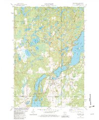
 1981 Mikana1982 Print · USGSBarron County's lake district is documented here in the early eighties as rail corridors transitioned into recreational trails. Genealogists and local researchers can locate Mikana, the Immanuel Ch, and family-named landmarks like Stout Island.
 - 1982 Map of Birchwood
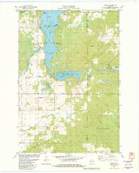
 1982 Birchwood1982 Print · USGSThe village of Birchwood stands at a three-county junction in the early 1980s, surrounded by a labyrinth of glacial lakes. Researchers can trace local landmarks like Woodlawn Cem, the Tuscobia Parkway State Trail, and Stouts Point on Red Cedar Lake.
End of results
Showing maps 1-6 of 6
Top cities of Rusk County
- Ladysmith historical maps
- Thornapple historical maps
- Bruce historical maps
- Weyerhaeuser historical maps
- Hawkins historical maps
- Strickland historical maps
See more
Frequently asked questions
- What are the different types of historical maps available for Rusk County?
- What is the oldest map of Rusk County?
- Where can I purchase historical maps of Rusk County for my home or office?
- Where can I download high-res historical maps of Rusk County?
- Are there historical topographic maps available for Rusk County?
- Is there historical aerial imagery available for Rusk County?
- Where are historical maps of Rusk County sourced from?