2020s Maps of Kinnickinnic, Wisconsin
Explore 4 historic maps of Kinnickinnic from the 2020s. These maps offer a rare glimpse into what life looked like during the 2020s — showing old roads, neighborhoods, homes, and landmarks that have changed or disappeared over time.
Whether you're researching your family's past, planning a metal detecting trip, or studying how Kinnickinnic's landscape evolved across the 2020s, these high-resolution maps are a powerful tool for exploring the history of this region.
- Focus on a specific era: All maps on this page are from the 2020s, giving you a focused view of this time period.
- See what’s changed: Compare century-old streets, trails, and buildings to today's modern landscape using overlays and satellite layers.
- Research with precision: Use these maps for genealogy, historical research, land use analysis, or educational projects.
- View, download, or print: Maps are fully viewable online in high resolution, and can be downloaded or printed for your own records.
Start exploring Kinnickinnic's history through authentic maps from the 2020s. This is your window into the past.
Kinnickinnic, WI maps
(4)- 2022 Map of River Falls East, 2022 Print
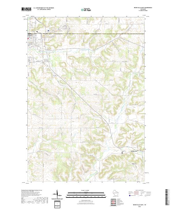 2022 River Falls East2022 Print · USGSPierce County’s eastern townships come into focus here during the early twenty-first century as the city meets the country. Genealogists can locate family sites at Thurston Hill Cem or follow the waters of the S Fork Kinnickinnic River past Beldenville.
 - 2022 Map of Baldwin West, 2022 Print
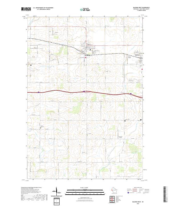 2022 Baldwin West2022 Print · USGSSaint Croix County in the early 2020s shows a landscape of established villages and persistent rural cemeteries. Genealogists can locate several historic burial sites like Saint Marys Cem and Hawkins Cem while tracing the waters of the Rush River.
 - 2022 Map of Roberts, 2022 Print
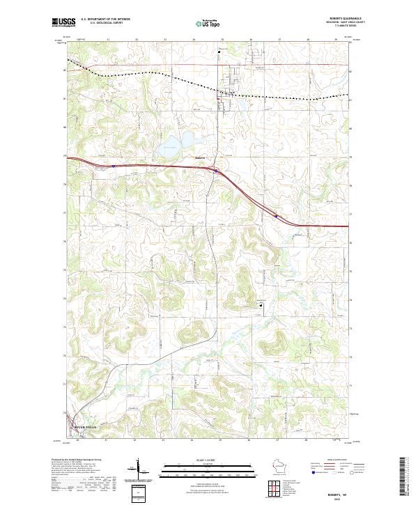 2022 Roberts2022 Print · USGSThe village of Roberts sits at the center of this recent survey, showcasing the modern landscape of St. Croix County. Local researchers can trace family landmarks like Warren Cem and the winding course of the Kinnickinnic River near River Falls.
 - 2022 Map of Martell, 2022 Print
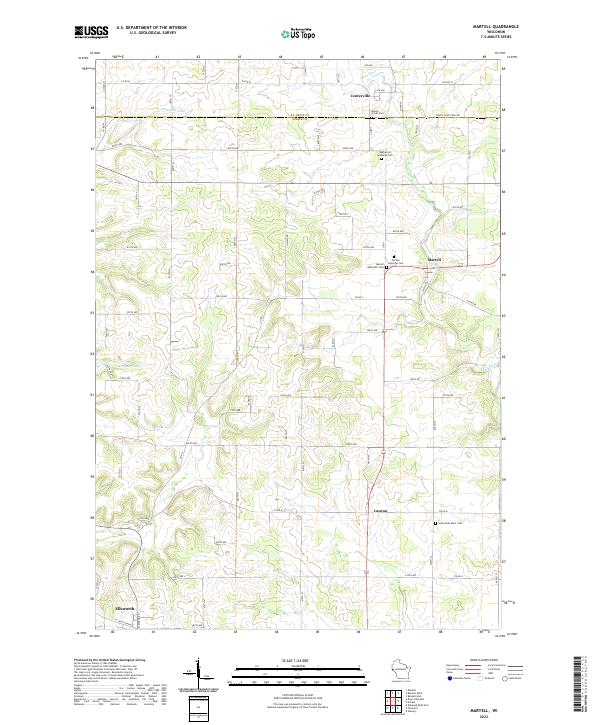 2022 Martell2022 Print · USGSEastern Pierce County is shown in the early 2020s, a landscape defined by the winding Rush River. Researchers can locate several community burial sites, including Rush River Lutheran Cem and Martell Methodist Cem.
End of results
Showing maps 1-4 of 4
Top cities near Kinnickinnic
- River Falls historical maps
- Hudson historical maps
- New Richmond historical maps
- Prescott historical maps
- Baldwin historical maps
- Oak Park Heights historical maps
See more
Frequently asked questions
- What are the different types of historical maps available for Kinnickinnic?
- What is the oldest map of Kinnickinnic?
- Where can I purchase historical maps of Kinnickinnic for my home or office?
- Where can I download high-res historical maps of Kinnickinnic?
- Are there historical topographic maps available for Kinnickinnic?
- Is there historical aerial imagery available for Kinnickinnic?
- Where are historical maps of Kinnickinnic sourced from?