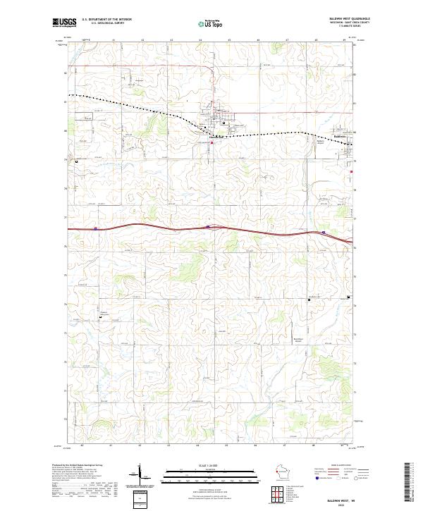
2022 Map of Baldwin West
USGS Topo · Published 2022About this map
Hammond and Baldwin serve as the primary hubs in this section of Saint Croix County, where the transition between agricultural townships is marked by a high density of small burial grounds. Local genealogy is well-served by the presence of Saint Marys Cem, Hammond Cem, and Hawkins Cem, alongside the Pleasant Valley Cem, Woodside Cem, and Peace Cem further south. The landscape is defined by the headwaters of several notable waterways, including the Kinnickinnic River and its S Br Kinnickinnic River in the northwest, while the Rush River and Parker Cr drain the eastern and southern reaches. This modern survey illustrates the persistent importance of the section-line road grid, with routes like Co Hwy J and Co Hwy TT connecting the dispersed farmsteads between the larger village centers. Aviation is represented by both the Baldwin Airport and the Rush River Airport, reflecting the area's mix of rural residential and light industrial utility.
Find a feature on this map
54 named features on this map. Tap any name to fly to it.
Don’t see what you’re looking for? This feature index may not catch every label — zoom into the map to look around manually.
Map Details
Editions of this 2022 Baldwin West Map
This is the sole edition of this map. No revisions or reprints were ever made.
Other maps of this area

1946 · River Falls
USGS Topo · 1:62,500

1948 · New Richmond
USGS Topo · 1:62,500

1949 · New Richmond
USGS Topo · 1:62,500

1949 · River Falls
USGS Topo · 1:62,500

1949 · Baldwin
USGS Topo · 1:62,500

1950 · Deer Park
USGS Topo · 1:62,500

1953 · Saint Paul
USGS Topo · 1:250,000

1953 · Stillwater
USGS Topo · 1:250,000

1955 · Stillwater
USGS Topo · 1:250,000

1958 · Stillwater
USGS Topo · 1:250,000