2020s Maps of Bear Creek, Wisconsin
Explore 6 historic maps of Bear Creek from the 2020s. These maps offer a rare glimpse into what life looked like during the 2020s — showing old roads, neighborhoods, homes, and landmarks that have changed or disappeared over time.
Whether you're researching your family's past, planning a metal detecting trip, or studying how Bear Creek's landscape evolved across the 2020s, these high-resolution maps are a powerful tool for exploring the history of this region.
- Focus on a specific era: All maps on this page are from the 2020s, giving you a focused view of this time period.
- See what’s changed: Compare century-old streets, trails, and buildings to today's modern landscape using overlays and satellite layers.
- Research with precision: Use these maps for genealogy, historical research, land use analysis, or educational projects.
- View, download, or print: Maps are fully viewable online in high resolution, and can be downloaded or printed for your own records.
Start exploring Bear Creek's history through authentic maps from the 2020s. This is your window into the past.
Bear Creek, WI maps
(6)- 2022 Map of Bear Valley, 2022 Print
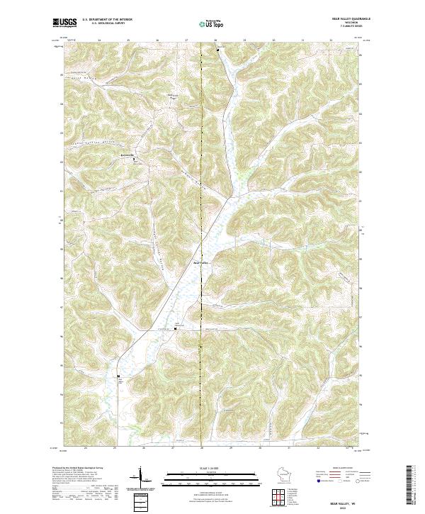 2022 Bear Valley2022 Print · USGSRichland and Sauk counties maintain their rural character in the early twenty-first century, with settlements organized around high ridges and deep creek bottoms. Genealogists can locate family names at Saint Marys Cemetery or Ward Cemetery near Keyesville and Bear Valley.
 - 2022 Map of Lime Ridge, 2022 Print
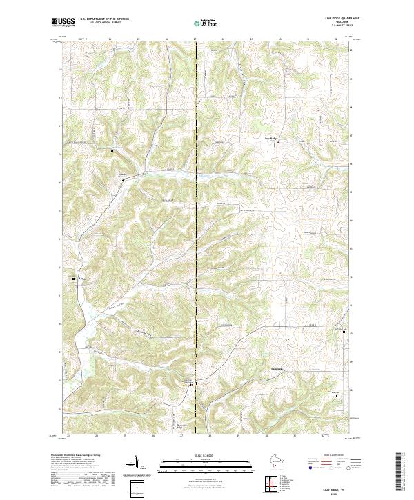 2022 Lime Ridge2022 Print · USGSThe rural border of Richland and Sauk Counties is documented here in the early twenty-first century as agricultural traditions endure. Researchers can locate family heritage sites like Saint Paul Lutheran Cemetery and the hamlets of Loyd and Sandusky.
 - 2022 Map of Lone Rock, 2022 Print
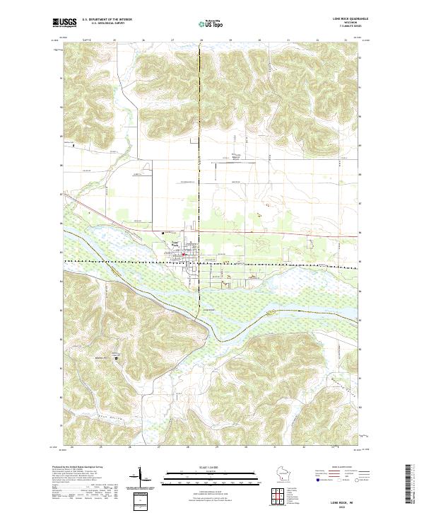 2022 Lone Rock2022 Print · USGSThe village of Lone Rock and the braided channels of the Wisconsin River define this corner of the Driftless Area in the 2020s. Genealogists and local historians can trace rural burial grounds like Button Cem or explore the terrain of Bigelow Hill and Penn Hollow.
 - 2022 Map of Loganville, 2022 Print
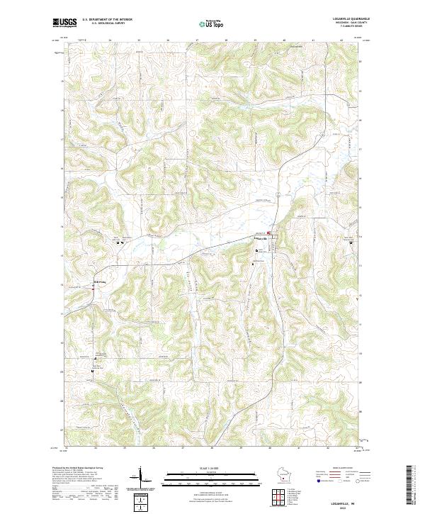 2022 Loganville2022 Print · USGSSauk County's rural valleys and ridges come into focus in this contemporary record of the Driftless Area's agricultural landscape. Researchers can locate numerous family and church burial grounds like Tuckertown Cem, Westfield Cem, and Saint Peter Cem.
 - 2022 Map of Spring Green, 2022 Print
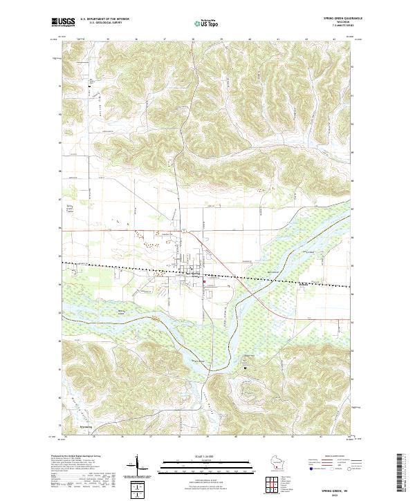 2022 Spring Green2022 Print · USGSThe Wisconsin River valley comes alive in this contemporary record of Sauk and Iowa Counties, showing the complex interaction of water and settlement. Local researchers can trace family landmarks and historical sites from Spring Green to the Old Helena Cem and Big Hollow Cem.
 - 2022 Map of Plain, 2022 Print
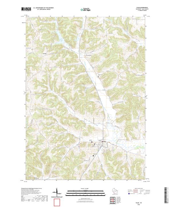 2022 Plain2022 Print · USGSSauk County's rolling valley landscape is meticulously detailed in the early 2020s, centered on the village of Plain. Researchers can trace local heritage through Saint Lukes Cem, Pleasant Hill Cem, and the old paths of Sugar Grove Valley.
End of results
Showing maps 1-6 of 6
Top cities near Bear Creek
- Reedsburg historical maps
- Richland Center historical maps
- Spring Green historical maps
- Lone Rock historical maps
- Arena historical maps
- Rockbridge historical maps
See more
Top neighborhoods of Bear Creek
Frequently asked questions
- What are the different types of historical maps available for Bear Creek?
- What is the oldest map of Bear Creek?
- Where can I purchase historical maps of Bear Creek for my home or office?
- Where can I download high-res historical maps of Bear Creek?
- Are there historical topographic maps available for Bear Creek?
- Is there historical aerial imagery available for Bear Creek?
- Where are historical maps of Bear Creek sourced from?