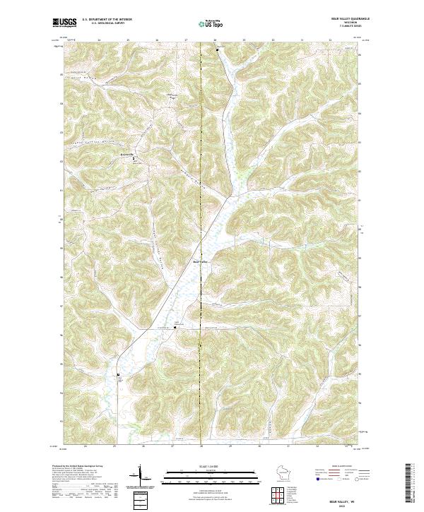
2022 Map of Bear Valley
USGS Topo · Published 2022About this map
Bear Creek meanders through a landscape defined by deep ridges and narrow valleys along the Richland County and Sauk County border. The settlement of Keyesville sits atop high ground near the intersection of County Highway N and Keyesville Ridge Drive, serving as a central point for the surrounding agricultural community. To the south, the village of Bear Valley occupies a lower position where the creek basin widens.
Find a feature on this map
44 named features on this map. Tap any name to fly to it.
Don’t see what you’re looking for? This feature index may not catch every label — zoom into the map to look around manually.
Map Details
Editions of this 2022 Bear Valley Map
This is the sole edition of this map. No revisions or reprints were ever made.
Other maps of this area

1905 · Richland Center
USGS Topo · 1:125,000

1958 · La Crosse
USGS Topo · 1:250,000

1960 · Richland Center
USGS Topo · 1:62,500

1960 · Plain
USGS Topo · 1:62,500

1960 · Muscoda
USGS Topo · 1:62,500

1960 · Spring Green
USGS Topo · 1:62,500

1961 · La Crosse
USGS Topo · 1:250,000

1965 · La Crosse
USGS Topo · 1:250,000

1976 · La Crosse
USGS Topo · 1:250,000
1983 · Lime Ridge
USGS Topo · 1:24,000