2020s Maps of Draper, Wisconsin
Explore 6 historic maps of Draper from the 2020s. These maps offer a rare glimpse into what life looked like during the 2020s — showing old roads, neighborhoods, homes, and landmarks that have changed or disappeared over time.
Whether you're researching your family's past, planning a metal detecting trip, or studying how Draper's landscape evolved across the 2020s, these high-resolution maps are a powerful tool for exploring the history of this region.
- Focus on a specific era: All maps on this page are from the 2020s, giving you a focused view of this time period.
- See what’s changed: Compare century-old streets, trails, and buildings to today's modern landscape using overlays and satellite layers.
- Research with precision: Use these maps for genealogy, historical research, land use analysis, or educational projects.
- View, download, or print: Maps are fully viewable online in high resolution, and can be downloaded or printed for your own records.
Start exploring Draper's history through authentic maps from the 2020s. This is your window into the past.
Draper, WI maps
(6)- 2022 Map of Oxbo, 2022 Print
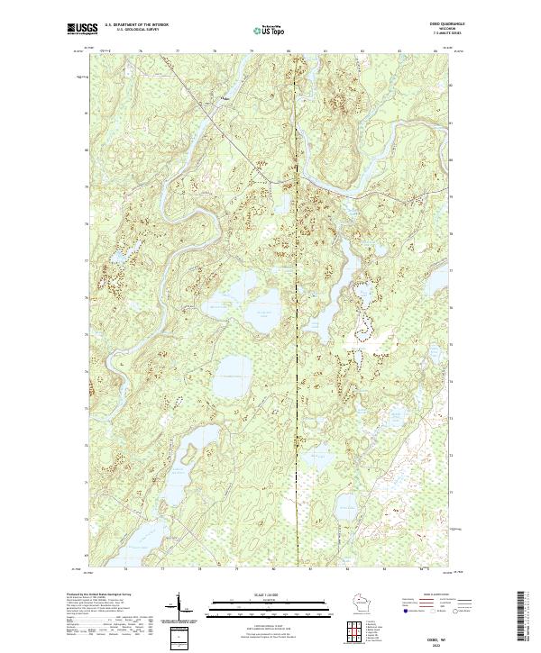 2022 Oxbo2022 Print · USGSThe Flambeau River corridor comes alive in this contemporary record of the Wisconsin Northwoods near the Sawyer and Price county line. Modern researchers can trace the shores of Lake of the Pines, locate Jackson Springs, and follow the river to Barnaby Rapids.
 - 2022 Map of Lake Winter, 2022 Print
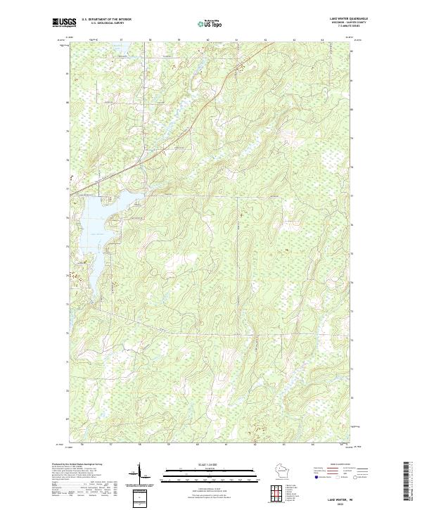 2022 Lake Winter2022 Print · USGSSawyer County at the start of the 2020s remains a landscape of deep woods and winding waterways. Follow the Tuscobia State Trl as it passes north of Lake Winter, or trace the remote drainages of Thornapple River and Deadman Cr.
 - 2022 Map of Blaisdell Lake, 2022 Print
 2022 Blaisdell Lake2022 Print · USGSSawyer County’s forested lake country is shown here in the early twenty-first century as part of the Chequamegon National Forest. Researchers can trace the winding East Fork Chippewa River through Blaisdell Lake and explore local routes like Sagert Rd or the Black Lake Trl.
 - 2022 Map of Loretta, 2022 Print
 2022 Loretta2022 Print · USGSSawyer County’s northern woods come alive in this record of the settlements at Loretta and Draper. Genealogists and outdoor historians can trace family-named roads near Draper Cem or follow old rail-and-logging corridors like the Tuscobia State Trl.
 - 2022 Map of Babbs Island, 2022 Print
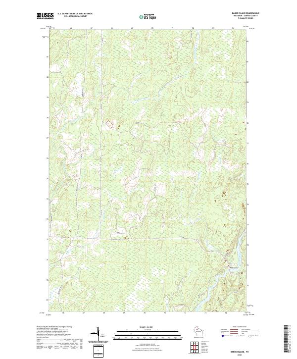 2022 Babbs Island2022 Print · USGSSawyer County in the early 2020s remains a landscape defined by its waterways and timber heritage. Genealogists and historians can trace family-named routes like Slattery Rd and Tepaske Ln near the confluence at Babbs Island.
 - 2022 Map of Kennedy, 2022 Print
 2022 Kennedy2022 Print · USGSSawyer County and the surrounding northwoods are captured in this contemporary survey of the Chequamegon National Forest. Outdoor enthusiasts and historians can trace the Tuscobia State Trl as it passes near the settlement of Kennedy and the banks of the Flambeau River.
End of results
Showing maps 1-6 of 6
Top cities near Draper
Top neighborhoods of Draper
Frequently asked questions
- What are the different types of historical maps available for Draper?
- What is the oldest map of Draper?
- Where can I purchase historical maps of Draper for my home or office?
- Where can I download high-res historical maps of Draper?
- Are there historical topographic maps available for Draper?
- Is there historical aerial imagery available for Draper?
- Where are historical maps of Draper sourced from?