Old Maps of Hunter, Wisconsin for Academic Research
Study the evolution of Hunter with 27 high-resolution historic maps. Whether you're teaching, researching, or modeling changes in land use, these maps provide essential visual documentation of urban, environmental, and geographic change.
- Analyze long-term change: Track patterns in development, transportation, and natural features.
- Ideal for environmental or urban studies: Support academic projects with primary historical map data.
- Use in the classroom or lab: Educators and researchers rely on these maps to bring historical context to life.
These maps are a powerful tool for teaching, research, and visualizing how Hunter has changed over the decades.
Hunter, WI maps
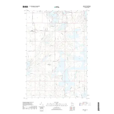
(27)- 1944 Map of Couderay, 1956 Print
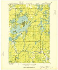
 1944 Couderay1956 Print · USGSSawyer County’s lake country is captured here during the 1940s, showing the intersection of tribal lands and rail-driven settlements. Genealogists and historians can trace old homesteads near Reserve, the village of Couderay, and rural schools like Boylan Sch.2 unique versions available
 - 1944 Map of Radisson, 1957 Print
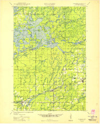
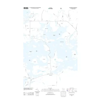
 1944 Radisson1957 Print · USGSSawyer County in the mid-1940s shows a landscape of timber and rail along the Chippewa River. Local historians can trace the Chicago and North Western Railway through Radisson or locate rural landmarks like Hunter Sch and New Post.2 unique versions available
 - 1948 Map of Couderay
 1948 Couderay1948 Print · USGSSawyer County at the end of the Second World War shows a landscape defined by its great lakes and a dense network of early railroads. Genealogists and local historians can trace family-named sites and rural centers like Hauer, Whitefish Ch, and Kinnamon Sch.
 - 1949 Map of Radisson
 1949 Radisson1949 Print · USGSSawyer County's timber and rail landscape is captured here in the mid-1940s, showing the early development of the Chippewa River valley. Researchers can trace historic local sites like New Post, the Bishop Bridge Sch, and the Chicago and North Western rail line.
 - 1953 Map of Rice Lake, 1967 Print
 1953 Rice Lake1967 Print · USGSNorthwest Wisconsin during the mid-fifties reveals a landscape defined by timber, rail, and water. Genealogists and historians can trace the development of river towns like Ladysmith and Rice Lake along the Soo Line and Chicago and North Western railroads.2 unique versions available
 - 1959 Map of Rice Lake
 1959 Rice Lake1959 Print · USGSNorthwest Wisconsin in the late fifties was a land of expanding road networks and deep-seated timber history. Genealogists and historians can trace rail lines like the Soo Line RR and Chicago St Paul Minneapolis and Omaha Ry as they link settlements from Spooner to Medford.
 - 1971 Map of Chief Lake, 1973 Print
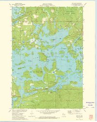
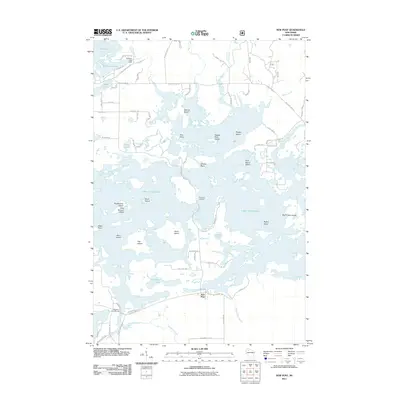
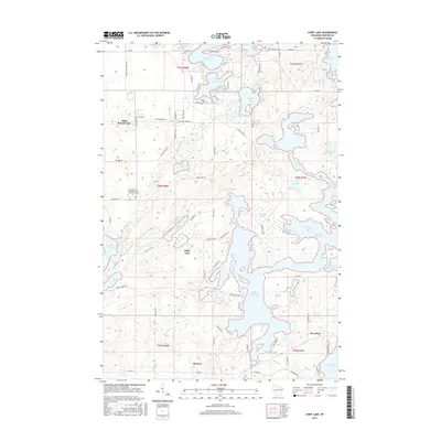
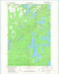 1971 Chief Lake1973 Print · USGSSawyer County’s glacial lake country is captured here in the early 1970s, showcasing the intersection of tribal lands and Northwoods recreation. Genealogists and local historians can locate the Round Lake Cem and trace old routes like Trepania Road and Gurno Road.
 - 1972 Map of Barker Lake, 1974 Print
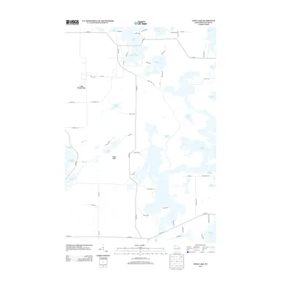
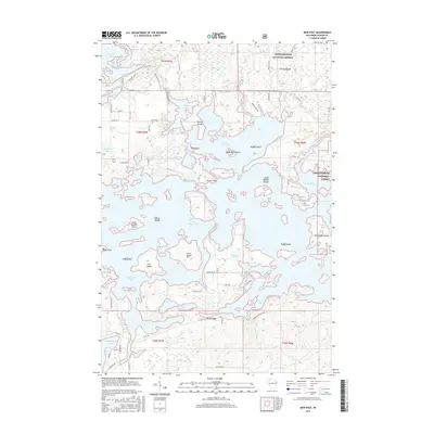
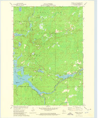 1972 Barker Lake1974 Print · USGSThe Chippewa River forks meet in Sawyer County during the early 1970s, where the national forest meets tribal lands. Trace the complex shoreline of Lake Chippewa to find Wagon Wheel Island, the Winter Dam, and isolated spots like Venison Spring.2 unique versions available
 - 1972 Map of New Post, 1975 Print
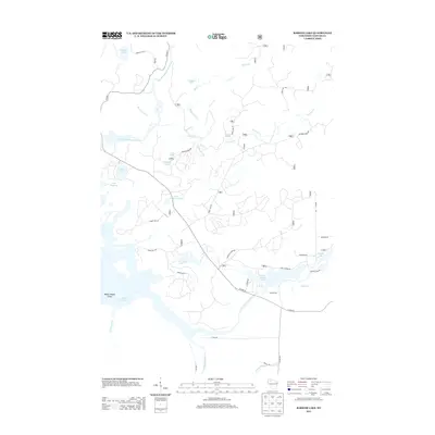
 1972 New Post1975 Print · USGSThe Northwoods of Sawyer County are shown in the early seventies as a dense landscape of interconnected glacial lakes and managed timberlands. Researchers can locate family landmarks like Hermans Landing, the settlement of New Post, and islands such as Scott Island or Flat Island.3 unique versions available
 - 1980 Map of Spooner
 1980 Spooner1980 Print · USGSNorthwestern Wisconsin at the dawn of the eighties reveals a landscape of deep forests and transitioning rail corridors. Genealogists and historians can trace lakefront settlements like Spooner and Birchwood or follow the early Tuscobia-Park Falls State Trail.
 - 2005 Map of Barker Lake, 2006 Print
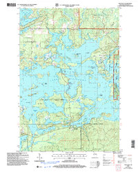
 2005 Barker Lake2006 Print · USGSSawyer County’s intricate water systems and forest boundaries are clearly defined in this mid-2000s survey of the Wisconsin northwoods. Researchers can trace the sprawling reaches of Lake Chippewa, locate the Winter Dam, and identify landmarks like Big Timber Island.
 - 2005 Map of New Post, 2006 Print
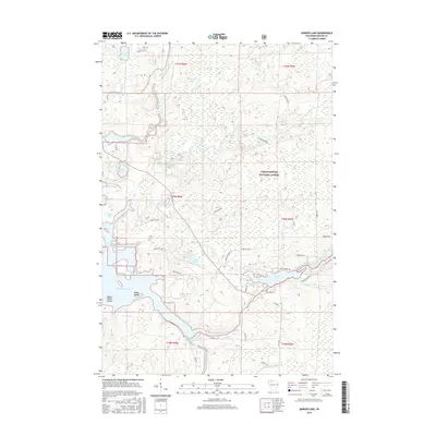
 2005 New Post2006 Print · USGSSawyer County’s lake country is captured here in the early 2000s, showing the intersection of forest service lands and tribal territory. Researchers can locate the New Post settlement and its Cem, alongside named landmarks like Hermans Landing and Pork Barrel Island.
 - 2010 Map of Chief Lake, 2010 Print
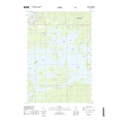
 2010 Chief Lake2010 Print · USGSCovers Hunter, including Bass Lake, Chief Lake, and other nearby areas
 - 2011 Map of Barker Lake, 2011 Print
 2011 Barker Lake2011 Print · USGSCovers Hunter, including Ojibwa, Winter, and other nearby areas
 - 2011 Map of New Post, 2011 Print
 2011 New Post2011 Print · USGSCovers Hunter, including Ojibwa, Radisson, and other nearby areas
 - 2013 Map of Chief Lake, 2013 Print
 2013 Chief Lake2013 Print · USGSCovers Hunter, including Bass Lake, Chief Lake, and other nearby areas
 - 2013 Map of Barker Lake, 2013 Print
 2013 Barker Lake2013 Print · USGSCovers Hunter, including Ojibwa, Winter, and other nearby areas
 - 2013 Map of New Post, 2013 Print
 2013 New Post2013 Print · USGSCovers Hunter, including Ojibwa, Radisson, and other nearby areas
 - 2015 Map of Chief Lake, 2015 Print
 2015 Chief Lake2015 Print · USGSCovers Hunter, including Bass Lake, Chief Lake, and other nearby areas
 - 2015 Map of New Post, 2015 Print
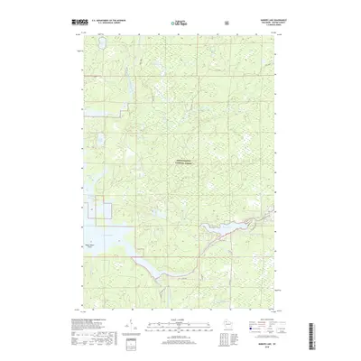
 2015 New Post2015 Print · USGSCovers Hunter, including Ojibwa, Radisson, and other nearby areas
 - 2015 Map of Barker Lake, 2015 Print
 2015 Barker Lake2015 Print · USGSCovers Hunter, including Ojibwa, Winter, and other nearby areas
 - 2018 Map of Chief Lake, 2018 Print
 2018 Chief Lake2018 Print · USGSCovers Hunter, including Bass Lake, Chief Lake, and other nearby areas
 - 2018 Map of New Post, 2018 Print
 2018 New Post2018 Print · USGSCovers Hunter, including Ojibwa, Radisson, and other nearby areas
 - 2018 Map of Barker Lake, 2018 Print
 2018 Barker Lake2018 Print · USGSCovers Hunter, including Ojibwa, Winter, and other nearby areas
 - 2022 Map of Barker Lake, 2022 Print
 2022 Barker Lake2022 Print · USGSSawyer County in the 2020s remains a landscape of deep timber and winding waterways within the Chequamegon National Forest. Researchers can trace the shoreline of Lake Chippewa and follow the route of the East Fork Chippewa River past Wagon Wheel Island.
Showing maps 1-25 of 27
Top cities near Hunter
- Cable historical maps
- Weirgor historical maps
- Winter historical maps
- Ojibwa historical maps
- Radisson historical maps
- Meteor historical maps
See more
Top neighborhoods of Hunter
Frequently asked questions
- What are the different types of historical maps available for Hunter?
- What is the oldest map of Hunter?
- Where can I purchase historical maps of Hunter for my home or office?
- Where can I download high-res historical maps of Hunter?
- Are there historical topographic maps available for Hunter?
- Is there historical aerial imagery available for Hunter?
- Where are historical maps of Hunter sourced from?