Old Maps of South Pier District, Sheboygan for Genealogy
Trace your family roots with 10 historic maps of South Pier District. These high-res maps reveal old neighborhoods, homesites, landmarks, and streets — helping you uncover where your ancestors lived and how the area evolved over time.
- Explore historic neighborhoods: Identify where your relatives may have lived in the 1800s or 1900s.
- Compare maps over time: Trace the changes in streets, buildings, and landmarks for multi-generational research.
- Perfect for genealogy & ancestry research: Used by family historians and researchers to map out lineage and migration.
These maps are an incredible resource for exploring your personal connection to South Pier District's past.
South Pier District, Sheboygan maps
(10)- 1954 Map of Sheboygan South, 1956 Print
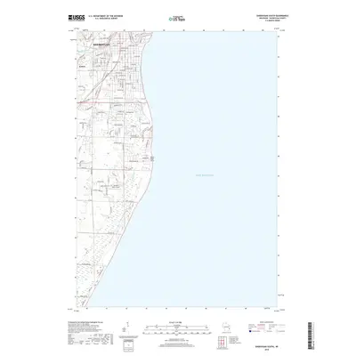
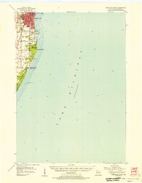 1954 Sheboygan South1956 Print · USGSThe Sheboygan shoreline in the mid-1950s shows a balance between industrial utility and lakeside recreation. Genealogists and historians can locate Southside Cemetery, early schools like Jackson School, and the industrial footprint of Kohler.
 - 1954 Map of Sheboygan South, 1956 Print
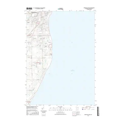
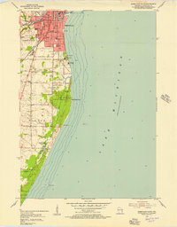 1954 Sheboygan South1956 Print · USGSThe Lake Michigan shoreline south of Sheboygan is captured here in the mid-1950s as industry and recreation began to shape the coastal landscape. Genealogists and researchers can trace urban landmarks like Central High Sch, local burial grounds including Wildwood Cem, and lakefront features like the Sunken Caisson.3 unique versions available
 - 1954 Map of Milwaukee, 1967 Print
 1954 Milwaukee1967 Print · USGSCoastal life and maritime commerce across Lake Michigan are seen here during the mid-fifties, bridging Wisconsin's industrial hubs and Michigan's timberlands. Genealogists and historians can trace the rail lines of the Grand Trunk Western and find long-established ports like Ludington, Port Washington, and Muskegon.3 unique versions available
 - 1958 Map of Milwaukee
 1958 Milwaukee1958 Print · USGSThe shorelines of Lake Michigan in the late fifties reveal a landscape of bustling ferry ports and growing industrial suburbs. Genealogists and historians can trace rail networks like the Chesapeake & Ohio and locate landmarks such as Little Sable Point and Holy Cross Church.
 - 1989 Map of Sheboygan, 1990 Print
 1989 Sheboygan1990 Print · USGSCoastal Wisconsin thrived in the late eighties as the industrial corridor between Sheboygan and Belgium expanded along the lake. Genealogists and local researchers can trace old township lines and small settlements like Howards Grove, Hingham, and Gibbsville.
 - 2010 Map of Sheboygan South, 2010 Print
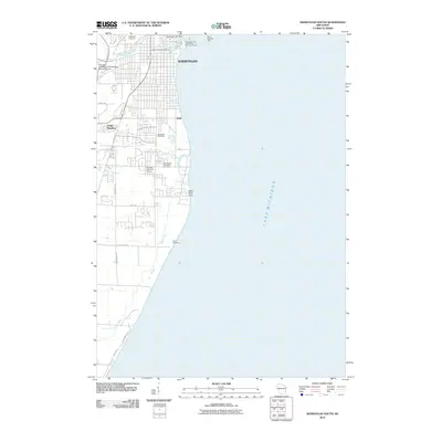 2010 Sheboygan South2010 Print · USGSCovers South Pier District, including Sheboygan, Kohler, and other nearby areas
 - 2013 Map of Sheboygan South, 2013 Print
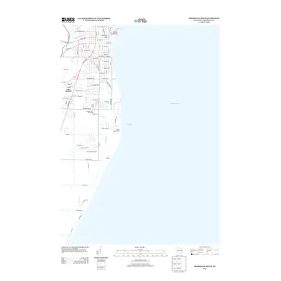 2013 Sheboygan South2013 Print · USGSCovers South Pier District, including Sheboygan, Kohler, and other nearby areas
 - 2016 Map of Sheboygan South, 2016 Print
 2016 Sheboygan South2016 Print · USGSCovers South Pier District, including Sheboygan, Kohler, and other nearby areas
 - 2018 Map of Sheboygan South, 2018 Print
 2018 Sheboygan South2018 Print · USGSCovers South Pier District, including Sheboygan, Kohler, and other nearby areas
 - 2022 Map of Sheboygan South, 2022 Print
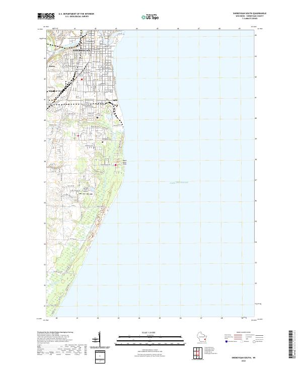 2022 Sheboygan South2022 Print · USGSThe southern reaches of the Sheboygan shoreline come into focus during this early twenty-first-century period of suburban growth. Genealogists and local historians can trace burial sites at Holy Cross Cem or locate regional landmarks like Van Der Vaart Airport.
End of results
Showing maps 1-10 of 10
Frequently asked questions
- What are the different types of historical maps available for South Pier District?
- What is the oldest map of South Pier District?
- Where can I purchase historical maps of South Pier District for my home or office?
- Where can I download high-res historical maps of South Pier District?
- Are there historical topographic maps available for South Pier District?
- Is there historical aerial imagery available for South Pier District?
- Where are historical maps of South Pier District sourced from?