1900s (20th Century) Maps of Cleveland, Wisconsin
Explore 13 historic maps of Cleveland from the 1900s (20th Century). These maps offer a rare glimpse into what life looked like during the 1900s — showing old roads, neighborhoods, homes, and landmarks that have changed or disappeared over time.
Whether you're researching your family's past, planning a metal detecting trip, or studying how Cleveland's landscape evolved across the 1900s, these high-resolution maps are a powerful tool for exploring the history of this region.
- Focus on a specific era: All maps on this page are from the 1900s, giving you a focused view of this time period.
- See what’s changed: Compare century-old streets, trails, and buildings to today's modern landscape using overlays and satellite layers.
- Research with precision: Use these maps for genealogy, historical research, land use analysis, or educational projects.
- View, download, or print: Maps are fully viewable online in high resolution, and can be downloaded or printed for your own records.
Start exploring Cleveland's history through authentic maps from the 1900s. This is your window into the past.
Cleveland, WI maps
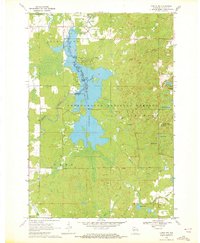
(13)- 1945 Map of Black River
 1945 Black River1945 Print · USGSNorthern Wisconsin's river systems and rural school districts are documented here just after the war years. Local historians can locate vanished landmarks like the Red Tile Sch, Meadow Creek Sch, and the early boundaries of the Chequamegon National Forest.
 - 1947 Map of Sheldon, 1967 Print
 1947 Sheldon1967 Print · USGSRusk and Taylor counties come into focus in the late 1940s, showing a landscape of river-valley settlements and timber management. Genealogists and historians can locate dozens of country schools and churches, from Sheldon to the Mt Nebo Cem and Hannibal.
 - 1949 Map of Sheldon
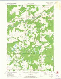
 1949 Sheldon1949 Print · USGSRusk and Taylor counties come into focus during the late 1940s, showing a landscape defined by small rail towns and scattered district schools. You can locate family-named landmarks like Baughman School or trace the early paths of the Jump River and Main Creek.
 - 1949 Map of Jump River Fire Tower
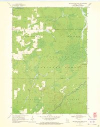
 1949 Jump River Fire Tower1949 Print · USGSThe dense forests and winding river forks of Price, Rusk, and Taylor counties are captured here in the years following World War II. Local historians can locate isolated rural landmarks like the Jump River Fire Tower, Red Tile Sch, and Lost Lake.
 - 1951 Map of Lublin, 1953 Print
 1951 Lublin1953 Print · USGSTaylor County agriculture meets the northern timberlands in the early fifties, centering on the rail hub of Lublin. Genealogists and historians can locate vanished rural schoolhouses like Redville Sch and trace the original paths of the MINNEAPOLIS ST PAUL AND SAULT STE MARIE railroad.
 - 1951 Map of Gilman, 1969 Print
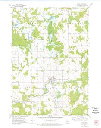
 1951 Gilman1969 Print · USGSTaylor and Clark counties are captured here in the early fifties, showing a rural landscape defined by the Yellow River and the Soo Line railroad. Genealogists can locate numerous landmarks including the Russian Ch, Meadowbrook Cem, and the Sunnyview Sch.
 - 1953 Map of Rice Lake, 1967 Print
 1953 Rice Lake1967 Print · USGSNorthwest Wisconsin during the mid-fifties reveals a landscape defined by timber, rail, and water. Genealogists and historians can trace the development of river towns like Ladysmith and Rice Lake along the Soo Line and Chicago and North Western railroads.2 unique versions available
 - 1959 Map of Rice Lake
 1959 Rice Lake1959 Print · USGSNorthwest Wisconsin in the late fifties was a land of expanding road networks and deep-seated timber history. Genealogists and historians can trace rail lines like the Soo Line RR and Chicago St Paul Minneapolis and Omaha Ry as they link settlements from Spooner to Medford.
 - 1969 Map of Lublin NW, 1972 Print
 1969 Lublin NW1972 Print · USGSTaylor County’s timber and water resources are centered here in the late sixties, where the massive Chequamegon Waters Flowage meets the national forest. Researchers can trace the development of the Perkinstown Winter Sports Area Ski Slide and the rural roads near Hughey.3 unique versions available
 - 1970 Map of Jump River Fire Tower SW, 1972 Print
 1970 Jump River Fire Tower SW1972 Print · USGSTaylor County forest lands and river valleys are captured here in the early 1970s. Local historians can trace the Old Railroad Grade and identify the numerous rapids along the Jump River and Yellow River.2 unique versions available
 - 1971 Map of Jump River, 1974 Print
 1971 Jump River1974 Print · USGSJump River and Hannibal are documented in the early 1970s as this Taylor County landscape transitioned toward conservation and wildlife management. Researchers can trace the Old Railroad Grade, locate the Mt Nebo Cem, and see the extent of the Monson Flowage.
 - 1973 Map of Gilman, 1976 Print
 1973 Gilman1976 Print · USGSIn the early 1970s, this Taylor County landscape centered on Gilman and the winding Yellow River. Researchers can trace old transportation corridors along the Soo Line Railroad and the Old Railroad Grade or locate family plots at Meadowbrook Cem.2 unique versions available
 - 1980 Map of Medford
 1980 Medford1980 Print · USGSNorth-central Wisconsin in the early eighties shows a landscape of dense timber and rail-linked settlements. Genealogists and historians can trace the Soo Line through towns like Medford and Westboro or locate family homesteads near Perkinstown and Athens.
End of results
Showing maps 1-13 of 13
Top cities near Cleveland
- Ogema historical maps
- Colburn historical maps
- Westboro historical maps
- Gilman historical maps
- Ruby historical maps
- Maplehurst historical maps
See more
Top neighborhoods of Cleveland
Frequently asked questions
- What are the different types of historical maps available for Cleveland?
- What is the oldest map of Cleveland?
- Where can I purchase historical maps of Cleveland for my home or office?
- Where can I download high-res historical maps of Cleveland?
- Are there historical topographic maps available for Cleveland?
- Is there historical aerial imagery available for Cleveland?
- Where are historical maps of Cleveland sourced from?