Old Maps of Westboro, Wisconsin for Hiking & Exploration
Hike through history with 79 historic maps of Westboro. Explore old trails, ghost towns, and forgotten backroads — perfect for outdoor adventurers and local explorers.
- Rediscover forgotten places: Map out old mining camps, roads, and footpaths that no longer exist on modern maps.
- Layer with modern tools: Combine with LiDAR or satellite views to plan hikes through historical terrain.
- Made for exploration: Popular among hikers, overlanders, and local history lovers.
Use these maps to find adventure and explore the hidden past of Westboro.
Westboro, WI maps
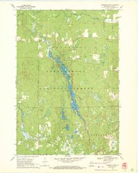
(79)- 1944 Map of Ogema
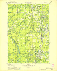
 1944 Ogema1944 Print · USGSPrice County during the early 1940s was a landscape of remote farmsteads and timber interests centered on the rail corridor. Genealogists can trace family locations through a dense network of country schools like Forest Hill Sch and Larkin Sch, or the small siding at Mackeys Spur.
 - 1945 Map of Rib Lake
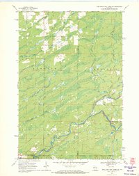
 1945 Rib Lake1945 Print · USGSNorthern Wisconsin lake country is captured here during the 1940s, showing a landscape of timber and township life. Genealogists can locate rural landmarks like Spirit Town Hall, Mission Ch, and schools like Ring Sch or Stone Lake Sch.
 - 1945 Map of Black River
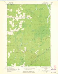
 1945 Black River1945 Print · USGSNorthern Wisconsin's river systems and rural school districts are documented here just after the war years. Local historians can locate vanished landmarks like the Red Tile Sch, Meadow Creek Sch, and the early boundaries of the Chequamegon National Forest.
 - 1947 Map of Rib Lake, 1956 Print
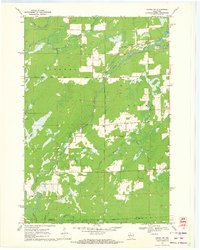
 1947 Rib Lake1956 Print · USGSTaylor and Price Counties come into focus during the late 1940s, a period when the timber industry and small-town life shaped this north-central Wisconsin landscape. Genealogists can trace family footprints through rural landmarks like Mission Ch, Stone Lake Sch, and the village of Rib Lake.
 - 1947 Map of Ogema, 1966 Print
 1947 Ogema1966 Print · USGSPrice and Taylor Counties are captured here just after the war, showing a rural landscape defined by logging, rail, and small lakeside settlements. Genealogists can trace family roots through numerous country schools like Centerville Sch and landmarks like Mt Olive Cem or Mackeys Spur.
 - 1949 Map of Ogema
 1949 Ogema1949 Print · USGSPrice and Taylor Counties are captured here in the late 1940s, showing the Northwoods before the modern era of highway expansion. Genealogists and local historians can trace many rural schoolhouses like Centerville School, church sites at Mt Olive Cemetery, and the Soo Line rail stops.
 - 1949 Map of Jump River Fire Tower
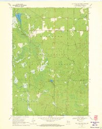
 1949 Jump River Fire Tower1949 Print · USGSThe dense forests and winding river forks of Price, Rusk, and Taylor counties are captured here in the years following World War II. Local historians can locate isolated rural landmarks like the Jump River Fire Tower, Red Tile Sch, and Lost Lake.
 - 1949 Map of Rib Lake
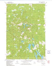
 1949 Rib Lake1949 Print · USGSRib Lake and the surrounding Northwoods townships appear here in the late 1940s, just as the rural schoolhouse system remained a central pillar of the community. Genealogists and historians can locate numerous local landmarks like Ring Sch, the Wilderness Lookout Tower, and the Mission Ch.
 - 1953 Map of Rice Lake, 1967 Print
 1953 Rice Lake1967 Print · USGSNorthwest Wisconsin during the mid-fifties reveals a landscape defined by timber, rail, and water. Genealogists and historians can trace the development of river towns like Ladysmith and Rice Lake along the Soo Line and Chicago and North Western railroads.2 unique versions available
 - 1959 Map of Rice Lake
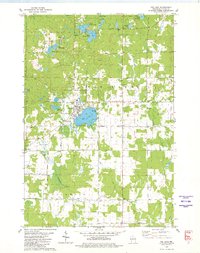
 1959 Rice Lake1959 Print · USGSNorthwest Wisconsin in the late fifties was a land of expanding road networks and deep-seated timber history. Genealogists and historians can trace rail lines like the Soo Line RR and Chicago St Paul Minneapolis and Omaha Ry as they link settlements from Spooner to Medford.
 - 1970 Map of Westboro, 1972 Print
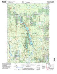
 1970 Westboro1972 Print · USGSTaylor County's northwoods were transitioning in the 1970s, as traditional rail activity met the expanding public lands of the Chequamegon National Forest. Trace family histories near Westboro and Chelsea, locating Mount Olive Cem and the Old Railroad Grade through the timber.2 unique versions available
 - 1970 Map of Jump River Fire Tower NW, 1972 Print
 1970 Jump River Fire Tower NW1972 Print · USGSThe Northwoods of Rusk and Price counties are documented here in the early 1970s, showing a landscape shaped by winding river systems and old timber routes. Trace the path of the Old Railroad Grade or locate historic recreation spots like Big Falls and Big Falls Campground.3 unique versions available
 - 1970 Map of Ogema, 1972 Print
 1970 Ogema1972 Print · USGSPrice and Taylor counties come into focus in the early 1970s, centered on the millpond and rail-side settlements of the Wisconsin Northwoods. Genealogists and local historians can trace family locations along Hallstrand Road, visit Hillside Cem, or locate the old Townhall and Mackeys Spur.
 - 1970 Map of Jump River Fire Tower NE, 1972 Print
 1970 Jump River Fire Tower NE1972 Print · USGSThe confluence of the Jump River forks in northern Wisconsin is captured here during the early seventies, spanning the Price and Taylor county line. Outdoorsmen and local historians can trace the bounds of the Township Corners State Wildlife Management Area and find named river landmarks like Big Falls and Steve Creek Flowage.
 - 1970 Map of Jump River Fire Tower SW, 1972 Print
 1970 Jump River Fire Tower SW1972 Print · USGSTaylor County forest lands and river valleys are captured here in the early 1970s. Local historians can trace the Old Railroad Grade and identify the numerous rapids along the Jump River and Yellow River.2 unique versions available
 - 1970 Map of Ogema NW, 1972 Print
 1970 Ogema NW1972 Print · USGSThe river forks and rural corridors of Price County are captured here in the early seventies as the landscape transitioned into the modern era. Genealogists and historians can trace the Fourth Principal Meridian and locate landmarks like Hallberg Hill and South Fork Jump River.2 unique versions available
 - 1970 Map of Mondeaux Dam, 1972 Print
 1970 Mondeaux Dam1972 Print · USGSWisconsin’s Northwoods are showcased here in the early 1970s, focused on the recreation and timber lands of the Chequamegon National Forest. Researchers can trace the Old Railroad Grade or locate historic campsites like Camp 11 and the Mondeaux Dam.2 unique versions available
 - 1970 Map of Jump River Fire Tower, 1972 Print
 1970 Jump River Fire Tower1972 Print · USGSTaylor County's deep woods and water networks are captured here in the early seventies, spanning the borders of Westboro and Molitor. Researchers can trace the hydrography of the Upper Silver Creek Flowage and locate landmarks like the Jump River Fire Tower and Lost Lake.
 - 1979 Map of Timms Hill, 1980 Print
 1979 Timms Hill1980 Print · USGSThe Wisconsin Northwoods are captured here in the late seventies, centered on the state's highest elevation. Local historians can locate the Garden of Memory Church, trace old routes like Goetzke Road, and explore the shoreline of Spirit Lake.2 unique versions available
 - 1979 Map of Rib Lake, 1980 Print
 1979 Rib Lake1980 Print · USGSThe village of Rib Lake and its surrounding lake-dotted landscape are documented here in the late seventies. Family historians and local researchers can trace sites like Lake View Cem, the rural St Ann Ch, and the defunct Old Railroad Grade.
 - 1980 Map of Medford
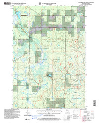
 1980 Medford1980 Print · USGSNorth-central Wisconsin in the early eighties shows a landscape of dense timber and rail-linked settlements. Genealogists and historians can trace the Soo Line through towns like Medford and Westboro or locate family homesteads near Perkinstown and Athens.
 - 2005 Map of Jump River Fire Tower NE, 2006 Print
 2005 Jump River Fire Tower NE2006 Print · USGSUpper Price County and Taylor County meet along the Jump River at the dawn of the millennium, showcasing a landscape of managed forests and waterways. Researchers can trace the river's path through Big Falls, find the Steve Greek Flowage, and locate several Gravel Pits along rural routes.
 - 2005 Map of Ogema NW, 2006 Print
 2005 Ogema NW2006 Print · USGSNorthern Wisconsin's timberlands and river forks are captured here at the dawn of the millennium. Trace the path of the North Fork Jump River through Ogema and find landmarks like Hallberg Hill and Silver Creek.
 - 2005 Map of Mondeaux Dam, 2006 Print
 2005 Mondeaux Dam2006 Print · USGSNorthern Wisconsin's glacial forest landscape is captured here in the early 2000s, centered on the Mondeaux Flowage. Trace the path of the National Scenic Trail past recreation sites like Spearhead and Picnic Point.
 - 2005 Map of Jump River Fire Tower, 2006 Print
 2005 Jump River Fire Tower2006 Print · USGSTaylor County forest lands are captured here in the early 2000s, showing a landscape defined by conservation and glacial history. Trace the remote trails of the Ice Age Semi Primitive Non Motorized Area or locate the Jump River Fire Tower and Lost Lake.
Showing maps 1-25 of 79
Top cities near Westboro
- Medford historical maps
- Little Black historical maps
- Ogema historical maps
- Chelsea historical maps
- Prentice historical maps
- Maplehurst historical maps
See more
Top neighborhoods of Westboro
Frequently asked questions
- What are the different types of historical maps available for Westboro?
- What is the oldest map of Westboro?
- Where can I purchase historical maps of Westboro for my home or office?
- Where can I download high-res historical maps of Westboro?
- Are there historical topographic maps available for Westboro?
- Is there historical aerial imagery available for Westboro?
- Where are historical maps of Westboro sourced from?