Old Maps of Trempealeau County, Wisconsin
Explore 52 old maps of Trempealeau County, spanning from 1926 to today. These high-resolution historic maps reveal how streets, neighborhoods, landmarks, and natural features evolved over time — perfect for genealogy, metal detecting, research, and local history exploration.
What you can do with these maps:
- See how Trempealeau County changed over time: Compare historical maps to modern-day views to trace roads, homesites, rail lines & more.
- View detailed metadata: Each map includes creators, publishers, year, scale, and archive source.
- Overlay maps with satellite & LiDAR: Visualize the past alongside modern tools to explore terrain & human change.
- Trusted historical sources: Maps sourced from the USGS, Library of Congress, and other archives.
- Access maps your way: View online, download high-res files, or order prints for personal or research use.
Start exploring old maps of Trempealeau County to uncover forgotten places, hidden landmarks, and the deep history beneath your feet.
Trempealeau County, WI maps
(52)- 1926 Map of North Bend, 1965 Print
 1926 North Bend1965 Print · USGSCovers Trempealeau County, including Irving, Melrose, and other nearby areas
 - 1926 Map of Whitehall, 1972 Print
 1926 Whitehall1972 Print · USGSCovers Trempealeau County, including Arcadia, Whitehall, and other nearby areas
 - 1927 Map of Blair
 1927 Blair1927 Print · USGSCovers Trempealeau County, including Blair, Hale, and other nearby areas2 unique versions available
 - 1927 Map of Strum, 1972 Print
 1927 Strum1972 Print · USGSCovers Trempealeau County, including Eau Claire, Pleasant Valley, and other nearby areas
 - 1929 Map of Whitehall
 1929 Whitehall1929 Print · USGSCovers Trempealeau County, including Arcadia, Whitehall, and other nearby areas2 unique versions available
 - 1929 Map of Fountain City
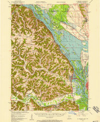
 1929 Fountain City1929 Print · USGSCovers Trempealeau County, including Winona, Arcadia, and other nearby areas2 unique versions available
 - 1929 Map of Galesville
 1929 Galesville1929 Print · USGSCovers Trempealeau County, including Holmen, Arcadia, and other nearby areas2 unique versions available
 - 1929 Map of North Bend
 1929 North Bend1929 Print · USGSCovers Trempealeau County, including Irving, Melrose, and other nearby areas2 unique versions available
 - 1930 Map of La Crescent
 1930 La Crescent1930 Print · USGSCovers Trempealeau County, including La Crosse, Holmen, and other nearby areas3 unique versions available
 - 1930 Map of Strum
 1930 Strum1930 Print · USGSCovers Trempealeau County, including Eau Claire, Pleasant Valley, and other nearby areas2 unique versions available
 - 1932 Map of Gilmanton
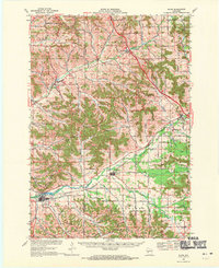
 1932 Gilmanton1932 Print · USGSCovers Trempealeau County, including Arcadia, Glencoe, and other nearby areas2 unique versions available
 - 1932 Map of Mondovi
 1932 Mondovi1932 Print · USGSCovers Trempealeau County, including Pleasant Valley, Mondovi, and other nearby areas2 unique versions available
 - 1934 Map of Winona, 1955 Print
 1934 Winona1955 Print · USGSCovers Trempealeau County, including Winona, Arcadia, and other nearby areas2 unique versions available
 - 1935 Map of Osseo
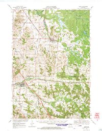
 1935 Osseo1935 Print · USGSCovers Trempealeau County, including Osseo, Augusta, and other nearby areas
 - 1937 Map of Winona
 1937 Winona1937 Print · USGSCovers Trempealeau County, including Winona, Arcadia, and other nearby areas3 unique versions available
 - 1940 Map of Osseo
 1940 Osseo1940 Print · USGSCovers Trempealeau County, including Osseo, Augusta, and other nearby areas
 - 1953 Map of Eau Claire, 1965 Print
 1953 Eau Claire1965 Print · USGSCovers Trempealeau County, including Eau Claire, Winona, and other nearby areas4 unique versions available
 - 1956 Map of La Crescent, 1958 Print
 1956 La Crescent1958 Print · USGSCovers Trempealeau County, including La Crosse, Holmen, and other nearby areas2 unique versions available
 - 1958 Map of Eau Claire
 1958 Eau Claire1958 Print · USGSCovers Trempealeau County, including Eau Claire, Winona, and other nearby areas
 - 1958 Map of La Crosse, 1979 Print
 1958 La Crosse1979 Print · USGSCovers Trempealeau County, including La Crosse, Winona, and other nearby areas2 unique versions available
 - 1961 Map of La Crosse
 1961 La Crosse1961 Print · USGSCovers Trempealeau County, including La Crosse, Winona, and other nearby areas
 - 1964 Map of Eau Claire
 1964 Eau Claire1964 Print · USGSCovers Trempealeau County, including Eau Claire, Winona, and other nearby areas
 - 1965 Map of La Crosse
 1965 La Crosse1965 Print · USGSCovers Trempealeau County, including La Crosse, Winona, and other nearby areas
 - 1968 Map of Blair, 1971 Print
 1968 Blair1971 Print · USGSCovers Trempealeau County, including Blair, Hale, and other nearby areas2 unique versions available
 - 1968 Map of Osseo, 1971 Print
 1968 Osseo1971 Print · USGSCovers Trempealeau County, including Osseo, Augusta, and other nearby areas
Showing maps 1-25 of 52
Top cities of Trempealeau County
- Arcadia historical maps
- Osseo historical maps
- Whitehall historical maps
- Trempealeau historical maps
- Independence historical maps
- Galesville historical maps
See more
Frequently asked questions
- What are the different types of historical maps available for Trempealeau County?
- What is the oldest map of Trempealeau County?
- Where can I purchase historical maps of Trempealeau County for my home or office?
- Where can I download high-res historical maps of Trempealeau County?
- Are there historical topographic maps available for Trempealeau County?
- Is there historical aerial imagery available for Trempealeau County?
- Where are historical maps of Trempealeau County sourced from?