2020s Maps of Darien, Wisconsin
Explore 4 historic maps of Darien from the 2020s. These maps offer a rare glimpse into what life looked like during the 2020s — showing old roads, neighborhoods, homes, and landmarks that have changed or disappeared over time.
Whether you're researching your family's past, planning a metal detecting trip, or studying how Darien's landscape evolved across the 2020s, these high-resolution maps are a powerful tool for exploring the history of this region.
- Focus on a specific era: All maps on this page are from the 2020s, giving you a focused view of this time period.
- See what’s changed: Compare century-old streets, trails, and buildings to today's modern landscape using overlays and satellite layers.
- Research with precision: Use these maps for genealogy, historical research, land use analysis, or educational projects.
- View, download, or print: Maps are fully viewable online in high resolution, and can be downloaded or printed for your own records.
Start exploring Darien's history through authentic maps from the 2020s. This is your window into the past.
Darien, WI maps
(4)- 2022 Map of Avalon, 2022 Print
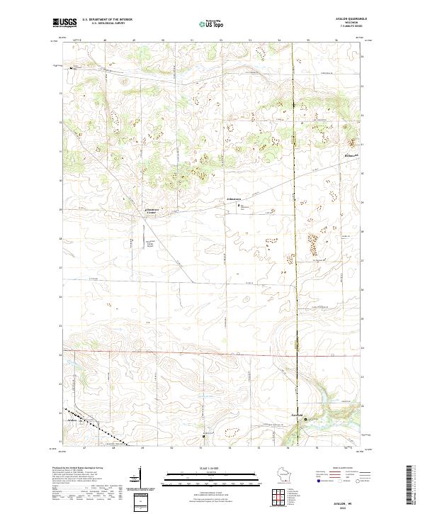 2022 Avalon2022 Print · USGSThe Rock and Walworth county line comes into focus in this contemporary study of rural Wisconsin townships. Genealogists can trace family names and burial sites at Old Johnstown Cem and Fairfield Cem or follow the waters of Turtle Creek.
 - 2022 Map of Delavan, 2022 Print
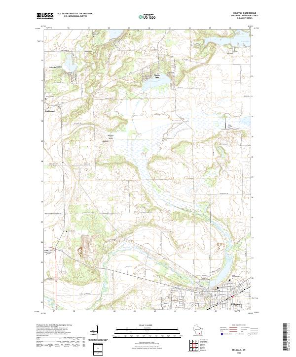 2022 Delavan2022 Print · USGSWalworth County at the start of the 2020s shows a landscape of glacial lakes and growing settlements. Genealogists can locate family sites at Old Settlers Cem or Richmond Cem, while others can trace the waters of Turtle Creek and Comus Lake.
 - 2022 Map of Clinton, 2022 Print
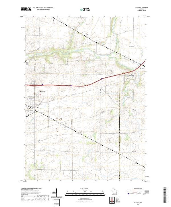 2022 Clinton2022 Print · USGSSouthern Wisconsin farm country along the Rock and Walworth county line is captured here in the early twenty-first century. Genealogists and local researchers can locate several rural burial grounds such as Saint Catherine Cem and Mount Phillips Cem alongside the waters of Turtle Creek.
 - 2022 Map of Sharon, 2022 Print
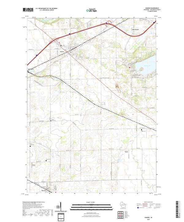 2022 Sharon2022 Print · USGSWalworth County agricultural lands and small-town centers are captured here in the early 2020s. Genealogists and local historians can trace burial sites like Brick Church Cem and Darien Cem, or locate landmarks such as Big Foot Airfield and the shoreline of Delavan Lake.
End of results
Showing maps 1-4 of 4
Top cities near Darien
- Janesville historical maps
- Whitewater historical maps
- Harvard historical maps
- Elkhorn historical maps
- Delavan historical maps
- Milton historical maps
See more
Top neighborhoods of Darien
Frequently asked questions
- What are the different types of historical maps available for Darien?
- What is the oldest map of Darien?
- Where can I purchase historical maps of Darien for my home or office?
- Where can I download high-res historical maps of Darien?
- Are there historical topographic maps available for Darien?
- Is there historical aerial imagery available for Darien?
- Where are historical maps of Darien sourced from?