Old Maps of Baldwins Mill, Royalton for Hiking & Exploration
Hike through history with 9 historic maps of Baldwins Mill. Explore old trails, ghost towns, and forgotten backroads — perfect for outdoor adventurers and local explorers.
- Rediscover forgotten places: Map out old mining camps, roads, and footpaths that no longer exist on modern maps.
- Layer with modern tools: Combine with LiDAR or satellite views to plan hikes through historical terrain.
- Made for exploration: Popular among hikers, overlanders, and local history lovers.
Use these maps to find adventure and explore the hidden past of Baldwins Mill.
Baldwins Mill, Royalton maps
(9)- 1955 Map of Green Bay, 1968 Print
 1955 Green Bay1968 Print · USGSCentral and Eastern Wisconsin are captured here in the mid-fifties, showing the industrial growth of the Fox Valley and Wisconsin River corridors. Genealogists and historians can trace rail lines like the Green Bay and Western through settlements like Weyauwega, Clintonville, and Pulaski.2 unique versions available
 - 1956 Map of Weyauwega, 1958 Print
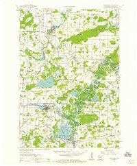 1956 Weyauwega1958 Print · USGSCentral Waupaca County is mapped here in the mid-fifties, showing a landscape defined by the winding Wolf River and a thriving network of rural townships. Genealogists can trace family roots at St Patricks Cem, Baldwins Mill Sch, and the State Sanatorium.
 - 1969 Map of Manawa, 1971 Print
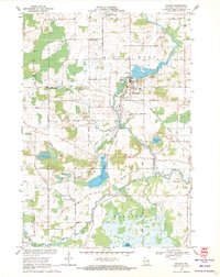 1969 Manawa1971 Print · USGSWaupaca County's rural heartland is captured here in the late sixties as the river-and-rail economy defined local life. Researchers can trace family-named roads and find quiet landmarks like St John Ch, Baldwins Mill Cem, and Green Valley Sch.2 unique versions available
 - 1984 Map of Appleton, 1985 Print
 1984 Appleton1985 Print · USGSThe Fox River Valley in the mid-eighties shows a bustling corridor of industry and nature, from the shores of Lake Winnebago to the Oneida Indian Reservation. Trace local heritage through landmarks like Riverside Cem or explore the wetlands of Poygan Marsh State Wildlife Area.2 unique versions available
 - 2010 Map of Manawa, 2010 Print
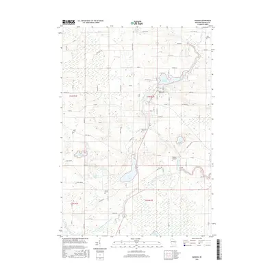
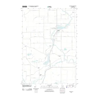 2010 Manawa2010 Print · USGSCovers Baldwins Mill, including Manawa, Saint Lawrence, and other nearby areas
 - 2013 Map of Manawa, 2013 Print
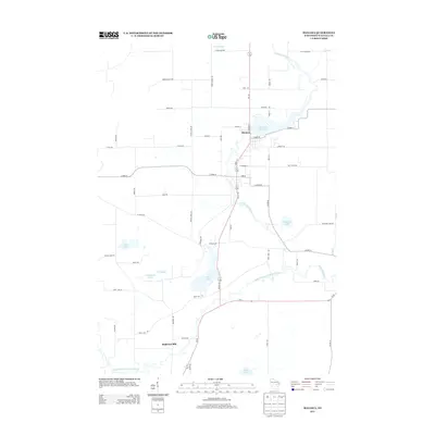 2013 Manawa2013 Print · USGSCovers Baldwins Mill, including Manawa, Saint Lawrence, and other nearby areas
 - 2016 Map of Manawa, 2016 Print
 2016 Manawa2016 Print · USGSCovers Baldwins Mill, including Manawa, Saint Lawrence, and other nearby areas
 - 2018 Map of Manawa, 2018 Print
 2018 Manawa2018 Print · USGSCovers Baldwins Mill, including Manawa, Saint Lawrence, and other nearby areas
 - 2022 Map of Manawa, 2022 Print
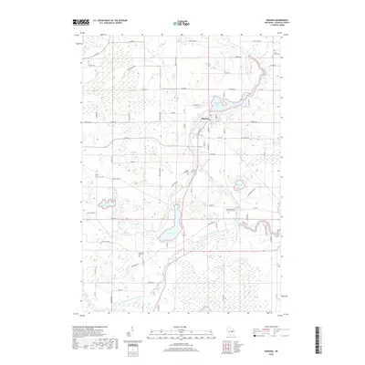
 2022 Manawa2022 Print · USGSManawa and the surrounding Waupaca County wetlands are captured here in the early twenty-first century. Researchers can trace rural lineages through the Waupaca County Poor Farm Cem, Little Wolf Cem, and the waters of Bear Lake.
End of results
Showing maps 1-9 of 9
Top cities near Baldwins Mill
- New London historical maps
- Waupaca historical maps
- Clintonville historical maps
- Dale historical maps
- Weyauwega historical maps
- Winchester historical maps
See more
Frequently asked questions
- What are the different types of historical maps available for Baldwins Mill?
- What is the oldest map of Baldwins Mill?
- Where can I purchase historical maps of Baldwins Mill for my home or office?
- Where can I download high-res historical maps of Baldwins Mill?
- Are there historical topographic maps available for Baldwins Mill?
- Is there historical aerial imagery available for Baldwins Mill?
- Where are historical maps of Baldwins Mill sourced from?