2020s Maps of Port Edwards, Wisconsin
Explore 2 historic maps of Port Edwards from the 2020s. These maps offer a rare glimpse into what life looked like during the 2020s — showing old roads, neighborhoods, homes, and landmarks that have changed or disappeared over time.
Whether you're researching your family's past, planning a metal detecting trip, or studying how Port Edwards's landscape evolved across the 2020s, these high-resolution maps are a powerful tool for exploring the history of this region.
- Focus on a specific era: All maps on this page are from the 2020s, giving you a focused view of this time period.
- See what’s changed: Compare century-old streets, trails, and buildings to today's modern landscape using overlays and satellite layers.
- Research with precision: Use these maps for genealogy, historical research, land use analysis, or educational projects.
- View, download, or print: Maps are fully viewable online in high resolution, and can be downloaded or printed for your own records.
Start exploring Port Edwards's history through authentic maps from the 2020s. This is your window into the past.
Port Edwards, WI maps
(2)- 2022 Map of Wisconsin Rapids South, 2022 Print
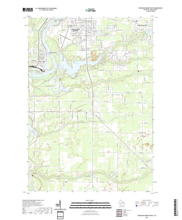 2022 Wisconsin Rapids South2022 Print · USGSThe southern edges of Wisconsin Rapids and Port Edwards are captured here in the early twenty-first century. Researchers can trace the layout of family lands near Pioneer Cem or explore the hydrography of Nepco Lake and the Wisconsin River.
 - 2022 Map of Nekoosa, 2022 Print
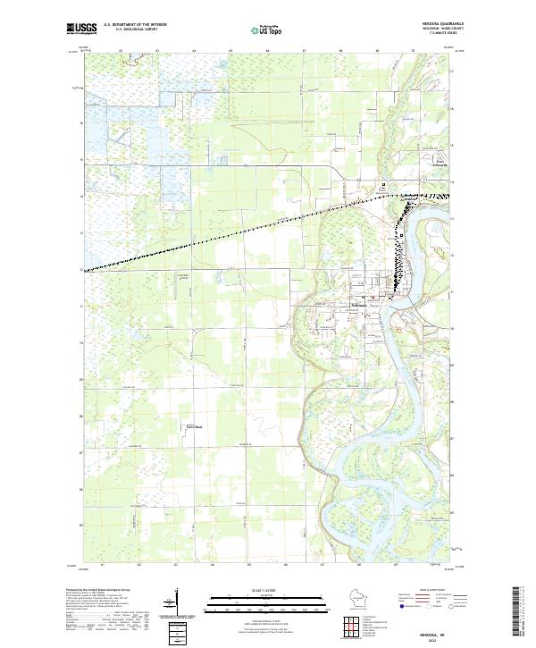 2022 Nekoosa2022 Print · USGSWisconsin River life and industrial settlement define this Wood County landscape in the early 2020s. Researchers can trace the residential growth of Nekoosa and Port Edwards, locate family plots at Riverside Cem, or find the Cranmoor Airstrip out among the western marshes.
End of results
Showing maps 1-2 of 2
Top cities near Port Edwards
- Wisconsin Rapids historical maps
- Nekoosa historical maps
- Big Flats historical maps
- Biron historical maps
- Sherry historical maps
- Vesper historical maps
See more
Top neighborhoods of Port Edwards
- Nekoosa Junction historical maps
- Sunset Point at NEPCO Lake historical maps
- White Pine Point at NEPCO Lake historical maps
Frequently asked questions
- What are the different types of historical maps available for Port Edwards?
- What is the oldest map of Port Edwards?
- Where can I purchase historical maps of Port Edwards for my home or office?
- Where can I download high-res historical maps of Port Edwards?
- Are there historical topographic maps available for Port Edwards?
- Is there historical aerial imagery available for Port Edwards?
- Where are historical maps of Port Edwards sourced from?