Old Maps of Squaw Place, Wyoming for Metal Detecting
Plan your next treasure hunt with 9 historic maps of Squaw Place. Find old homesites, ghost towns, trails, and gathering spots that may be lost to time — perfect for identifying promising metal detecting locations.
- Locate forgotten sites: Uncover places like long-lost settlements, abandoned rail lines, or gathering spots.
- Plan better hunts: Use map overlays combined with LiDAR or satellite views to narrow in on historically rich areas.
- Made for detectorists: Thousands of hobbyists use these maps to discover relics, coins, and hidden history.
Use these historic maps to boost your research and find new opportunities beneath the surface of Squaw Place.
Squaw Place, WY maps
(9)- 1954 Map of Torrington, 1963 Print
 1954 Torrington1963 Print · USGSEastern Wyoming and the Nebraska borderlands are captured here during the mid-fifties, showing a landscape shaped by the Platte River and the Laramie Range. Researchers can trace deep history at the Fort Laramie National Historical Site, the Old Doty Ranch Site, and along the Old Fetterman Road.4 unique versions available
 - 1958 Map of Torrington
 1958 Torrington1958 Print · USGSEastern Wyoming and the Nebraska borderlands are captured in the late fifties, showcasing a landscape of high plains ranching and river-fed industry. Trace the historic paths of the Union Pacific railroad and find legacy sites like Fort Laramie and Sunrise.
 - 1964 Map of Toltec, 1967 Print
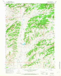 1964 Toltec1967 Print · USGSThe Laramie River high country is captured here in the mid-sixties, showing a landscape shaped by early frontier transit and mountain ranching. Trace the historic Old Fetterman Road past Toltec or locate water features like Soldier Creek Reservoir and Buck Point.2 unique versions available
 - 1981 Map of Laramie Peak
 1981 Laramie Peak1981 Print · USGSThe Laramie Mountains and Medicine Bow National Forest define this landscape in the early eighties. Genealogists and historians can trace high-country settlements like Toltec and Binford, or locate industrial sites like the Mica Mine near the North Laramie River.2 unique versions available
 - 1992 Map of Toltec, 1996 Print
 1992 Toltec1996 Print · USGSHigh in the Wyoming mountains during the early nineties, this area was a landscape of remote ranching outposts and public forest land. Genealogists and researchers can locate the Reed Place, trace the historic Old Fort Fetterman Road, and find numerous high-country water sources like Kafko Reservoir.
 - 2012 Map of Toltec, 2012 Print
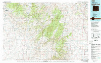
 2012 Toltec2012 Print · USGSCovers Squaw Place, including Reed Place, Toltec, and other nearby areas
 - 2015 Map of Toltec, 2015 Print
 2015 Toltec2015 Print · USGSCovers Squaw Place, including Reed Place, Toltec, and other nearby areas
 - 2017 Map of Toltec, 2017 Print
 2017 Toltec2017 Print · USGSCovers Squaw Place, including Reed Place, Toltec, and other nearby areas
 - 2021 Map of Toltec, 2021 Print
 2021 Toltec2021 Print · USGSAlbany County's high-country peaks and forest lands are captured here during the early twenty-first century. Researchers can trace historic mountain routes like Fetterman Rd and locate remote landmarks such as Fortymile Spring and Eggleston Reservoir.
End of results
Showing maps 1-9 of 9
Frequently asked questions
- What are the different types of historical maps available for Squaw Place?
- What is the oldest map of Squaw Place?
- Where can I purchase historical maps of Squaw Place for my home or office?
- Where can I download high-res historical maps of Squaw Place?
- Are there historical topographic maps available for Squaw Place?
- Is there historical aerial imagery available for Squaw Place?
- Where are historical maps of Squaw Place sourced from?