Old Maps of Bill, Wyoming for Metal Detecting
Plan your next treasure hunt with 6 historic maps of Bill. Find old homesites, ghost towns, trails, and gathering spots that may be lost to time — perfect for identifying promising metal detecting locations.
- Locate forgotten sites: Uncover places like long-lost settlements, abandoned rail lines, or gathering spots.
- Plan better hunts: Use map overlays combined with LiDAR or satellite views to narrow in on historically rich areas.
- Made for detectorists: Thousands of hobbyists use these maps to discover relics, coins, and hidden history.
Use these historic maps to boost your research and find new opportunities beneath the surface of Bill.
Bill, WY maps
(6)- 1955 Map of Newcastle, 1963 Print
 1955 Newcastle1963 Print · USGSThe high plains of eastern Wyoming and western South Dakota are captured in the mid-fifties, showing a landscape of sprawling ranches and emerging oil fields. Researchers can locate family landmarks like Saunders Ranch, trace the Chicago Burlington & Quincy RR, and explore small rail towns such as Osage and Edgemont.2 unique versions available
 - 1958 Map of Newcastle
 1958 Newcastle1958 Print · USGSThe high plains of eastern Wyoming meet the Black Hills in the late fifties, showcasing a landscape of rail-connected towns and historic trails. Trace the path of the Chicago Burlington & Quincy RR through Newcastle or locate the Bozeman Trail Monument and Summitt Ridge Lookout Tower.
 - 1959 Map of Bill, 1961 Print
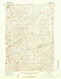 1959 Bill1961 Print · USGSIn the Wyoming high plains during the late fifties, ranching families carved a living out of the arid Converse County terrain. Researchers can trace historic property boundaries and infrastructure from the Dry Creek Sch to the Weston Ranch and Fowler Ranch.2 unique versions available
 - 1979 Map of Bill, 1980 Print
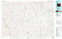 1979 Bill1980 Print · USGSConverse County and the surrounding ranchlands are shown in the late 1970s as industrial mining began to reshape the cattle country. Researchers can trace the Burlington Northern rail line and locate landmarks like the Johnston Mine, Bill, and Red Butte.2 unique versions available
 - 1984 Map of Bill
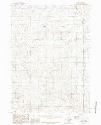 1984 Bill1984 Print · USGSThe settlement of Bill and its surrounding ranchlands are captured here in the mid-1980s. Local researchers can trace water management and transportation routes through features like Rice Reservoir, Dry Creek, and the path of highway 59.
 - 2021 Map of Bill, 2021 Print
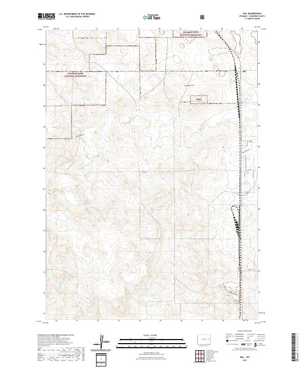 2021 Bill2021 Print · USGSConverse County cattle country and public lands are mapped here in the early twenty-first century. Researchers can locate the settlement of Bill and trace local water sources like Rice Reservoir and Thomas Reservoir.
End of results
Showing maps 1-6 of 6
Frequently asked questions
- What are the different types of historical maps available for Bill?
- What is the oldest map of Bill?
- Where can I purchase historical maps of Bill for my home or office?
- Where can I download high-res historical maps of Bill?
- Are there historical topographic maps available for Bill?
- Is there historical aerial imagery available for Bill?
- Where are historical maps of Bill sourced from?