Old Maps of Moneta, Wyoming for Academic Research
Study the evolution of Moneta with 9 high-resolution historic maps. Whether you're teaching, researching, or modeling changes in land use, these maps provide essential visual documentation of urban, environmental, and geographic change.
- Analyze long-term change: Track patterns in development, transportation, and natural features.
- Ideal for environmental or urban studies: Support academic projects with primary historical map data.
- Use in the classroom or lab: Educators and researchers rely on these maps to bring historical context to life.
These maps are a powerful tool for teaching, research, and visualizing how Moneta has changed over the decades.
Moneta, WY maps
(9)- 1952 Map of Moneta, 1953 Print
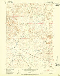 1952 Moneta1953 Print · USGSFremont County ranchlands and rail lines are captured here in the early fifties. Genealogists and historians can trace the footprints of the Kanson Ranch and Webb Ranch or follow the Chicago Burlington and Quincy tracks through the high plains.2 unique versions available
 - 1955 Map of Arminto, 1976 Print
 1955 Arminto1976 Print · USGSCentral Wyoming at the mid-century shows a landscape of energy reserves and high-plains ranching. Genealogists and historians can trace the Burlington Northern line through Lost Cabin and the famed Teapot Dome Naval Petroleum Reserve No 3.2 unique versions available
 - 1958 Map of Arminto
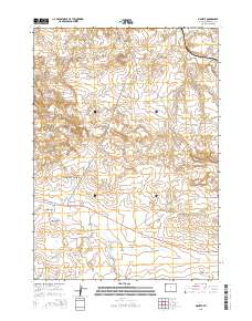
 1958 Arminto1958 Print · USGSCentral Wyoming in the late fifties was a landscape of high-plains energy and remote rail outposts. Researchers can trace the Chicago Burlington and Quincy railroad through towns like Arminto and Waltman or locate landmarks like Teapot Rock.
 - 1962 Map of Arminto
 1962 Arminto1962 Print · USGSCentral Wyoming in the early sixties reveals a landscape shaped by the Chicago and North Western railroad and early energy development. Trace the history of the region through remote outposts like Arminto, the US Naval Petroleum Reserve, and the geologic landmark at Hells Half Acre.
 - 1982 Map of Lysite
 1982 Lysite1982 Print · USGSCentral Wyoming's high plains and mountain foothills are captured here in the early 1980s, centered on the ranching and rail outposts of Natrona and Fremont Counties. Genealogists and historians can trace the paths of the Burlington Northern and the Old Railroad Grade through Lysite, Lost Cabin, and Arminto.
 - 2012 Map of Moneta, 2012 Print
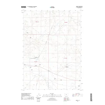
 2012 Moneta2012 Print · USGSCovers Moneta, including Fremont County, United States, and other nearby areas
 - 2015 Map of Moneta, 2015 Print
 2015 Moneta2015 Print · USGSCovers Moneta, including Fremont County, United States, and other nearby areas
 - 2017 Map of Moneta, 2017 Print
 2017 Moneta2017 Print · USGSCovers Moneta, including Fremont County, United States, and other nearby areas
 - 2021 Map of Moneta, 2021 Print
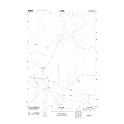
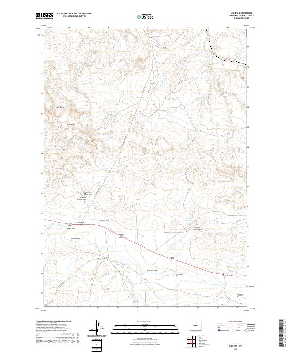 2021 Moneta2021 Print · USGSThe high plains of Fremont County are captured here in the early twenty-first century, centered on the crossroads at Moneta. Researchers can trace rural infrastructure like Linn Ranch Rd or find local landmarks such as Graham Reservoir and Alkali Flats.
End of results
Showing maps 1-9 of 9
Frequently asked questions
- What are the different types of historical maps available for Moneta?
- What is the oldest map of Moneta?
- Where can I purchase historical maps of Moneta for my home or office?
- Where can I download high-res historical maps of Moneta?
- Are there historical topographic maps available for Moneta?
- Is there historical aerial imagery available for Moneta?
- Where are historical maps of Moneta sourced from?